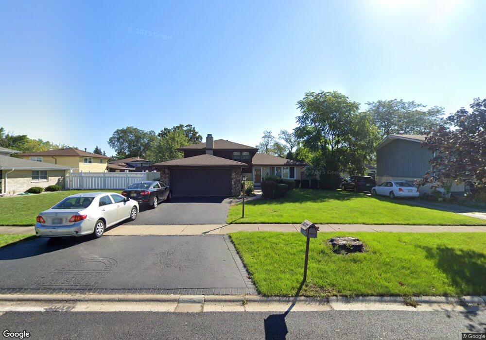
10507 S Michael Dr Palos Hills, IL 60465
Estimated Value: $317,000 - $386,815
3
Beds
2
Baths
1,390
Sq Ft
$265/Sq Ft
Est. Value
About This Home
This home is located at 10507 S Michael Dr, Palos Hills, IL 60465 and is currently estimated at $368,454, approximately $265 per square foot. 10507 S Michael Dr is a home located in Cook County with nearby schools including Sorrick Elementary School, Oak Ridge Elementary School, and H H Conrady Jr High School.
Ownership History
Date
Name
Owned For
Owner Type
Purchase Details
Closed on
Nov 20, 2003
Sold by
Founders Bank
Bought by
Nazer Waddah M and Barmou Rafah M
Current Estimated Value
Home Financials for this Owner
Home Financials are based on the most recent Mortgage that was taken out on this home.
Original Mortgage
$210,000
Interest Rate
6.1%
Mortgage Type
Purchase Money Mortgage
Create a Home Valuation Report for This Property
The Home Valuation Report is an in-depth analysis detailing your home's value as well as a comparison with similar homes in the area
Home Values in the Area
Average Home Value in this Area
Purchase History
| Date | Buyer | Sale Price | Title Company |
|---|---|---|---|
| Nazer Waddah M | $263,000 | -- |
Source: Public Records
Mortgage History
| Date | Status | Borrower | Loan Amount |
|---|---|---|---|
| Closed | Nazer Waddah M | $210,000 |
Source: Public Records
Tax History Compared to Growth
Tax History
| Year | Tax Paid | Tax Assessment Tax Assessment Total Assessment is a certain percentage of the fair market value that is determined by local assessors to be the total taxable value of land and additions on the property. | Land | Improvement |
|---|---|---|---|---|
| 2024 | $7,711 | $30,000 | $6,599 | $23,401 |
| 2023 | $6,124 | $30,000 | $6,599 | $23,401 |
| 2022 | $6,124 | $20,204 | $5,748 | $14,456 |
| 2021 | $5,966 | $20,203 | $5,747 | $14,456 |
| 2020 | $5,920 | $20,203 | $5,747 | $14,456 |
| 2019 | $6,336 | $21,807 | $5,321 | $16,486 |
| 2018 | $6,097 | $21,807 | $5,321 | $16,486 |
| 2017 | $5,900 | $21,807 | $5,321 | $16,486 |
| 2016 | $6,372 | $20,942 | $4,683 | $16,259 |
| 2015 | $6,240 | $20,942 | $4,683 | $16,259 |
| 2014 | $6,146 | $20,942 | $4,683 | $16,259 |
| 2013 | $5,675 | $20,738 | $4,683 | $16,055 |
Source: Public Records
Map
Nearby Homes
- 10440 S 75th Ct
- 10300 S Kathy Ct
- 10409 Sheffield Dr Unit 13
- 10531 S Roberts Rd Unit 2D
- 7810 W 102nd St
- 10233 Concord Ln Unit C
- 10225 Camden Ln Unit K
- 10324 S 81st Ave
- 10820 Kathleen Ct Unit D
- 10226 S 81st Ave
- 10125 S 81st Ct
- 7357 W 109th St
- 7822 W 99th Place
- 10441 S 83rd Ave
- 10926 Circle Ct
- 7110 W 107th St Unit 16
- 10927 Circle Dr
- 10609 Southwest Hwy Unit 2A
- 7213 W 109th St
- 8057 Valley Dr
- 10513 S Michael Dr
- 7659 W 105th St
- 7653 W 105th St
- 7649 W 105th St
- 10506 S Michael Dr
- 10512 S Michael Dr
- 10518 S Michael Dr
- 10500 S Michael Dr
- 7643 W 105th St
- 10524 S Michael Dr
- 10442 S Michael Dr
- 7658 W 105th St
- 7637 W 105th St
- 10512 S Terry Dr
- 10506 S Terry Dr
- 10436 S Michael Dr
- 10530 S Michael Dr
- 7652 W 105th St
- 10431 S Michael Dr
- 10524 S Terry Dr