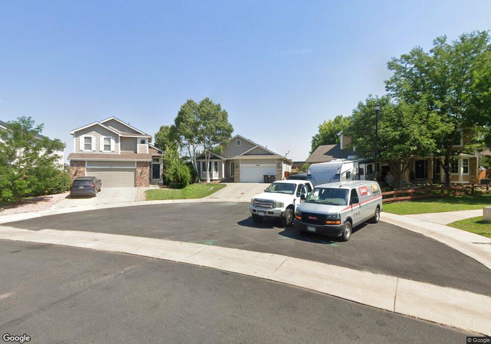
10509 Taylor Ave Firestone, CO 80504
Estimated Value: $566,000 - $696,000
5
Beds
3
Baths
3,970
Sq Ft
$158/Sq Ft
Est. Value
About This Home
This home is located at 10509 Taylor Ave, Firestone, CO 80504 and is currently estimated at $627,497, approximately $158 per square foot. 10509 Taylor Ave is a home located in Weld County with nearby schools including Prairie Ridge Elementary School, Coal Ridge Middle School, and Frederick Senior High School.
Ownership History
Date
Name
Owned For
Owner Type
Purchase Details
Closed on
Jan 18, 2023
Sold by
Stirling Merrell Cooper Sr Revocable Liv
Bought by
Cooper Christopher B Shearer
Current Estimated Value
Purchase Details
Closed on
Dec 29, 2009
Sold by
Nicholson John J and Nicholson Jennifer
Bought by
Cooper Stirling Merrell
Purchase Details
Closed on
Mar 11, 2002
Sold by
U S Home Corp
Bought by
Nicholson John J and Nicholson Jennifer
Home Financials for this Owner
Home Financials are based on the most recent Mortgage that was taken out on this home.
Original Mortgage
$198,400
Interest Rate
7.01%
Create a Home Valuation Report for This Property
The Home Valuation Report is an in-depth analysis detailing your home's value as well as a comparison with similar homes in the area
Home Values in the Area
Average Home Value in this Area
Purchase History
| Date | Buyer | Sale Price | Title Company |
|---|---|---|---|
| Cooper Christopher B Shearer | -- | -- | |
| Cooper Stirling Merrell | $282,900 | Utc Colorado | |
| Nicholson John J | $248,050 | -- |
Source: Public Records
Mortgage History
| Date | Status | Borrower | Loan Amount |
|---|---|---|---|
| Previous Owner | Nicholson John J | $198,400 |
Source: Public Records
Tax History Compared to Growth
Tax History
| Year | Tax Paid | Tax Assessment Tax Assessment Total Assessment is a certain percentage of the fair market value that is determined by local assessors to be the total taxable value of land and additions on the property. | Land | Improvement |
|---|---|---|---|---|
| 2025 | $3,810 | $40,680 | $6,380 | $34,300 |
| 2024 | $3,810 | $40,680 | $6,380 | $34,300 |
| 2023 | $3,655 | $40,570 | $6,900 | $33,670 |
| 2022 | $4,233 | $33,860 | $5,000 | $28,860 |
| 2021 | $4,180 | $34,840 | $5,150 | $29,690 |
| 2020 | $3,522 | $31,140 | $3,720 | $27,420 |
| 2019 | $3,218 | $31,140 | $3,720 | $27,420 |
| 2018 | $2,743 | $27,550 | $3,740 | $23,810 |
| 2017 | $2,804 | $27,550 | $3,740 | $23,810 |
| 2016 | $2,729 | $26,380 | $2,790 | $23,590 |
| 2015 | $2,646 | $26,380 | $2,790 | $23,590 |
| 2014 | $2,056 | $20,520 | $2,310 | $18,210 |
Source: Public Records
Map
Nearby Homes
- 10521 Taylor Ave
- 10476 Sunburst Ave
- 10472 Sunburst Ave
- 10429 Dresden St
- 6200 Sparrow Ave
- 6291 Snowberry Ave
- 6447 St Vrain Ranch Blvd
- 6230 Snowberry Ave
- 10289 Dresden St
- 10278 Dover St
- 10298 Devonshire St
- 10245 Dusk St
- 6512 Silverleaf Ct
- 6650 Stagecoach Ave
- 10185 Dusk St
- 10818 Cimarron St Unit 302
- 10818 Cimarron St Unit 1102
- 10818 Cimarron St Unit 1203
- 10818 Cimarron St Unit 307
- 6877 Summerset Ave
- 10505 Taylor Ave
- 10513 Taylor Ave
- 10504 Sunburst Ave
- 10501 Taylor Ave
- 10508 Sunburst Ave
- 10497 Taylor Ave
- 10500 Sunburst Ave
- 10502 Taylor Ave
- 10525 Taylor Ave
- 10496 Sunburst Ave
- 10522 Taylor Ave
- 10493 Taylor Ave
- 10512 Sunburst Ave
- 10529 Taylor Ave
- 10500 Taylor Ave
- 10492 Sunburst Ave
- 10528 Taylor Ave
- 10489 Taylor Ave
- 10516 Sunburst Ave
- 10496 Taylor Ave