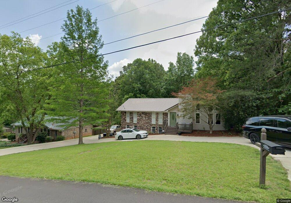
1051 Crestview Dr Mc Calla, AL 35111
Estimated Value: $294,000 - $653,969
3
Beds
3
Baths
1,532
Sq Ft
$252/Sq Ft
Est. Value
About This Home
This home is located at 1051 Crestview Dr, Mc Calla, AL 35111 and is currently estimated at $385,742, approximately $251 per square foot. 1051 Crestview Dr is a home located in Jefferson County with nearby schools including Mcadory Elementary School, Mcadory Middle School, and Mcadory High School.
Ownership History
Date
Name
Owned For
Owner Type
Purchase Details
Closed on
Feb 9, 2024
Sold by
Davis Richard Andrew
Bought by
Collier Family Trust and Davis Richard Andrew
Current Estimated Value
Purchase Details
Closed on
May 28, 2004
Sold by
Thomas Barry L and Thomas Sonja G
Bought by
Pearson Kelly
Home Financials for this Owner
Home Financials are based on the most recent Mortgage that was taken out on this home.
Original Mortgage
$119,960
Interest Rate
5.89%
Mortgage Type
Purchase Money Mortgage
Purchase Details
Closed on
Feb 26, 1999
Sold by
Edwards George E and Edwards Carol N
Bought by
Thomas Barry L and Thomas Sonja G
Home Financials for this Owner
Home Financials are based on the most recent Mortgage that was taken out on this home.
Original Mortgage
$138,855
Interest Rate
6.79%
Mortgage Type
FHA
Create a Home Valuation Report for This Property
The Home Valuation Report is an in-depth analysis detailing your home's value as well as a comparison with similar homes in the area
Home Values in the Area
Average Home Value in this Area
Purchase History
| Date | Buyer | Sale Price | Title Company |
|---|---|---|---|
| Collier Family Trust | $625,600 | -- | |
| Pearson Kelly | $149,900 | -- | |
| Thomas Barry L | $140,000 | -- |
Source: Public Records
Mortgage History
| Date | Status | Borrower | Loan Amount |
|---|---|---|---|
| Previous Owner | Pearson Kelly | $119,960 | |
| Previous Owner | Thomas Barry L | $138,855 | |
| Closed | Pearson Kelly | $29,990 |
Source: Public Records
Tax History Compared to Growth
Tax History
| Year | Tax Paid | Tax Assessment Tax Assessment Total Assessment is a certain percentage of the fair market value that is determined by local assessors to be the total taxable value of land and additions on the property. | Land | Improvement |
|---|---|---|---|---|
| 2024 | $1,311 | $25,700 | -- | -- |
| 2022 | $1,098 | $22,980 | $6,500 | $16,480 |
| 2021 | $874 | $18,490 | $6,500 | $11,990 |
| 2020 | $1,055 | $16,930 | $6,500 | $10,430 |
| 2019 | $872 | $18,460 | $0 | $0 |
| 2018 | $964 | $20,300 | $0 | $0 |
| 2017 | $925 | $19,520 | $0 | $0 |
| 2016 | $925 | $19,520 | $0 | $0 |
| 2015 | $908 | $19,180 | $0 | $0 |
| 2014 | $949 | $18,320 | $0 | $0 |
| 2013 | $949 | $18,940 | $0 | $0 |
Source: Public Records
Map
Nearby Homes
- 6525 Shadowrock Cir
- 6525 Shadowrock Cir Unit 10
- 1016 Tall Oaks Cir Unit 1
- 2186 Rock Mountain Lake Dr
- 2134 Rock Mountain Dr
- 2140 Lakeside Dr
- 2216 Lakeside Dr
- 7317 Lowetown Rd
- 2005 Rock Mountain Dr
- 1015 Coleman Dr
- 1700 Lakeside Dr
- 2010 Rock Mountain Dr
- Beau Ridge Ln
- 7045 Summerdale Dr
- 1928 Lakeside Dr
- 8410 Beau Ridge Ln
- 1904 Leafwood Cir
- 1901 Lakeside Dr
- 6942 Robin Ln
- 6021 Mcashan Dr
- 1047 Crestview Dr
- 1059 Crestview Dr
- 1043 Crestview Dr
- 1160 Rock Crest Dr
- 1063 Crestview Dr
- 1050 Crestview Dr
- 1209 Rock Crest Dr
- 1158 Rock Crest Dr
- 1039 Crestview Dr
- 1154 Rock Crest Dr
- 6530 Shadowrock Cir
- 6543 Shadowrock Cir
- 1040 Crestview Dr
- 1069 Crestview Dr
- 6526 Shadowrock Cir
- 1074 Crestview Dr
- 1035 Crestview Dr
- 1150 Rock Crest Dr
- 6535 Shadowrock Cir