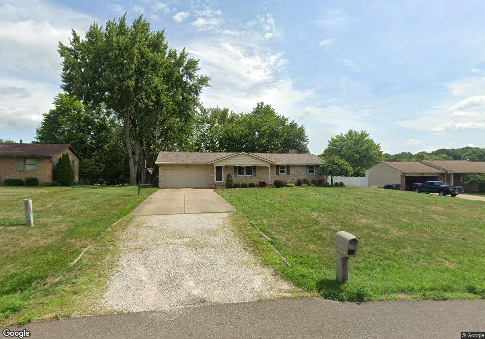
1051 Tumbleweed St NW Uniontown, OH 44685
Estimated Value: $257,000 - $275,000
3
Beds
2
Baths
1,248
Sq Ft
$211/Sq Ft
Est. Value
About This Home
This home is located at 1051 Tumbleweed St NW, Uniontown, OH 44685 and is currently estimated at $263,255, approximately $210 per square foot. 1051 Tumbleweed St NW is a home located in Stark County with nearby schools including Lake Middle/High School and Lake Center Christian School.
Ownership History
Date
Name
Owned For
Owner Type
Purchase Details
Closed on
Jul 10, 2020
Sold by
Burnside Kimberly A and Manegay Kimberly A
Bought by
Burnside Kimberly A and Burnside Dale R
Current Estimated Value
Home Financials for this Owner
Home Financials are based on the most recent Mortgage that was taken out on this home.
Original Mortgage
$64,500
Interest Rate
2.8%
Mortgage Type
New Conventional
Purchase Details
Closed on
Aug 5, 2004
Sold by
Menegay Thomas A
Bought by
Menegay Kimberly A
Create a Home Valuation Report for This Property
The Home Valuation Report is an in-depth analysis detailing your home's value as well as a comparison with similar homes in the area
Home Values in the Area
Average Home Value in this Area
Purchase History
| Date | Buyer | Sale Price | Title Company |
|---|---|---|---|
| Burnside Kimberly A | -- | None Available | |
| Menegay Kimberly A | -- | -- |
Source: Public Records
Mortgage History
| Date | Status | Borrower | Loan Amount |
|---|---|---|---|
| Closed | Burnside Kimberly A | $64,500 |
Source: Public Records
Tax History Compared to Growth
Tax History
| Year | Tax Paid | Tax Assessment Tax Assessment Total Assessment is a certain percentage of the fair market value that is determined by local assessors to be the total taxable value of land and additions on the property. | Land | Improvement |
|---|---|---|---|---|
| 2022 | $2,953 | $57,750 | $14,840 | $42,910 |
| 2021 | $2,985 | $57,750 | $14,840 | $42,910 |
| 2020 | $2,861 | $49,460 | $12,780 | $36,680 |
| 2019 | $2,838 | $48,690 | $12,780 | $35,910 |
| 2018 | $2,796 | $48,690 | $12,780 | $35,910 |
| 2017 | $2,692 | $43,370 | $11,410 | $31,960 |
| 2016 | $697 | $43,370 | $11,410 | $31,960 |
| 2015 | $2,696 | $43,370 | $11,410 | $31,960 |
| 2014 | $487 | $41,130 | $10,820 | $30,310 |
| 2013 | $1,244 | $41,130 | $10,820 | $30,310 |
Source: Public Records
Map
Nearby Homes
- 1037 Canyon St NE
- 12055 King Church Ave NW
- 786 Fair Vista Cir SW
- 531 Gentlebrook Blvd SW
- 778 Fair Vista Cir SW
- 747 Grandview Cir
- 525 Gentlebrook Blvd SW
- 550 Woodlands Glen Ave
- 12201 King Church Ave NW
- 510 Meadow Cir SW Unit 11
- 11900 Geib Ave NE
- 1771 Midway St NW
- 11121 Geib Ave NE
- Unit 9 Meadow Trail SW Unit 9
- 425 Tonawanda Trail SW
- 2084 Hazel St NE
- 225 Seneca Trail SW
- 1180 Tessa Trail Unit 1180
- 1975 Eloise Cir NE
- 1702 Gulf St NW
- 1033 Tumbleweed St NW
- 1075 Tumbleweed St NW
- 11383 Market Ave NW
- 11298 Sarahann Ave NW
- 11395 Market Ave NE
- 11383 Market Ave N
- 1080 Tumbleweed St NW
- 11395 Market Ave NW
- 11276 Sarahann Ave NW
- 11255 Market Ave NW
- 11291 Sarahann Ave NW
- 1101 Tumbleweed St NW
- 1097 Shelview Cir NW
- 1096 Tumbleweed St NW
- 1022 Tumbleweed St NE
- 1102 Tumbleweed St NW
- 1087 Shelview Cir NW
- 11275 Sarahann Ave NW
- 11225 Market Ave NW
- 1055 Tumbleweed St NE