Estimated Value: $216,000 - $313,000
2
Beds
2
Baths
1,520
Sq Ft
$169/Sq Ft
Est. Value
About This Home
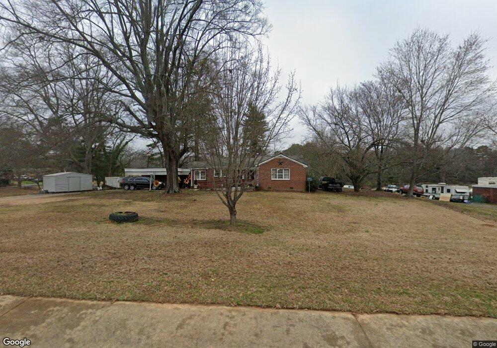
This home is located at 10512 Highway 72 W, Hull, GA 30646 and is currently estimated at $256,315, approximately $168 per square foot. 10512 Highway 72 W is a home located in Madison County with nearby schools including Madison County High School.
Ownership History
Date
Name
Owned For
Owner Type
Purchase Details
Closed on
Oct 31, 2022
Sold by
King Shirley Estate
Bought by
Lovett Betty and Burgess Bennie
Current Estimated Value
Purchase Details
Closed on
Nov 18, 2019
Sold by
Tarver Brenda Gale
Bought by
King Shirley
Purchase Details
Closed on
Jul 28, 2017
Bought by
Tarver Brenda Gale
Purchase Details
Closed on
Jul 24, 1997
Bought by
Thomason W Lance
Purchase Details
Closed on
Jan 1, 1946
Bought by
Thomason W Lance
Create a Home Valuation Report for This Property
The Home Valuation Report is an in-depth analysis detailing your home's value as well as a comparison with similar homes in the area
Home Values in the Area
Average Home Value in this Area
Purchase History
| Date | Buyer | Sale Price | Title Company |
|---|---|---|---|
| Lovett Betty | -- | -- | |
| King Shirley | $110,000 | -- | |
| Tarver Brenda Gale | -- | -- | |
| Thomason W Lance | -- | -- | |
| Thomason W Lance | -- | -- |
Source: Public Records
Tax History Compared to Growth
Tax History
| Year | Tax Paid | Tax Assessment Tax Assessment Total Assessment is a certain percentage of the fair market value that is determined by local assessors to be the total taxable value of land and additions on the property. | Land | Improvement |
|---|---|---|---|---|
| 2024 | $2,062 | $75,858 | $13,890 | $61,968 |
| 2023 | $1,885 | $69,355 | $11,575 | $57,780 |
| 2022 | $1,361 | $58,639 | $7,957 | $50,682 |
| 2021 | $1,059 | $42,994 | $7,956 | $35,038 |
| 2020 | $1,027 | $41,836 | $6,799 | $35,037 |
| 2019 | $1,274 | $41,034 | $6,799 | $34,235 |
| 2018 | $1,226 | $39,437 | $6,220 | $33,217 |
| 2017 | $1,152 | $38,440 | $5,788 | $32,652 |
| 2016 | $671 | $32,268 | $5,261 | $27,008 |
| 2015 | $667 | $32,268 | $5,261 | $27,008 |
| 2014 | $669 | $32,335 | $5,302 | $27,032 |
| 2013 | -- | $32,335 | $5,302 | $27,032 |
Source: Public Records
Map
Nearby Homes
- 0 Virginia Ln Unit Lot 15 CL336098
- 0 Virginia Ln Unit LOT 15 10579204
- 300 Harve Mathis Rd
- 0 Spratlin Mill Rd Unit 1025918
- 0 Spratlin Mill Rd Unit 10526335
- 242 Pittard Rd
- 0 Woodland Creek Place Unit 10421130
- 540 & 542 Harve Mathis Rd
- 525 Virginia Ln
- 336 Old Pittard Rd
- 1226 Hull Rd
- 181 Bedford Dr
- 685 Bedford Dr
- 481 Bedford Dr
- 136 Wellington Dr
- 151 Rolling Woods Ln
- 519 Cheyenne Ave
- 0 Highway 29 S Unit 1024268
- 10512 Georgia 72
- 10482 Highway 72 W
- 10558 Highway 72 W
- 10446 Georgia 72
- 10446 Highway 72 W
- 67 Yarbrough Rd
- 67 Yarborough Ridgeway Rd
- 10535 Highway 72 W
- 10535 Hwy 72w
- 10533 Highway 72 W
- 10531 Hwy 72w
- 10531 Highway 72 W
- 21 Chandler Ray Rd
- 10600 Highway 72 W
- 85 Yarbrough Rd
- 107 Yarbrough Rd
- 30 Cornelia Dr
- 37 Chandler Ray Rd
- 48 Davis St
- 48 & 26 Davis St