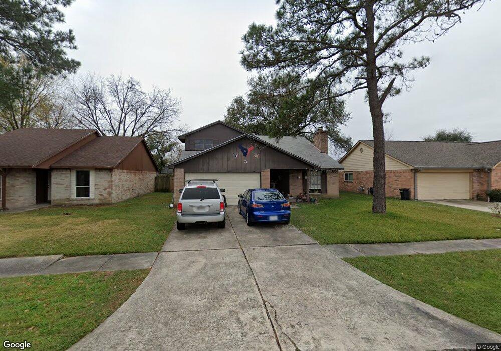
10515 Mackenzie Dr Houston, TX 77086
North Houston NeighborhoodEstimated Value: $243,000 - $269,000
4
Beds
2
Baths
2,337
Sq Ft
$110/Sq Ft
Est. Value
About This Home
This home is located at 10515 Mackenzie Dr, Houston, TX 77086 and is currently estimated at $256,499, approximately $109 per square foot. 10515 Mackenzie Dr is a home located in Harris County with nearby schools including Kujawa EC/Pre-K/K School, Carmichael Elementary School, and Shotwell Middle School.
Ownership History
Date
Name
Owned For
Owner Type
Purchase Details
Closed on
Mar 24, 2004
Sold by
Roberts Patricia
Bought by
Dealejandro Guillermo E
Current Estimated Value
Home Financials for this Owner
Home Financials are based on the most recent Mortgage that was taken out on this home.
Original Mortgage
$1,397,893
Outstanding Balance
$651,941
Interest Rate
5.64%
Mortgage Type
Purchase Money Mortgage
Estimated Equity
-$395,442
Purchase Details
Closed on
Mar 13, 2002
Sold by
Murphy Edward J and Murphy Julia A
Bought by
Roberts Patricia
Home Financials for this Owner
Home Financials are based on the most recent Mortgage that was taken out on this home.
Original Mortgage
$81,118
Interest Rate
7.01%
Mortgage Type
FHA
Create a Home Valuation Report for This Property
The Home Valuation Report is an in-depth analysis detailing your home's value as well as a comparison with similar homes in the area
Home Values in the Area
Average Home Value in this Area
Purchase History
| Date | Buyer | Sale Price | Title Company |
|---|---|---|---|
| Dealejandro Guillermo E | -- | Texas American Title Company | |
| Roberts Patricia | -- | Chicago Title |
Source: Public Records
Mortgage History
| Date | Status | Borrower | Loan Amount |
|---|---|---|---|
| Open | Dealejandro Guillermo E | $1,397,893 | |
| Previous Owner | Roberts Patricia | $81,118 |
Source: Public Records
Tax History Compared to Growth
Tax History
| Year | Tax Paid | Tax Assessment Tax Assessment Total Assessment is a certain percentage of the fair market value that is determined by local assessors to be the total taxable value of land and additions on the property. | Land | Improvement |
|---|---|---|---|---|
| 2025 | $5,625 | $239,360 | $39,471 | $199,889 |
| 2024 | $5,625 | $243,197 | $39,471 | $203,726 |
| 2023 | $5,625 | $251,768 | $39,471 | $212,297 |
| 2022 | $5,154 | $211,746 | $33,450 | $178,296 |
| 2021 | $4,203 | $173,060 | $33,450 | $139,610 |
| 2020 | $4,422 | $163,799 | $33,450 | $130,349 |
| 2019 | $4,516 | $160,896 | $17,052 | $143,844 |
| 2018 | $2,186 | $152,218 | $17,052 | $135,166 |
| 2017 | $3,865 | $142,829 | $15,312 | $127,517 |
| 2016 | $3,499 | $129,284 | $15,312 | $113,972 |
| 2015 | $2,443 | $120,196 | $15,312 | $104,884 |
| 2014 | $2,443 | $90,146 | $15,312 | $74,834 |
Source: Public Records
Map
Nearby Homes
- 10614 Mackenzie Dr
- 10307 Bammel North Houston Rd
- 10711 Heather Hill Dr
- 10723 Mackenzie Dr
- 7023 Sandswept Ln
- 7302 Seton Lake Dr
- 7218 Winding Trace Dr
- 7002 Sandswept Ln
- 7307 Silver Star Dr
- 7222 Northleaf Dr
- 6911 Silver Star Dr
- 7227 Greenyard Dr
- 6722 Winding Trace Dr
- 6822 Dusty Dawn Dr
- 11007 Tobasa Ct
- 9815 Lonsford Dr
- 6654 Brownie Campbell Rd
- 6830 Desert Rose Ln
- 11006 Crinkleawn Dr
- 6630 Brownie Campbell Rd
- 10511 Mackenzie Dr
- 10519 Mackenzie Dr
- 10523 Mackenzie Dr
- 10507 Mackenzie Dr
- 10527 Mackenzie Dr
- 10503 Mackenzie Dr
- 10514 Mackenzie Dr
- 10510 Mackenzie Dr
- 10518 Mackenzie Dr
- 10506 Mackenzie Dr
- 10522 Mackenzie Dr
- 10510 Canyoncrest Ln
- 10514 Canyoncrest Ln
- 10506 Canyoncrest Ln
- 10603 Mackenzie Dr
- 10435 Mackenzie Dr
- 10518 Canyoncrest Ln
- 10502 Mackenzie Dr
- 10526 Mackenzie Dr
- 10502 Canyoncrest Ln