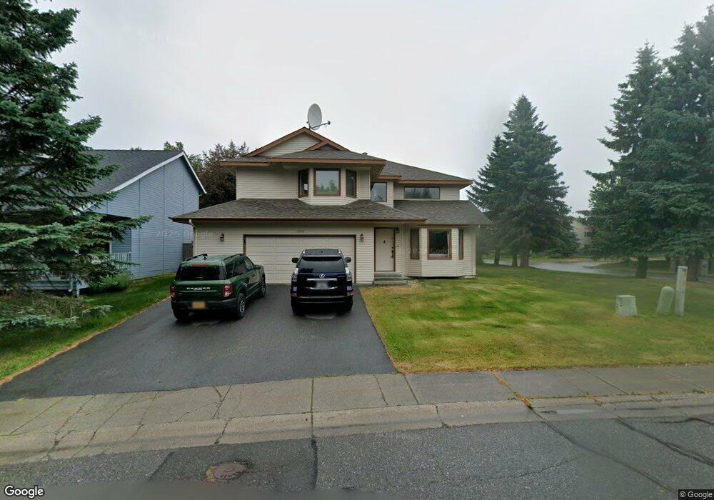
10516 Spindrift Loop Anchorage, AK 99515
Bayshore-Klatt NeighborhoodEstimated Value: $445,000 - $573,000
4
Beds
3
Baths
2,263
Sq Ft
$230/Sq Ft
Est. Value
About This Home
This home is located at 10516 Spindrift Loop, Anchorage, AK 99515 and is currently estimated at $521,371, approximately $230 per square foot. 10516 Spindrift Loop is a home located in Anchorage Municipality with nearby schools including Bayshore Elementary School, Mears Middle School, and Dimond High School.
Ownership History
Date
Name
Owned For
Owner Type
Purchase Details
Closed on
Nov 15, 2022
Sold by
Rozell Connie
Bought by
Cr Trust
Current Estimated Value
Purchase Details
Closed on
Sep 29, 1994
Sold by
Ave Robert M and Ave Barbara B
Bought by
Awezec John S and Awezec Tara L
Home Financials for this Owner
Home Financials are based on the most recent Mortgage that was taken out on this home.
Original Mortgage
$156,400
Interest Rate
8.58%
Mortgage Type
New Conventional
Purchase Details
Closed on
Jul 5, 1989
Sold by
Premiere Development & Construction Inc
Bought by
Ave Robert M and Ave Barbara B
Home Financials for this Owner
Home Financials are based on the most recent Mortgage that was taken out on this home.
Original Mortgage
$139,500
Interest Rate
10.6%
Mortgage Type
New Conventional
Create a Home Valuation Report for This Property
The Home Valuation Report is an in-depth analysis detailing your home's value as well as a comparison with similar homes in the area
Home Values in the Area
Average Home Value in this Area
Purchase History
| Date | Buyer | Sale Price | Title Company |
|---|---|---|---|
| Cr Trust | -- | -- | |
| Awezec John S | -- | -- | |
| Ave Robert M | -- | -- |
Source: Public Records
Mortgage History
| Date | Status | Borrower | Loan Amount |
|---|---|---|---|
| Previous Owner | Awezec John S | $156,400 | |
| Previous Owner | Ave Robert M | $139,500 |
Source: Public Records
Tax History
| Year | Tax Paid | Tax Assessment Tax Assessment Total Assessment is a certain percentage of the fair market value that is determined by local assessors to be the total taxable value of land and additions on the property. | Land | Improvement |
|---|---|---|---|---|
| 2025 | $4,043 | $511,500 | $105,800 | $405,700 |
| 2024 | $4,043 | $475,400 | $93,700 | $381,700 |
| 2023 | $3,460 | $428,200 | $89,800 | $338,400 |
| 2022 | $3,713 | $420,500 | $89,800 | $330,700 |
| 2021 | $6,866 | $381,000 | $89,800 | $291,200 |
| 2020 | $2,972 | $376,000 | $89,800 | $286,200 |
| 2019 | $2,866 | $375,200 | $89,800 | $285,400 |
| 2018 | $2,755 | $368,000 | $89,800 | $278,200 |
| 2017 | $3,044 | $364,400 | $89,800 | $274,600 |
| 2016 | $2,457 | $365,200 | $89,800 | $275,400 |
| 2015 | $2,457 | $364,200 | $90,900 | $273,300 |
| 2014 | $2,457 | $345,000 | $90,200 | $254,800 |
Source: Public Records
Map
Nearby Homes
- L6 B8 Spartan Dr
- L5 B8 Spartan Dr
- 2356 Leander Cir
- 10935 Northfleet Dr
- 3000 Admiralty Bay Dr
- 10031 Eshamy Bay Dr
- 3017 Bettles Bay Loop
- 3101 Bettles Bay Loop
- 10031 Zeus Cir
- 3099 Seclusion Cove Dr Unit 24
- 3121 Marathon Cir
- 9520 Albatross Dr
- 10205 Goodnews Cir
- 9561 Canton Loop Unit 174
- 2005 Casey Cusack Loop
- 3340 Lakeside Dr
- 11402 Discovery Park Dr Unit 16B
- 9468 Canton Loop Unit 158
- 11500 Jennifer Ann Cir
- 2542 Curlew Cir Unit 5
- 10520 Spindrift Loop
- 2411 Spindrift Cir
- 2411 Spindrift Cir
- 10521 Spindrift Loop
- 2421 Spindrift Cir
- 2351 Ariel Cir
- 10527 Spindrift Loop
- 10514 Northfleet Dr
- 2431 Spindrift Cir
- 2341 Ariel Cir
- 2340 Ariel Cir
- 2412 Spindrift Cir
- 2432 Spindrift Cir
- 10533 Spindrift Loop
- 10524 Northfleet Dr
- 10526 Spindrift Loop
- 2422 Spindrift Cir
- 2331 Ariel Cir
- 10525 Northfleet Dr
- 10539 Spindrift Loop
Your Personal Tour Guide
Ask me questions while you tour the home.