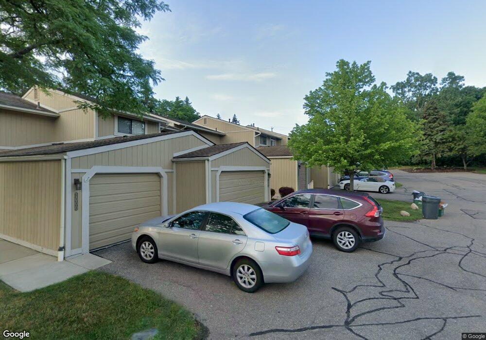
1052 Bristol Ct Northville, MI 48167
Estimated Value: $340,633 - $382,000
--
Bed
3
Baths
1,727
Sq Ft
$210/Sq Ft
Est. Value
About This Home
This home is located at 1052 Bristol Ct, Northville, MI 48167 and is currently estimated at $363,408, approximately $210 per square foot. 1052 Bristol Ct is a home located in Oakland County with nearby schools including Moraine Elementary School, Hillside Middle School, and Northville High School.
Ownership History
Date
Name
Owned For
Owner Type
Purchase Details
Closed on
Mar 20, 2017
Sold by
Stone Diane K and Stone James M
Bought by
Stone Diane K and Diane K Stone Trust
Current Estimated Value
Purchase Details
Closed on
Dec 7, 2000
Sold by
Kaiser Virginia
Bought by
Stone Diane K
Home Financials for this Owner
Home Financials are based on the most recent Mortgage that was taken out on this home.
Original Mortgage
$140,000
Outstanding Balance
$51,851
Interest Rate
7.77%
Mortgage Type
Purchase Money Mortgage
Estimated Equity
$311,557
Purchase Details
Closed on
Nov 18, 2000
Sold by
Mctaggart Marilyn C
Bought by
Stone Diane K
Home Financials for this Owner
Home Financials are based on the most recent Mortgage that was taken out on this home.
Original Mortgage
$140,000
Outstanding Balance
$51,851
Interest Rate
7.77%
Mortgage Type
Purchase Money Mortgage
Estimated Equity
$311,557
Create a Home Valuation Report for This Property
The Home Valuation Report is an in-depth analysis detailing your home's value as well as a comparison with similar homes in the area
Home Values in the Area
Average Home Value in this Area
Purchase History
| Date | Buyer | Sale Price | Title Company |
|---|---|---|---|
| Stone Diane K | -- | None Available | |
| Stone Diane K | $175,000 | -- | |
| Stone Diane K | -- | -- |
Source: Public Records
Mortgage History
| Date | Status | Borrower | Loan Amount |
|---|---|---|---|
| Open | Stone Diane K | $140,000 |
Source: Public Records
Tax History Compared to Growth
Tax History
| Year | Tax Paid | Tax Assessment Tax Assessment Total Assessment is a certain percentage of the fair market value that is determined by local assessors to be the total taxable value of land and additions on the property. | Land | Improvement |
|---|---|---|---|---|
| 2024 | $2,431 | $149,400 | $32,500 | $116,900 |
| 2023 | $2,663 | $119,300 | $25,000 | $94,300 |
| 2022 | $2,328 | $110,500 | $25,000 | $85,500 |
| 2021 | $2,424 | $110,500 | $29,800 | $80,700 |
| 2020 | $2,150 | $108,100 | $29,800 | $78,300 |
| 2018 | $2,244 | $90,400 | $0 | $0 |
Source: Public Records
Map
Nearby Homes
- 862 Yorktown Ct Unit L79
- 1054 Bristol Ct
- 958 New Haven Ct Unit 14
- 1202 Concord Ct Unit 67
- 20900 Taft Rd
- 20730 Taft Rd
- 48000 Eight Mile W
- 745 Randolph St Unit 223
- 21082 Boulder Cir Unit 303
- 21054 Boulder Cir Unit 502
- 21106 Boulder Cir Unit 101
- 1002 Coldspring Dr
- 46328 Northvalley Dr
- 822 Springfield Dr
- 551 Dubuar St
- 549 Dubuar St
- 21150 E Chigwidden St
- 1044 Elmsmere Dr
- 924 Carrington Dr
- 711 N Center St
- 858 Yorktown Ct Unit 77-BldgL
- 1118 Washington Cir Unit 50-BldgH
- 908 Williamsburg Ct Unit Bldg-Unit
- 1118 Washington Cir Unit BldgH-Unit50
- 894 Yorktown Ct Unit Bldg-Unit
- 888 Yorktown Ct
- 890 Yorktown Ct Unit 94
- 892 Yorktown Ct
- 896 Yorktown Ct
- 898 Yorktown Ct
- 872 Yorktown Ct
- 874 Yorktown Ct Unit M87
- 878 Yorktown Ct
- 880 Yorktown Ct
- 882 Yorktown Ct
- 868 Yorktown Ct Unit I82
- 866 Yorktown Ct
- 864 Yorktown Ct
- 860 Yorktown Ct
- 858 Yorktown Ct Unit L77