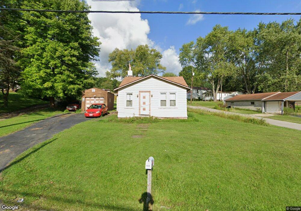
1052 Broadway Ave Masury, OH 44438
Estimated Value: $57,385 - $96,000
2
Beds
1
Bath
986
Sq Ft
$84/Sq Ft
Est. Value
About This Home
This home is located at 1052 Broadway Ave, Masury, OH 44438 and is currently estimated at $83,096, approximately $84 per square foot. 1052 Broadway Ave is a home located in Trumbull County with nearby schools including Brookfield Elementary School, Brookfield Middle School, and Brookfield High School.
Ownership History
Date
Name
Owned For
Owner Type
Purchase Details
Closed on
Oct 13, 2021
Sold by
Hoffman James E and Estate Of Bryan Paul Roth
Bought by
Lambing Crystal L
Current Estimated Value
Purchase Details
Closed on
Sep 24, 2007
Sold by
Roth John
Bought by
Roth Bryan Paul
Purchase Details
Closed on
Sep 20, 2007
Sold by
Roth John
Bought by
Roth Bryan Paul
Purchase Details
Closed on
Jan 1, 1990
Bought by
Bryan Paul Roth
Create a Home Valuation Report for This Property
The Home Valuation Report is an in-depth analysis detailing your home's value as well as a comparison with similar homes in the area
Home Values in the Area
Average Home Value in this Area
Purchase History
| Date | Buyer | Sale Price | Title Company |
|---|---|---|---|
| Lambing Crystal L | $9,000 | None Available | |
| Roth Bryan Paul | -- | None Available | |
| Roth Bryan Paul | -- | None Available | |
| Bryan Paul Roth | -- | -- |
Source: Public Records
Tax History Compared to Growth
Tax History
| Year | Tax Paid | Tax Assessment Tax Assessment Total Assessment is a certain percentage of the fair market value that is determined by local assessors to be the total taxable value of land and additions on the property. | Land | Improvement |
|---|---|---|---|---|
| 2024 | $916 | $10,080 | $2,660 | $7,420 |
| 2023 | $855 | $10,080 | $2,660 | $7,420 |
| 2022 | $487 | $8,300 | $2,660 | $5,640 |
| 2021 | $6 | $8,300 | $2,660 | $5,640 |
| 2020 | $6 | $8,300 | $2,660 | $5,640 |
| 2019 | $6 | $7,980 | $2,660 | $5,320 |
| 2018 | $6 | $7,980 | $2,660 | $5,320 |
| 2017 | $155 | $11,410 | $2,660 | $8,750 |
| 2016 | $6 | $8,190 | $2,660 | $5,530 |
| 2015 | $6 | $8,190 | $2,660 | $5,530 |
| 2014 | $6 | $8,190 | $2,660 | $5,530 |
| 2013 | $6 | $8,610 | $2,660 | $5,950 |
Source: Public Records
Map
Nearby Homes
- 7440 Stewart Sharon Rd
- 1354 Stevenson Rd
- 928 Bedford Rd
- 766 S Irvine Ave
- 545 & 625 Davis St
- 691 S Irvine Ave
- 609 Syme St
- 7182 Stewart Sharon Rd
- 365 Brookfield Ave
- 807 Lee Ave
- 306 Federal St
- 887 State Route 7 SE
- 268 Malleable St
- 506 Spearman Ave
- 1952 Hubbard Masury Rd
- 1120 Wallis Ave
- 872 Yankee Run Rd
- 626 Fruit Ave
- 6855 Stewart Sharon Rd
- 268 Ridge Way
- 1052 Broadway St
- 1042 Broadway St
- 1055 Broadway St
- 7839 Service St
- 1036 Broadway St
- 1066 Broadway
- 1059 Broadway St
- 7835 Service St
- 1071 Broadway St
- 1030 Broadway St
- 7872 Service St
- 1037 Broadway St
- 7865 Rose Ave
- 7825 Service St
- 7854 Budd St
- 7844 Budd St
- 7878 Service Ave
- 7815 Service St
- 7834 Budd St
- 7817 Rose Ave