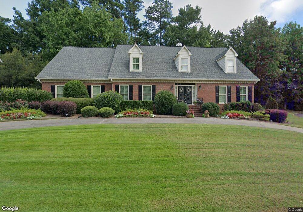
1052 Manning Farms Ct Atlanta, GA 30338
Estimated Value: $958,000 - $1,062,000
3
Beds
4
Baths
3,649
Sq Ft
$277/Sq Ft
Est. Value
About This Home
This home is located at 1052 Manning Farms Ct, Atlanta, GA 30338 and is currently estimated at $1,011,320, approximately $277 per square foot. 1052 Manning Farms Ct is a home located in DeKalb County with nearby schools including Austin Elementary School, Peachtree Middle School, and Dunwoody High School.
Ownership History
Date
Name
Owned For
Owner Type
Purchase Details
Closed on
Dec 21, 2012
Sold by
Duckett Charles Preston
Bought by
Duckett Terri Badour
Current Estimated Value
Home Financials for this Owner
Home Financials are based on the most recent Mortgage that was taken out on this home.
Original Mortgage
$332,950
Outstanding Balance
$225,289
Interest Rate
2.88%
Mortgage Type
New Conventional
Estimated Equity
$786,031
Purchase Details
Closed on
Aug 21, 2003
Sold by
Carothers Steven A
Bought by
Duckett C Preston and Duckett Terri
Home Financials for this Owner
Home Financials are based on the most recent Mortgage that was taken out on this home.
Original Mortgage
$220,000
Interest Rate
5.94%
Mortgage Type
New Conventional
Create a Home Valuation Report for This Property
The Home Valuation Report is an in-depth analysis detailing your home's value as well as a comparison with similar homes in the area
Home Values in the Area
Average Home Value in this Area
Purchase History
| Date | Buyer | Sale Price | Title Company |
|---|---|---|---|
| Duckett Terri Badour | -- | -- | |
| Duckett C Preston | $433,600 | -- |
Source: Public Records
Mortgage History
| Date | Status | Borrower | Loan Amount |
|---|---|---|---|
| Open | Duckett Terri Badour | $332,950 | |
| Previous Owner | Duckett C Preston | $220,000 |
Source: Public Records
Tax History Compared to Growth
Tax History
| Year | Tax Paid | Tax Assessment Tax Assessment Total Assessment is a certain percentage of the fair market value that is determined by local assessors to be the total taxable value of land and additions on the property. | Land | Improvement |
|---|---|---|---|---|
| 2025 | $8,039 | $315,160 | $80,000 | $235,160 |
| 2024 | $8,639 | $335,840 | $80,000 | $255,840 |
| 2023 | $8,639 | $242,000 | $80,000 | $162,000 |
| 2022 | $6,531 | $242,000 | $80,000 | $162,000 |
| 2021 | $5,229 | $274,440 | $80,000 | $194,440 |
| 2020 | $5,350 | $189,000 | $80,000 | $109,000 |
| 2019 | $5,267 | $189,000 | $80,000 | $109,000 |
| 2018 | $5,083 | $216,600 | $80,000 | $136,600 |
| 2017 | $5,503 | $170,000 | $51,000 | $119,000 |
| 2016 | $5,341 | $170,000 | $51,000 | $119,000 |
| 2014 | $5,339 | $165,440 | $53,920 | $111,520 |
Source: Public Records
Map
Nearby Homes
- 1136 Coronation Dr
- 5625 Roberts Dr
- 5662 Queensborough Dr
- 5697 Whitehall Walk
- 1120 Whitehall Pointe
- 812 Stratford Ct
- 1293 Witham Dr
- 1495 Spalding Dr
- 525 Spender Trace
- 980 Fenimore Cir
- 4006 Wingate Way
- 7632 Auden Trail
- 3020 Wingate Way
- 5816 Chamblee Dunwoody Rd
- 7967 Magnolia Square
- 1605 Saint Tropez Way
- 5379 Harris Cir
- 8205 Innsbruck Dr
- 1064 Manning Farms Ct
- 1174 Manning Farms Ct
- 1168 Manning Farms Ct
- 1155 Manning Farms Ct
- 1057 Mannings Farm Ct
- 1057 Manning Farms Ct
- 1072 Manning Farms Ct
- 1067 Manning Farms Ct
- 0 Manning Farms Ct Unit 7266753
- 0 Manning Farms Ct Unit 3192298
- 0 Manning Farms Ct Unit 8365006
- 0 Manning Farms Ct Unit 7253237
- 0 Manning Farms Ct Unit 7228311
- 0 Manning Farms Ct Unit 7200953
- 0 Manning Farms Ct Unit 7192363
- 0 Manning Farms Ct Unit 7172167
- 0 Manning Farms Ct Unit 7132896
- 1156 Manning Farms Ct
- 1141 Manning Farms Ct
- 1123 Manning Farms Ct