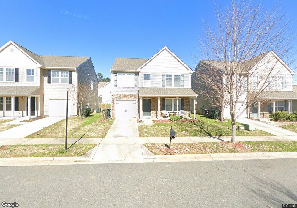
1052 Ramsgate Dr SW Unit 153 Concord, NC 28025
Estimated Value: $337,671 - $353,000
4
Beds
3
Baths
2,062
Sq Ft
$167/Sq Ft
Est. Value
About This Home
This home is located at 1052 Ramsgate Dr SW Unit 153, Concord, NC 28025 and is currently estimated at $345,168, approximately $167 per square foot. 1052 Ramsgate Dr SW Unit 153 is a home located in Cabarrus County with nearby schools including A.T. Allen Elementary School, C.C. Griffin Middle School, and Central Cabarrus High School.
Ownership History
Date
Name
Owned For
Owner Type
Purchase Details
Closed on
Apr 13, 2023
Sold by
Thompson Amanda Lynne
Bought by
Penton Christina and Penton Larry
Current Estimated Value
Home Financials for this Owner
Home Financials are based on the most recent Mortgage that was taken out on this home.
Original Mortgage
$353,479
Outstanding Balance
$343,014
Interest Rate
6.65%
Mortgage Type
FHA
Estimated Equity
$2,154
Purchase Details
Closed on
Aug 2, 2010
Sold by
True Homes Llc
Bought by
Thompson Amanda Lynne
Home Financials for this Owner
Home Financials are based on the most recent Mortgage that was taken out on this home.
Original Mortgage
$143,926
Interest Rate
4.5%
Mortgage Type
FHA
Purchase Details
Closed on
Jun 1, 2010
Sold by
Dan Moser Company Inc
Bought by
True Homes Llc
Create a Home Valuation Report for This Property
The Home Valuation Report is an in-depth analysis detailing your home's value as well as a comparison with similar homes in the area
Home Values in the Area
Average Home Value in this Area
Purchase History
| Date | Buyer | Sale Price | Title Company |
|---|---|---|---|
| Penton Christina | $360,000 | None Listed On Document | |
| Penton Christina | $360,000 | None Listed On Document | |
| Thompson Amanda Lynne | $146,000 | None Available | |
| True Homes Llc | $26,000 | None Available |
Source: Public Records
Mortgage History
| Date | Status | Borrower | Loan Amount |
|---|---|---|---|
| Open | Penton Christina | $353,479 | |
| Closed | Penton Christina | $10,604 | |
| Closed | Penton Christina | $353,479 | |
| Previous Owner | Thompson Amanda Lynne | $143,926 |
Source: Public Records
Tax History
| Year | Tax Paid | Tax Assessment Tax Assessment Total Assessment is a certain percentage of the fair market value that is determined by local assessors to be the total taxable value of land and additions on the property. | Land | Improvement |
|---|---|---|---|---|
| 2025 | $3,236 | $324,860 | $68,000 | $256,860 |
| 2024 | $3,236 | $324,860 | $68,000 | $256,860 |
| 2023 | $2,612 | $214,060 | $40,000 | $174,060 |
| 2022 | $2,612 | $214,060 | $40,000 | $174,060 |
| 2021 | $2,612 | $214,060 | $40,000 | $174,060 |
| 2020 | $2,612 | $214,060 | $40,000 | $174,060 |
| 2019 | $2,015 | $165,170 | $20,000 | $145,170 |
| 2018 | $1,982 | $165,170 | $20,000 | $145,170 |
| 2017 | $1,949 | $165,170 | $20,000 | $145,170 |
| 2016 | $1,156 | $147,380 | $24,000 | $123,380 |
| 2015 | -- | $147,380 | $24,000 | $123,380 |
| 2014 | -- | $147,380 | $24,000 | $123,380 |
Source: Public Records
Map
Nearby Homes
- 1039 Manston Place SW
- 4194 Clifftonville Ave SW
- 3969 Potts Grove Place
- 608 Nannyberry Ln
- 836 Chastain Ave
- 741 Nannyberry Ln
- 4003 Long Arrow Dr Unit 366
- 4018 Bethesda Place
- 303 Olde North Church Dr Unit 38
- 685 Continental Dr
- 1308 Roseberry Place SW
- 3560 Us Highway 601 S
- 5016 Hildreth Ct
- 4227 Kiser Woods Dr SW
- 5248 Ellie Ct
- 456 Debra Cir SW
- 3044 Parade Ln SW
- 4274 Kiser Woods Dr SW
- 1562 Piney Church Rd
- 3168 Sossamon Place
- 1052 Ramsgate Dr SW
- 1056 Ramsgate Dr SW
- 1046 Ramsgate Dr SW
- 4217 Broadstairs Dr
- 1040 Ramsgate Dr SW
- 4209 Broadstairs Dr
- 1064 Ramsgate Dr SW
- 4816 Broadstairs Dr SW
- 1036 Ramsgate Dr SW
- 1053 Ramsgate Dr SW
- 4201 Broadstairs Dr SW
- 4201 Broadstairs Dr
- 1045 Ramsgate Dr SW
- 1068 Ramsgate Dr SW
- 1049 Ramsgate Dr SW
- 1057 Ramsgate Dr SW
- 4222 Broadstairs Dr
- 4214 Broadstairs Dr SW
- 1041 Ramsgate Dr SW
- 4218 Broadstairs Dr
Your Personal Tour Guide
Ask me questions while you tour the home.