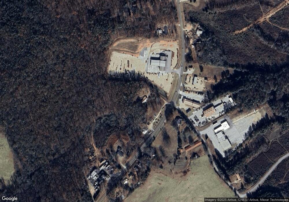
10520 Highway 59 Carnesville, GA 30521
Estimated Value: $294,000 - $353,000
3
Beds
2
Baths
1,758
Sq Ft
$180/Sq Ft
Est. Value
About This Home
This home is located at 10520 Highway 59, Carnesville, GA 30521 and is currently estimated at $316,667, approximately $180 per square foot. 10520 Highway 59 is a home with nearby schools including Franklin County High School.
Ownership History
Date
Name
Owned For
Owner Type
Purchase Details
Closed on
Sep 6, 2024
Sold by
Segars Brian T
Bought by
Vickery David
Current Estimated Value
Purchase Details
Closed on
Feb 19, 2021
Sold by
Segars Douglas T
Bought by
Segars Brian Terrell and Segars Kevin L
Purchase Details
Closed on
Feb 12, 2021
Sold by
Segars Teresa
Bought by
Segars Brian Terrell and Segars Kevin L
Purchase Details
Closed on
Jul 11, 2003
Sold by
Becky Douglas
Bought by
Segars Douglas
Purchase Details
Closed on
Aug 4, 1990
Bought by
Segars Douglas
Create a Home Valuation Report for This Property
The Home Valuation Report is an in-depth analysis detailing your home's value as well as a comparison with similar homes in the area
Home Values in the Area
Average Home Value in this Area
Purchase History
| Date | Buyer | Sale Price | Title Company |
|---|---|---|---|
| Vickery David | $330,000 | -- | |
| Segars Brian Terrell | -- | -- | |
| Segars Brian Terrell | -- | -- | |
| Segars Douglas | -- | -- | |
| Segars Douglas | -- | -- |
Source: Public Records
Tax History Compared to Growth
Tax History
| Year | Tax Paid | Tax Assessment Tax Assessment Total Assessment is a certain percentage of the fair market value that is determined by local assessors to be the total taxable value of land and additions on the property. | Land | Improvement |
|---|---|---|---|---|
| 2024 | $2,119 | $89,024 | $3,000 | $86,024 |
| 2023 | $1,757 | $68,108 | $3,000 | $65,108 |
| 2022 | $1,607 | $62,292 | $3,000 | $59,292 |
| 2021 | $1,467 | $53,331 | $1,500 | $51,831 |
| 2020 | $1,183 | $44,552 | $1,500 | $43,052 |
| 2019 | $1,143 | $44,552 | $1,500 | $43,052 |
| 2018 | $967 | $37,982 | $1,500 | $36,482 |
| 2017 | $1,005 | $37,982 | $1,500 | $36,482 |
| 2016 | $903 | $32,955 | $1,500 | $31,455 |
| 2015 | -- | $32,954 | $1,500 | $31,455 |
| 2014 | -- | $32,955 | $1,500 | $31,455 |
| 2013 | -- | $32,954 | $1,500 | $31,454 |
Source: Public Records
Map
Nearby Homes
- 10170 Lavonia Rd
- 228 Franklin Hills Dr
- 228 Franklin Hills Dr Unit B14
- 0 Manley St Unit 10611784
- 0 Turkey Creek Rd Unit 10589237
- 00 Hall Carson Rd
- 2556 Turkey Creek Rd
- 735 Bowersville Rd
- 7690 Royston Rd
- 210 Nora Moss Ln
- 7 Crest View Cir
- 110 Telford Rd
- 1845 Old Stagecoach Rd
- 110 Adaline Ct
- 5821 Georgia 320
- 0 Baty Rd Unit 10562917
- 456 Aderhold Rd
- 380 Thomas Rd
- 0 Murphy Rd Unit 10585891
- 499 Aderhold Rd
- 10520 Georgia 59
- 307 Busha Rd
- 10416 Lavonia Rd
- 10510 Highway 106
- 10372 Highway 106
- 10705 Georgia 106
- 10705 Highway 106
- 10340 Lavonia Rd
- 10368 Lavonia Rd
- 10459 Highway 106
- 520 Busha Rd
- 10315 Lavonia Rd
- 10763 Highway 106
- 10314 Lavonia Rd
- 10278 Lavonia Rd
- 10763 Georgia 106
- 401 Busha Rd
- 10250 Lavonia Rd
- 10234 Lavonia Rd
- 10210 Lavonia Rd
