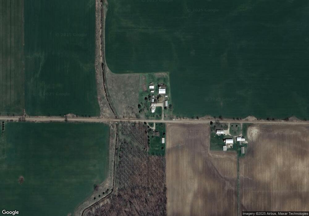
10520 W Jason Rd Fowler, MI 48835
Estimated Value: $389,000 - $1,344,832
5
Beds
2
Baths
2,170
Sq Ft
$403/Sq Ft
Est. Value
About This Home
This home is located at 10520 W Jason Rd, Fowler, MI 48835 and is currently estimated at $873,958, approximately $402 per square foot. 10520 W Jason Rd is a home located in Clinton County with nearby schools including Pewamo-Westphalia Elementary School and Pewamo-Westphalia Junior/Senior High School.
Ownership History
Date
Name
Owned For
Owner Type
Purchase Details
Closed on
Nov 21, 2023
Sold by
Revocable Living Trust
Bought by
Schmitz Robert S and Schmitz Alyson L
Current Estimated Value
Home Financials for this Owner
Home Financials are based on the most recent Mortgage that was taken out on this home.
Original Mortgage
$715,000
Outstanding Balance
$707,367
Interest Rate
7.57%
Mortgage Type
New Conventional
Estimated Equity
$299,121
Purchase Details
Closed on
Mar 8, 2017
Sold by
Schmitz Donald F and Schmitz Mary L
Bought by
Schmitz Donald F and Schmitz Mary L
Create a Home Valuation Report for This Property
The Home Valuation Report is an in-depth analysis detailing your home's value as well as a comparison with similar homes in the area
Home Values in the Area
Average Home Value in this Area
Purchase History
Date | Buyer | Sale Price | Title Company |
---|---|---|---|
Schmitz Robert S | $717,000 | Ata National Title Group | |
Schmitz Donald F | -- | Attorney |
Source: Public Records
Mortgage History
Date | Status | Borrower | Loan Amount |
---|---|---|---|
Open | Schmitz Robert S | $715,000 |
Source: Public Records
Tax History Compared to Growth
Tax History
Year | Tax Paid | Tax Assessment Tax Assessment Total Assessment is a certain percentage of the fair market value that is determined by local assessors to be the total taxable value of land and additions on the property. | Land | Improvement |
---|---|---|---|---|
2024 | $2,447 | $0 | $0 | $0 |
2023 | $2,447 | $807,600 | $0 | $0 |
2022 | $5,640 | $793,100 | $670,400 | $122,700 |
2021 | $5,205 | $785,400 | $672,900 | $112,500 |
2020 | $4,811 | $716,700 | $610,200 | $106,500 |
2019 | $2,611 | $691,200 | $595,100 | $96,100 |
2018 | $4,692 | $665,200 | $561,400 | $103,800 |
2017 | -- | $620,900 | $513,200 | $107,700 |
2016 | -- | $575,800 | $468,100 | $107,700 |
2015 | -- | $521,100 | $0 | $0 |
2011 | -- | $469,200 | $0 | $0 |
Source: Public Records
Map
Nearby Homes
- 11891 W Price Rd
- 8300 S Wacousta Rd
- 11471 S Bauer Rd
- 10880 S Francis Rd
- 7051 W Parks Rd
- 8464 W Howe Rd
- 00 W Cutler Rd
- 11325 Tyler Dr
- 9216 S Grove Rd
- 4050 Cayman Dr
- 426 S Main St
- 11266 W Herbison Rd
- 5337 W Chadwick Rd
- 9840 W Herbison Rd
- V/L W M21
- 11195 W Herbison Rd
- 11781 W Herbison Rd
- 0 W Herbison Rd
- 11958 Eden Trail
- 8767 Corrison Rd
- 10520 W Jason Rd
- 10517 W Jason Rd
- 10395 W Jason Rd
- 10801 W Jason Rd
- 10910 W Jason Rd
- 10987 W Jason Rd
- 7143 S Wright Rd
- 9760 S Bauer Rd
- 9605 S Bauer Rd
- 11060 W Jason Rd
- 11121 W Jason Rd
- 6663 S Bauer Rd
- 7455 S Wright Rd
- 6515 S Wright Rd
- 6500 S Wright Rd
- 11223 W Jason Rd
- 6449 S Wright Rd
- 7675 S Wright Rd
- 7566 S Wright Rd
- 6448 S Wright Rd