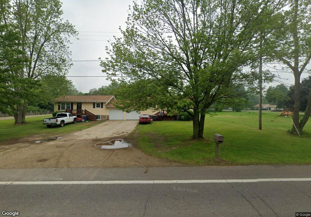
10522 Oakland Dr Portage, MI 49024
Estimated Value: $242,000 - $292,000
--
Bed
--
Bath
1,843
Sq Ft
$147/Sq Ft
Est. Value
About This Home
This home is located at 10522 Oakland Dr, Portage, MI 49024 and is currently estimated at $270,135, approximately $146 per square foot. 10522 Oakland Dr is a home located in Kalamazoo County with nearby schools including Moorsbridge Elementary School, Portage Central Middle School, and Portage Central High School.
Ownership History
Date
Name
Owned For
Owner Type
Purchase Details
Closed on
Aug 28, 2014
Sold by
Apessos Donna L and Troth Michelle P
Bought by
Troth Julius Gary and Troth Michele P
Current Estimated Value
Purchase Details
Closed on
Mar 24, 2010
Sold by
Apessos Donna L and Troth Michele P
Bought by
Apessos Donna L and Troth Michele P
Purchase Details
Closed on
Feb 23, 2004
Sold by
Shevchik Michael and Shevchik Mike
Bought by
Shevchik Michael and Troth Michele P
Create a Home Valuation Report for This Property
The Home Valuation Report is an in-depth analysis detailing your home's value as well as a comparison with similar homes in the area
Home Values in the Area
Average Home Value in this Area
Purchase History
| Date | Buyer | Sale Price | Title Company |
|---|---|---|---|
| Troth Julius Gary | $55,000 | None Available | |
| Apessos Donna L | -- | None Available | |
| Apessos Donna L | -- | None Available | |
| Shevchik Michael | -- | -- |
Source: Public Records
Tax History Compared to Growth
Tax History
| Year | Tax Paid | Tax Assessment Tax Assessment Total Assessment is a certain percentage of the fair market value that is determined by local assessors to be the total taxable value of land and additions on the property. | Land | Improvement |
|---|---|---|---|---|
| 2025 | $4,638 | $117,700 | $0 | $0 |
| 2024 | $4,239 | $118,800 | $0 | $0 |
| 2023 | $4,039 | $97,800 | $0 | $0 |
| 2022 | $4,206 | $87,200 | $0 | $0 |
| 2021 | $4,067 | $78,100 | $0 | $0 |
| 2020 | $3,987 | $65,500 | $0 | $0 |
| 2019 | $257 | $65,000 | $0 | $0 |
| 2018 | $0 | $73,900 | $0 | $0 |
| 2017 | $0 | $71,600 | $0 | $0 |
| 2016 | -- | $64,500 | $0 | $0 |
| 2015 | -- | $59,000 | $0 | $0 |
| 2014 | -- | $64,000 | $0 | $0 |
Source: Public Records
Map
Nearby Homes
- 1817 Alder Ave
- 10381 Schrier Ln
- 10382 Pennridge Dr
- 2633 Rolling Hill Ave
- Integrity 1800 Plan at Pennridge Trail North
- Integrity 2085 Plan at Pennridge Trail North
- Integrity 1910 Plan at Pennridge Trail North
- 10197 Pennridge Dr
- 10187 Pennridge Dr
- 10118 Pennridge Dr
- 10077 Kearns Ct
- 10025 Kearns Ct
- 10029 Kearns Ct
- 10565 Pierport Dr
- 10025 Shuman St
- 9899 Windflower Ln
- 9898 Windflower Ln
- 2612 Ashford Trail
- 2750 Ashford Trail
- 2613 Ashford Trail
- 2150 West Mar Ct
- 2180 West Mar Ct
- 2190 West Mar Ct
- 2200 West Mar Ct
- 2160 West Mar Ct
- 2170 West Mar Ct
- 2199 West Mar Ct
- 2205 West Mar Ct
- 2213 West Mar Ct
- 10506 Oakland Dr
- 2275 West Mar Ct
- 2191 West Mar Ct
- 10542 Oakland Dr
- 2183 West Mar Ct
- 2375 West Mar Ct
- 2175 West Mar Ct Unit 1
- 2205 W Osterhout Ave
- 10606 Oakland Dr
- 10541 Oakland Dr
- 2025 W Osterhout Ave