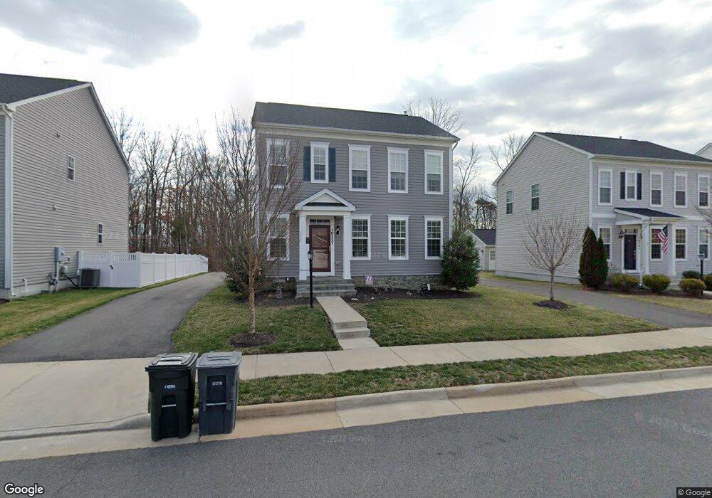
10527 Bittersweet Ln Bristow, VA 20136
Estimated Value: $669,000 - $714,000
3
Beds
4
Baths
1,680
Sq Ft
$409/Sq Ft
Est. Value
About This Home
This home is located at 10527 Bittersweet Ln, Bristow, VA 20136 and is currently estimated at $687,922, approximately $409 per square foot. 10527 Bittersweet Ln is a home located in Prince William County with nearby schools including The Nokesville School, Brentsville District High School, and Linton Hall School.
Ownership History
Date
Name
Owned For
Owner Type
Purchase Details
Closed on
Jul 24, 2015
Sold by
Brookfield Vint Hill Llc
Bought by
Salisbury Debra L
Current Estimated Value
Home Financials for this Owner
Home Financials are based on the most recent Mortgage that was taken out on this home.
Original Mortgage
$351,766
Outstanding Balance
$275,716
Interest Rate
4.01%
Mortgage Type
New Conventional
Estimated Equity
$412,206
Create a Home Valuation Report for This Property
The Home Valuation Report is an in-depth analysis detailing your home's value as well as a comparison with similar homes in the area
Home Values in the Area
Average Home Value in this Area
Purchase History
| Date | Buyer | Sale Price | Title Company |
|---|---|---|---|
| Salisbury Debra L | $439,708 | -- |
Source: Public Records
Mortgage History
| Date | Status | Borrower | Loan Amount |
|---|---|---|---|
| Open | Salisbury Debra L | $351,766 |
Source: Public Records
Tax History Compared to Growth
Tax History
| Year | Tax Paid | Tax Assessment Tax Assessment Total Assessment is a certain percentage of the fair market value that is determined by local assessors to be the total taxable value of land and additions on the property. | Land | Improvement |
|---|---|---|---|---|
| 2025 | $5,917 | $605,900 | $188,100 | $417,800 |
| 2024 | $5,917 | $595,000 | $185,400 | $409,600 |
| 2023 | $6,007 | $577,300 | $183,300 | $394,000 |
| 2022 | $5,737 | $507,700 | $160,100 | $347,600 |
| 2021 | $5,612 | $459,500 | $145,000 | $314,500 |
| 2020 | $6,752 | $435,600 | $142,700 | $292,900 |
| 2019 | $6,422 | $414,300 | $142,300 | $272,000 |
| 2018 | $4,951 | $410,000 | $142,000 | $268,000 |
| 2017 | $5,066 | $410,800 | $142,000 | $268,800 |
| 2016 | $4,989 | $408,300 | $141,800 | $266,500 |
| 2015 | $1,729 | $141,600 | $141,600 | $0 |
| 2014 | $1,729 | $141,600 | $141,600 | $0 |
Source: Public Records
Map
Nearby Homes
- 12021 Spring Beauty Rd
- 10505 Blazing Star Loop
- 10554 Andrew Humphreys Ct
- 12002 Fitzgerald Way
- 11650 Iron Brigade Unit Ave
- 12054 Nokesville Rd
- 11688 Camp Jones Ct
- 12203 Aster Rd
- 11823 Whitworth Cannon Ln
- 12171 Open Meadow Ln
- 9923 Bagpipe Ct
- 12360 Corncrib Ct
- 10024 Darnaway Ct
- 12410 Iona Sound Dr
- 11862 Arcari Dr
- 14058 Hawkeye Run Ct
- 12127 & 12131 Vint Hill Rd
- 9651 Bedder Stone Place
- 9817 Maitland Loop
- Hampton II Plan at Parkgate Estates
- 10531 Bittersweet Ln
- 10523 Bittersweet Ln
- Bittersweet Ln
- 10517 Bittersweet Ln
- 12001 Spring Beauty Rd
- 10546 Bittersweet Ln
- 10515 Bittersweet Ln
- 12009 Spring Beauty Rd
- 12000 Spring Beauty Rd
- Spring Beauty Rd
- 10543 Bittersweet Ln
- 10550 Bittersweet Ln
- 10511 Bittersweet Ln
- 12013 Spring Beauty Rd
- 12004 Spring Beauty Rd
- 10547 Bittersweet Ln
- 10507 Bittersweet Ln
- 10554 Bittersweet Ln
- 10551 Bittersweet Ln
- 10551 Bittersweet Ln