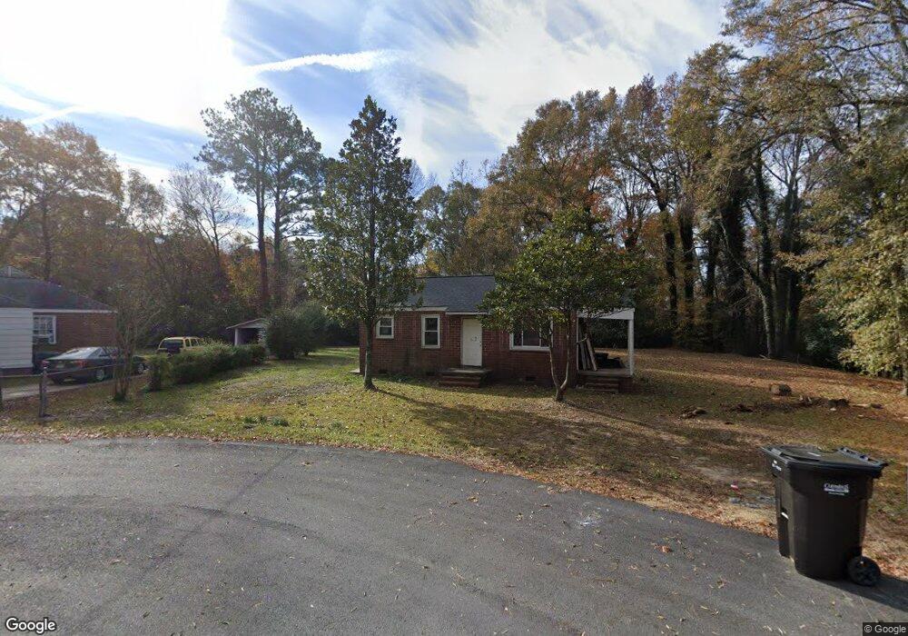
1053 Harbison Ct Columbus, GA 31903
Southern Columbus NeighborhoodEstimated Value: $41,000 - $51,523
2
Beds
2
Baths
858
Sq Ft
$52/Sq Ft
Est. Value
About This Home
This home is located at 1053 Harbison Ct, Columbus, GA 31903 and is currently estimated at $44,631, approximately $52 per square foot. 1053 Harbison Ct is a home located in Muscogee County with nearby schools including Dorothy Height Elementary School, Baker Middle School, and Spencer High School.
Ownership History
Date
Name
Owned For
Owner Type
Purchase Details
Closed on
Mar 18, 2025
Sold by
Vancamp Michael
Bought by
Lee Jonathan A and Carmichael Daniela N
Current Estimated Value
Purchase Details
Closed on
Mar 17, 2025
Sold by
Lee Jonathan A and Carmichael Daniela N
Bought by
Andrade Pedro
Purchase Details
Closed on
Sep 17, 2024
Sold by
Vancamp Michael
Bought by
Lee Jonathan A and Carmichael Daniela N
Home Financials for this Owner
Home Financials are based on the most recent Mortgage that was taken out on this home.
Original Mortgage
$30,000
Interest Rate
6.73%
Mortgage Type
Construction
Purchase Details
Closed on
Apr 12, 2018
Sold by
Rodriguez Ashley
Bought by
Vanvancampii Michael Van
Purchase Details
Closed on
Oct 22, 2014
Sold by
Camp Michael
Bought by
Rodriguez Ashley
Purchase Details
Closed on
Oct 1, 2010
Sold by
Atkins Glenn L
Bought by
Camp Ii Michael
Create a Home Valuation Report for This Property
The Home Valuation Report is an in-depth analysis detailing your home's value as well as a comparison with similar homes in the area
Home Values in the Area
Average Home Value in this Area
Purchase History
| Date | Buyer | Sale Price | Title Company |
|---|---|---|---|
| Lee Jonathan A | -- | None Listed On Document | |
| Andrade Pedro | $41,000 | None Listed On Document | |
| Lee Jonathan A | $35,000 | None Listed On Document | |
| Vanvancampii Michael Van | -- | -- | |
| Rodriguez Ashley | -- | -- | |
| Camp Ii Michael | $7,000 | None Available |
Source: Public Records
Mortgage History
| Date | Status | Borrower | Loan Amount |
|---|---|---|---|
| Previous Owner | Lee Jonathan A | $30,000 |
Source: Public Records
Tax History Compared to Growth
Tax History
| Year | Tax Paid | Tax Assessment Tax Assessment Total Assessment is a certain percentage of the fair market value that is determined by local assessors to be the total taxable value of land and additions on the property. | Land | Improvement |
|---|---|---|---|---|
| 2025 | $547 | $13,972 | $5,812 | $8,160 |
| 2024 | $719 | $18,356 | $4,800 | $13,556 |
| 2023 | $723 | $18,356 | $4,800 | $13,556 |
| 2022 | $612 | $14,980 | $4,800 | $10,180 |
| 2021 | $629 | $13,824 | $4,800 | $9,024 |
| 2020 | $565 | $13,824 | $4,800 | $9,024 |
| 2019 | $566 | $13,824 | $4,800 | $9,024 |
| 2018 | $566 | $13,824 | $4,800 | $9,024 |
| 2017 | $631 | $13,824 | $4,800 | $9,024 |
| 2016 | $435 | $10,547 | $2,210 | $8,337 |
| 2015 | $436 | $10,547 | $2,210 | $8,337 |
| 2014 | $436 | $10,547 | $2,210 | $8,337 |
| 2013 | -- | $10,547 | $2,210 | $8,337 |
Source: Public Records
Map
Nearby Homes
- 920 Brooks Rd
- 929 Winston Rd
- 906 Winston Rd
- 824 Winston Rd
- 3522 Youmans St
- 810 Winston Rd
- 1025 Fletcher Ave
- 917 Fletcher Ave
- 2463 Brownie St
- 716 Benning Dr
- 3711 Youmans St
- 2451 Brownie Ln
- 1274 Providence Ln
- 2463 Brownie Ln
- 3815 Baker Plaza Dr
- 3110 Victory Dr Unit 90
- 3110 Victory Dr
- 2973 Hawthorne Dr
- 2916 Lee St
- 2823 Lee St
- 1057 Harbison Ct
- 1049 Harbison Ct
- 1126 Baker Ct
- 1045 Harbison Ct
- 1039 Harbison Dr
- 3103 Head St
- 1122 Baker Ct
- 1130 Baker Ct
- 3126 Head St
- 1031 Harbison Dr
- 1044 Harbison Dr
- 3109 Head St
- 1029 Harbison Dr
- 3130 Head St
- 1134 Baker Ct
- 1040 Harbison Dr
- 3111 Baker Cir
- 3103 Baker Cir
- 3115 Head St
- 3115 Baker Cir