Estimated Value: $179,871 - $192,000
3
Beds
1
Bath
999
Sq Ft
$186/Sq Ft
Est. Value
About This Home
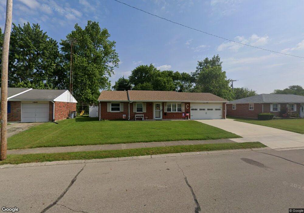
This home is located at 1053 Mayfield Dr, Troy, OH 45373 and is currently estimated at $185,718, approximately $185 per square foot. 1053 Mayfield Dr is a home located in Miami County with nearby schools including Cookson Elementary School, Troy Junior High School, and Van Cleve Elementary School.
Ownership History
Date
Name
Owned For
Owner Type
Purchase Details
Closed on
Oct 12, 2011
Sold by
Secretary Of Housing & Urban Development
Bought by
Chaney Becky L
Current Estimated Value
Purchase Details
Closed on
Aug 2, 2011
Sold by
U S Bank Na
Bought by
Sec Of Housing & Urban Dev
Purchase Details
Closed on
Mar 17, 2011
Sold by
Suerdieck Heidi L
Bought by
U S Bank Na
Purchase Details
Closed on
Feb 17, 2011
Sold by
U S Bank Na
Bought by
Sec Of Housing & Urban Dev
Purchase Details
Closed on
Mar 23, 2001
Sold by
Both Charles S
Bought by
Suerdieck Heidi L and Pearson James
Home Financials for this Owner
Home Financials are based on the most recent Mortgage that was taken out on this home.
Original Mortgage
$82,296
Interest Rate
7.03%
Mortgage Type
FHA
Purchase Details
Closed on
Dec 14, 1993
Bought by
Both Charles S
Create a Home Valuation Report for This Property
The Home Valuation Report is an in-depth analysis detailing your home's value as well as a comparison with similar homes in the area
Home Values in the Area
Average Home Value in this Area
Purchase History
| Date | Buyer | Sale Price | Title Company |
|---|---|---|---|
| Chaney Becky L | -- | -- | |
| Sec Of Housing & Urban Dev | -- | -- | |
| U S Bank Na | $52,000 | -- | |
| Sec Of Housing & Urban Dev | -- | -- | |
| Suerdieck Heidi L | $83,588 | -- | |
| Both Charles S | $72,000 | -- |
Source: Public Records
Mortgage History
| Date | Status | Borrower | Loan Amount |
|---|---|---|---|
| Previous Owner | Suerdieck Heidi L | $82,296 |
Source: Public Records
Tax History
| Year | Tax Paid | Tax Assessment Tax Assessment Total Assessment is a certain percentage of the fair market value that is determined by local assessors to be the total taxable value of land and additions on the property. | Land | Improvement |
|---|---|---|---|---|
| 2024 | $1,268 | $41,970 | $11,380 | $30,590 |
| 2023 | $1,213 | $41,970 | $11,380 | $30,590 |
| 2022 | $1,043 | $41,970 | $11,380 | $30,590 |
| 2021 | $1,066 | $32,270 | $8,750 | $23,520 |
| 2020 | $1,068 | $32,270 | $8,750 | $23,520 |
| 2019 | $1,078 | $32,270 | $8,750 | $23,520 |
| 2018 | $663 | $19,110 | $9,800 | $9,310 |
| 2017 | $670 | $19,110 | $9,800 | $9,310 |
| 2016 | $660 | $19,110 | $9,800 | $9,310 |
| 2015 | $650 | $18,030 | $9,240 | $8,790 |
| 2014 | $650 | $18,030 | $9,240 | $8,790 |
| 2013 | $654 | $18,030 | $9,240 | $8,790 |
Source: Public Records
Map
Nearby Homes
- 491 Mayfield Square E
- 1597 Old Staunton Rd
- 984 Mystic Ln
- 1142 Lee Rd
- 1206 Heritage Dr
- 1117 Scenic Ct
- 1057 Stonyridge Ave
- 555 Miami St
- 1257 Gettysburg Dr
- 1329 Lee Rd
- 1334 Skylark Dr
- 506 Michigan Ave
- 1210 Charleston Ct
- 708 N Market St
- 1728 Hunters Ridge Dr
- 598 N Market St
- 1424 Michael Dr
- 619 E Canal St
- 1400 Troy Urbana Rd
- 1119 Long St
- 1049 Mayfield Dr
- 1057 Mayfield Dr
- 1052 Nutmeg Square S
- 1056 Nutmeg Square S
- 1045 Mayfield Dr
- 1030 Mayfield Dr
- 1048 Nutmeg Square S
- 1061 Mayfield Dr
- 532 Stonyridge Ave
- 1041 Mayfield Dr
- 1026 Mayfield Dr
- 1060 Nutmeg Square S
- 489 Mayfield Ct
- 1044 Nutmeg Square S
- 490 Mayfield Ct
- 1037 Mayfield Dr
- 485 Mayfield Ct
- 1040 Nutmeg Square S
- 1065 Nutmeg Square N
- 1022 Mayfield Dr
Your Personal Tour Guide
Ask me questions while you tour the home.