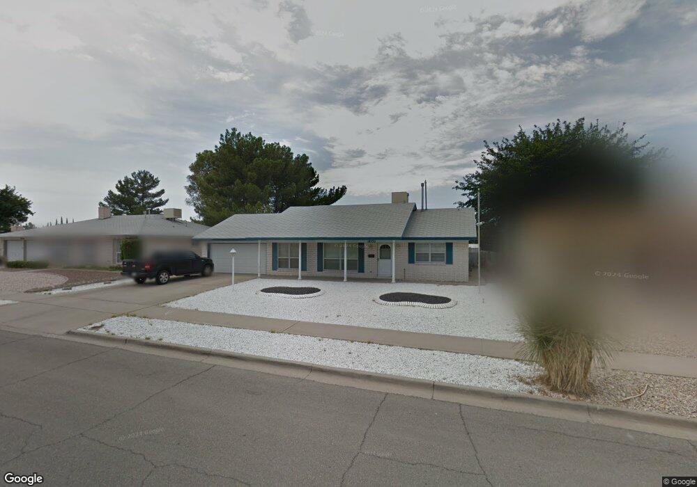
10532 Texwood Ave El Paso, TX 79925
Travis White NeighborhoodEstimated Value: $235,058 - $265,000
--
Bed
2
Baths
1,678
Sq Ft
$149/Sq Ft
Est. Value
About This Home
This home is located at 10532 Texwood Ave, El Paso, TX 79925 and is currently estimated at $249,515, approximately $148 per square foot. 10532 Texwood Ave is a home located in El Paso County with nearby schools including Eastwood Heights Elementary School, Eastwood High School, and St. Raphael School.
Ownership History
Date
Name
Owned For
Owner Type
Purchase Details
Closed on
Jul 11, 2007
Sold by
Chavez Hector and Chavez Aida M
Bought by
Chavez Jessica M
Current Estimated Value
Purchase Details
Closed on
Jun 13, 2000
Sold by
The Bank Of New York
Bought by
Va
Purchase Details
Closed on
May 9, 2000
Sold by
Pledged Property Iv Llc
Bought by
Va
Purchase Details
Closed on
May 2, 2000
Sold by
Hernandez Joseph D and Hernandez Janie A
Bought by
The Bank Of New York
Purchase Details
Closed on
Apr 27, 1995
Sold by
Mulcahy Beverlee and Anfang June B
Bought by
Hernandez Joseph D and Hernandez Janie A
Home Financials for this Owner
Home Financials are based on the most recent Mortgage that was taken out on this home.
Original Mortgage
$78,540
Interest Rate
8.36%
Mortgage Type
Assumption
Create a Home Valuation Report for This Property
The Home Valuation Report is an in-depth analysis detailing your home's value as well as a comparison with similar homes in the area
Home Values in the Area
Average Home Value in this Area
Purchase History
| Date | Buyer | Sale Price | Title Company |
|---|---|---|---|
| Chavez Jessica M | -- | None Available | |
| Va | -- | -- | |
| Va | -- | -- | |
| The Bank Of New York | $63,454 | -- | |
| Hernandez Joseph D | -- | -- |
Source: Public Records
Mortgage History
| Date | Status | Borrower | Loan Amount |
|---|---|---|---|
| Previous Owner | Hernandez Joseph D | $78,540 |
Source: Public Records
Tax History Compared to Growth
Tax History
| Year | Tax Paid | Tax Assessment Tax Assessment Total Assessment is a certain percentage of the fair market value that is determined by local assessors to be the total taxable value of land and additions on the property. | Land | Improvement |
|---|---|---|---|---|
| 2025 | $6,112 | $246,107 | $51,491 | $194,616 |
| 2024 | $6,112 | $222,525 | $27,909 | $194,616 |
| 2023 | $6,186 | $212,544 | $27,909 | $184,635 |
| 2022 | $5,866 | $188,910 | $27,909 | $161,001 |
| 2021 | $5,323 | $163,757 | $27,909 | $135,848 |
| 2020 | $5,125 | $162,271 | $21,468 | $140,803 |
| 2018 | $5,006 | $160,976 | $21,468 | $139,508 |
| 2017 | $4,489 | $146,853 | $21,468 | $125,385 |
| 2016 | $4,327 | $141,573 | $21,468 | $120,105 |
| 2015 | $4,381 | $141,573 | $21,468 | $120,105 |
| 2014 | $4,381 | $153,101 | $21,468 | $131,633 |
Source: Public Records
Map
Nearby Homes
- 10533 Springwood Dr
- 10463 Davwood Ln
- 10481 Deepwood Ct
- 10233 Byway Dr
- 10313 Byway Dr
- 10412 Chinaberry Dr
- 10401 Springwood Dr
- 1909 Crow Dr
- 10212 Garwood Ct
- 10617 Candlewood Ave
- 7936 Dogwood St
- 10304 Woodruff Ct
- 7921 Candlewood Ave
- 10309 Woodruff Ct
- 10844 Sombra Verde Dr
- 1649 Lomaland Dr
- 10145 Camwood Dr
- 9801 Eastridge Dr
- 1207 Bois d Arc Dr
- 1730 Bara Dr
- 10528 Texwood Ave
- 10536 Texwood Ave
- 10529 Springwood Dr
- 10529 Springwood Dr Unit 1
- 10537 Springwood Dr
- 10524 Texwood Ave
- 10540 Texwood Ave
- 10533 Texwood Ave
- 10525 Springwood Dr
- 10541 Springwood Dr
- 10529 Texwood Ave
- 10537 Texwood Ave
- 10520 Texwood Ave
- 10544 Texwood Ave
- 10525 Texwood Ave
- 10541 Texwood Ave
- 10521 Springwood Dr
- 10545 Sprinwood Dr
- 10521 Texwood Ave
- 10545 Texwood Ave