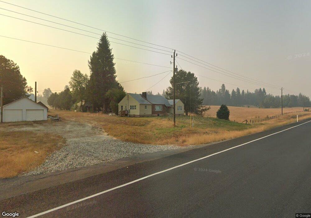
10534 Highway 55 Cascade, ID 83611
Estimated Value: $591,000 - $787,000
2
Beds
2
Baths
1,400
Sq Ft
$481/Sq Ft
Est. Value
About This Home
This home is located at 10534 Highway 55, Cascade, ID 83611 and is currently estimated at $672,712, approximately $480 per square foot. 10534 Highway 55 is a home located in Valley County with nearby schools including Cascade Elementary School and Cascade Junior/Senior High School.
Ownership History
Date
Name
Owned For
Owner Type
Purchase Details
Closed on
Mar 21, 2014
Sold by
West Lynda and Kroll James L
Bought by
Swanson Eric D and Swanson Christine J
Current Estimated Value
Home Financials for this Owner
Home Financials are based on the most recent Mortgage that was taken out on this home.
Original Mortgage
$133,200
Outstanding Balance
$100,807
Interest Rate
4.3%
Mortgage Type
New Conventional
Estimated Equity
$571,905
Create a Home Valuation Report for This Property
The Home Valuation Report is an in-depth analysis detailing your home's value as well as a comparison with similar homes in the area
Home Values in the Area
Average Home Value in this Area
Purchase History
| Date | Buyer | Sale Price | Title Company |
|---|---|---|---|
| Swanson Eric D | -- | Amerititle |
Source: Public Records
Mortgage History
| Date | Status | Borrower | Loan Amount |
|---|---|---|---|
| Open | Swanson Eric D | $133,200 |
Source: Public Records
Tax History Compared to Growth
Tax History
| Year | Tax Paid | Tax Assessment Tax Assessment Total Assessment is a certain percentage of the fair market value that is determined by local assessors to be the total taxable value of land and additions on the property. | Land | Improvement |
|---|---|---|---|---|
| 2025 | $1,239 | $624,655 | $110,451 | $514,204 |
| 2023 | $1,239 | $610,942 | $113,851 | $497,091 |
| 2022 | $1,210 | $536,510 | $98,567 | $437,943 |
| 2021 | $1,140 | $358,776 | $36,082 | $322,694 |
| 2020 | $1,043 | $276,011 | $45,509 | $230,502 |
| 2019 | $1,072 | $264,148 | $35,917 | $228,231 |
| 2018 | $978 | $247,943 | $45,243 | $202,700 |
| 2017 | $1,360 | $241,715 | $89,240 | $152,475 |
| 2016 | $1,071 | $176,625 | $48,299 | $128,326 |
| 2015 | $997 | $167,325 | $0 | $0 |
| 2013 | -- | $177,134 | $0 | $0 |
Source: Public Records
Map
Nearby Homes
- 100 Coit Dr
- 47 Coit Dr
- Lot 40 Challis Ln Unit 40
- 32 Saddle Rock Dr Unit 15
- 165 Clear Creek Rd
- TBD Hwy 55
- Lot 24 Sawtooth Loop Unit Lot 24
- 45 Price Loop
- 63 Price Loop
- 50 Sawtooth Loop Unit Lot 30
- 10389 Gamann Dr
- 191 Clear Creek Rd
- 39 Clear Creek Rd
- 40 Clear Creek Rd
- Lot 10 Timber Haven Place
- 38 Clear Creek Rd
- Lot 2/3 Timber Haven Place
- TBD Skunk Creek Rd
- 10357 Skunk Creek Rd
- 10342 Gamann Dr
- 10534 Highway 55
- 5 Laurins Ln Unit 6
- 5 Laurins Ln
- 10552 Highway 55
- 5 Laurins Lane Lot 6
- Lot B N Hwy 55 Unit B
- Lot B N Hwy 55
- Lot C Hwy 55
- Lot B N Parcel Hwy 55
- 8 Vaughn Dr
- 71 Coit Dr
- 71 Coit Dr Unit 3
- LOT C Hwy 55 N Parcel
- 10568 Highway 55
- 10568 Highway 55
- 10574 Idaho 55
- 10574 Highway 55
- 10405 Hwy 55
- Lot 8 Dakota Way Unit 8