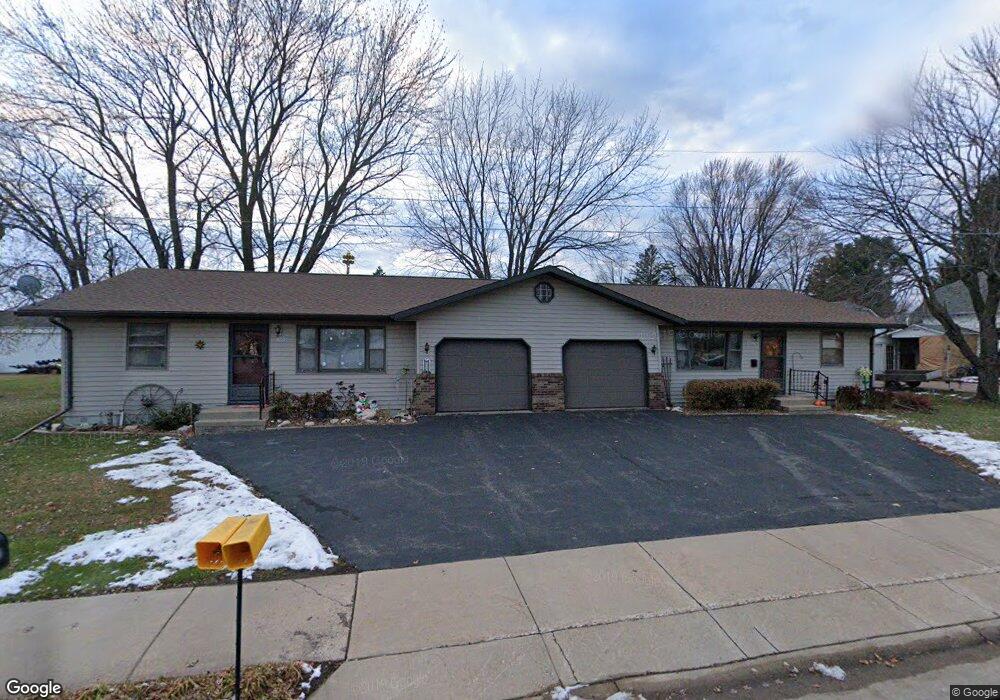
10535 George Ave Auburndale, WI 54412
Estimated Value: $232,000 - $304,000
--
Bed
--
Bath
--
Sq Ft
0.36
Acres
About This Home
This home is located at 10535 George Ave, Auburndale, WI 54412 and is currently estimated at $262,597. 10535 George Ave is a home located in Wood County with nearby schools including Auburndale Elementary School, Auburndale High School, and St. Mary School.
Ownership History
Date
Name
Owned For
Owner Type
Purchase Details
Closed on
Sep 29, 2015
Sold by
Matticks Gloria K
Bought by
Seidl Glen M
Current Estimated Value
Purchase Details
Closed on
Sep 1, 2006
Sold by
Seidi Glen M
Bought by
Matticks Gloria K
Home Financials for this Owner
Home Financials are based on the most recent Mortgage that was taken out on this home.
Original Mortgage
$112,000
Interest Rate
6.77%
Mortgage Type
New Conventional
Create a Home Valuation Report for This Property
The Home Valuation Report is an in-depth analysis detailing your home's value as well as a comparison with similar homes in the area
Home Values in the Area
Average Home Value in this Area
Purchase History
| Date | Buyer | Sale Price | Title Company |
|---|---|---|---|
| Seidl Glen M | $140,000 | -- | |
| Matticks Gloria K | $140,000 | Badger Title Llc | |
| Matticks Gloria K | $140,000 | -- |
Source: Public Records
Mortgage History
| Date | Status | Borrower | Loan Amount |
|---|---|---|---|
| Previous Owner | Matticks Gloria K | $112,000 |
Source: Public Records
Tax History Compared to Growth
Tax History
| Year | Tax Paid | Tax Assessment Tax Assessment Total Assessment is a certain percentage of the fair market value that is determined by local assessors to be the total taxable value of land and additions on the property. | Land | Improvement |
|---|---|---|---|---|
| 2024 | $3,378 | $264,200 | $15,700 | $248,500 |
| 2023 | $3,283 | $167,600 | $11,800 | $155,800 |
| 2022 | $3,218 | $167,600 | $11,800 | $155,800 |
| 2021 | $3,574 | $167,600 | $11,800 | $155,800 |
| 2020 | $3,312 | $167,600 | $11,800 | $155,800 |
| 2019 | $3,156 | $167,600 | $11,800 | $155,800 |
| 2018 | $3,067 | $167,600 | $11,800 | $155,800 |
| 2017 | $3,113 | $167,600 | $11,800 | $155,800 |
| 2016 | $3,121 | $167,600 | $11,800 | $155,800 |
| 2015 | $3,162 | $167,600 | $11,800 | $155,800 |
Source: Public Records
Map
Nearby Homes
- 4257 Maple Rd
- 7610 Apple Ln
- 10916 W 1st St
- 5382 County Rd N
- 7947 Victoria Ct
- 10758 W 9th St
- 10846 W 11th St
- 6163 Mill Rd
- 6418 County Rd N
- 8188 County Road Ee
- 10477 County Road A Unit Parcels 0300051,0300
- 7760 Wisconsin 186
- 118343 Birch Tree Rd
- 2104 S Cottonwood Ave
- 2101 S Ironwood Ave
- 2502 E Fillmore St
- 8483 County Road Y
- 500 N Auburn Ave
- 2204 S Ironwood Ave
- 1507 Green Acres Dr
- 10543 George Ave
- 10538 George Ave
- 10538 Brickle Ave
- 10534 Brickle Ave
- 10542 Brickle Ave
- 10549 George Ave
- 10554 Brickle Ave
- 5768 Main St
- 5772 Main St
- 10562 Brickle Ave
- 10528 George Ave
- 10556 George Ave
- 6018 1st St
- 6018 1st St Unit 5
- 6018 1st St Unit 1
- 6018 1st St Unit 2
- 10535 Brickle Ave
- 5741 Clark St
- 10562 George Ave
- 5749 Clark St