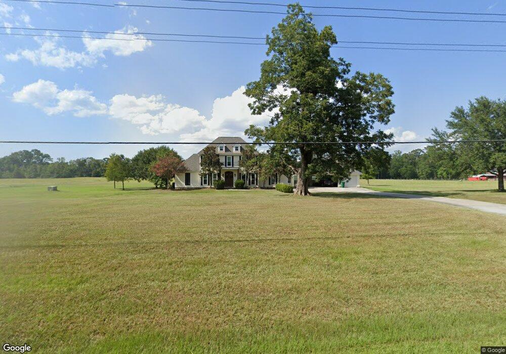
10535 La Highway 1033 Denham Springs, LA 70726
Estimated Value: $94,000 - $547,000
--
Bed
--
Bath
--
Sq Ft
2.25
Acres
About This Home
This home is located at 10535 La Highway 1033, Denham Springs, LA 70726 and is currently estimated at $384,667. 10535 La Highway 1033 is a home located in Livingston Parish with nearby schools including Seventh Ward Elementary School, Juban Parc Junior High School, and Denham Springs Freshman High School.
Ownership History
Date
Name
Owned For
Owner Type
Purchase Details
Closed on
Feb 9, 2015
Sold by
Williams Tinkler Carla
Bought by
Williams Greer Jason Robert and Williams Greer Ashley
Current Estimated Value
Home Financials for this Owner
Home Financials are based on the most recent Mortgage that was taken out on this home.
Original Mortgage
$34,200
Outstanding Balance
$26,320
Interest Rate
3.89%
Mortgage Type
Unknown
Estimated Equity
$358,347
Create a Home Valuation Report for This Property
The Home Valuation Report is an in-depth analysis detailing your home's value as well as a comparison with similar homes in the area
Home Values in the Area
Average Home Value in this Area
Purchase History
| Date | Buyer | Sale Price | Title Company |
|---|---|---|---|
| Williams Greer Jason Robert | $38,000 | Stewart Title Guaranty Co |
Source: Public Records
Mortgage History
| Date | Status | Borrower | Loan Amount |
|---|---|---|---|
| Open | Williams Greer Jason Robert | $34,200 |
Source: Public Records
Tax History Compared to Growth
Tax History
| Year | Tax Paid | Tax Assessment Tax Assessment Total Assessment is a certain percentage of the fair market value that is determined by local assessors to be the total taxable value of land and additions on the property. | Land | Improvement |
|---|---|---|---|---|
| 2024 | $4,583 | $45,160 | $6,323 | $38,837 |
| 2023 | $3,748 | $33,530 | $5,810 | $27,720 |
| 2022 | $3,776 | $33,530 | $5,810 | $27,720 |
| 2021 | $2,862 | $29,160 | $1,440 | $27,720 |
| 2020 | $2,845 | $29,160 | $1,440 | $27,720 |
| 2019 | $2,526 | $25,220 | $1,380 | $23,840 |
| 2018 | $2,563 | $25,220 | $1,380 | $23,840 |
| 2017 | $2,432 | $24,030 | $1,380 | $22,650 |
| 2015 | $2,315 | $30,520 | $1,370 | $29,150 |
| 2014 | $2,707 | $34,030 | $4,880 | $29,150 |
Source: Public Records
Map
Nearby Homes
- 10674 Louisiana 1033
- Idris II Plan at Manor Pointe
- 11588 Regal St
- 22835 La Hwy 16
- 11536 Mary Lee Dr
- 11556 Mary Lee Dr
- 11568 Cypress Dr Unit 17
- 14259 Monmouth Ave
- 14301 Monmouth Ave
- 14253 Monmouth Ave
- 14252 Monmouth Ave
- 14258 Monmouth Ave
- 14264 Monmouth Ave
- 11652 Derby Dr
- 25640 4-H Club Rd
- 23597 S Point Dr
- 23644 Southpoint Dr
- TBD Woodlore Ave Unit Tracts B & D
- 21560 Carew Harris Rd
- 23011 Priscilla Ln
- 10380 La Highway 1033
- 10332 La Highway 1033
- 10304 La Hwy 1033
- 10304 Louisiana 1033
- 10422 La Highway 1033
- 10304 La Highway 1033
- 10256 Louisiana 1033
- 10256 La Highway 1033
- 10452 La Highway 1033
- 22360 La Highway 1032
- 22340 La Highway 1032
- 22340 La Hwy 1032
- 10228 La Highway 1033
- 22360 La Highway 1032
- 10228 Louisiana 1033
- 22374 La Highway 1032
- 22354 La Highway 1032
- 10551 La Highway 1033
- 22350 La Highway 1032
- 22354 La Highway 1032