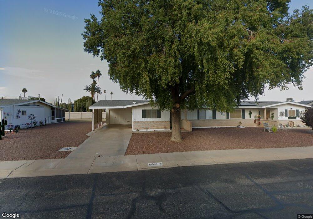
10536 W Clair Dr Unit 1 Sun City, AZ 85351
Estimated Value: $171,625 - $217,000
2
Beds
2
Baths
1,148
Sq Ft
$175/Sq Ft
Est. Value
About This Home
This home is located at 10536 W Clair Dr Unit 1, Sun City, AZ 85351 and is currently estimated at $201,406, approximately $175 per square foot. 10536 W Clair Dr Unit 1 is a home located in Maricopa County with nearby schools including Desert Mirage Elementary School, Ombudsman - Northwest Charter, and Peoria Accelerated High School.
Ownership History
Date
Name
Owned For
Owner Type
Purchase Details
Closed on
Jan 18, 2006
Sold by
Michaels James
Bought by
Day Peter and Day Eleanor T
Current Estimated Value
Home Financials for this Owner
Home Financials are based on the most recent Mortgage that was taken out on this home.
Original Mortgage
$104,800
Outstanding Balance
$58,486
Interest Rate
6.15%
Mortgage Type
Purchase Money Mortgage
Estimated Equity
$142,920
Purchase Details
Closed on
Dec 5, 2005
Sold by
Michaels Frances A
Bought by
Michaels James J
Home Financials for this Owner
Home Financials are based on the most recent Mortgage that was taken out on this home.
Original Mortgage
$104,800
Outstanding Balance
$58,486
Interest Rate
6.15%
Mortgage Type
Purchase Money Mortgage
Estimated Equity
$142,920
Purchase Details
Closed on
Mar 13, 2003
Sold by
Lacount Fred R and Lacount Francine
Bought by
Pavese Richard and Pavese Elizabeth
Create a Home Valuation Report for This Property
The Home Valuation Report is an in-depth analysis detailing your home's value as well as a comparison with similar homes in the area
Home Values in the Area
Average Home Value in this Area
Purchase History
| Date | Buyer | Sale Price | Title Company |
|---|---|---|---|
| Day Peter | $131,000 | First American Title Ins Co | |
| Michaels James J | -- | First American Title Ins Co | |
| Michaels James J | $110,000 | First American Title Ins Co | |
| Pavese Richard | $717,245 | Century Title Agency Inc |
Source: Public Records
Mortgage History
| Date | Status | Borrower | Loan Amount |
|---|---|---|---|
| Open | Day Peter | $104,800 | |
| Previous Owner | Michaels James J | $55,000 |
Source: Public Records
Tax History Compared to Growth
Tax History
| Year | Tax Paid | Tax Assessment Tax Assessment Total Assessment is a certain percentage of the fair market value that is determined by local assessors to be the total taxable value of land and additions on the property. | Land | Improvement |
|---|---|---|---|---|
| 2025 | $499 | $5,644 | -- | -- |
| 2024 | $454 | $5,375 | -- | -- |
| 2023 | $454 | $14,500 | $2,900 | $11,600 |
| 2022 | $425 | $12,150 | $2,430 | $9,720 |
| 2021 | $435 | $11,050 | $2,210 | $8,840 |
| 2020 | $424 | $9,930 | $1,980 | $7,950 |
| 2019 | $421 | $7,700 | $1,540 | $6,160 |
| 2018 | $407 | $6,670 | $1,330 | $5,340 |
| 2017 | $393 | $5,560 | $1,110 | $4,450 |
| 2016 | $369 | $4,850 | $970 | $3,880 |
| 2015 | $351 | $3,720 | $740 | $2,980 |
Source: Public Records
Map
Nearby Homes
- 10535 W Clair Dr
- 10202 N 105th Dr Unit 1
- 10522 W Camden Ave Unit 6
- 10613 W Clair Dr
- 10510 W Camden Ave
- 10616 W Camden Ave
- 10222 N 105th Dr Unit 5
- 10517 W Cumberland Dr
- 10236 N 105th Dr Unit 8
- 10230 N 106th Dr
- 10414 W Audrey Dr
- 10709 W Clair Dr Unit 1
- 10410 W Audrey Dr Unit 8
- 10417 W Deanne Dr Unit 5
- 10404 W Audrey Dr
- 10405 W Andover Ave
- 10440 W Cheryl Dr
- 10426 W Deanne Dr Unit 15
- 10724 W Cheryl Dr
- 10341 W Clair Dr
- 10534 W Clair Dr Unit 2
- 10602 W Clair Dr Unit 5
- 10213 N 106th Ave Unit 27
- 10606 W Clair Dr
- 10206 N 105th Dr Unit 2
- 10601 W Audrey Dr
- 10531 W Clair Dr
- 10217 N 106th Ave
- 10601 W Clair Dr
- 10610 W Clair Dr Unit 5
- 10527 W Clair Dr
- 10605 W Audrey Dr
- 10212 N 105th Dr Unit 3
- 10605 W Clair Dr Unit 5
- 10525 W Clair Dr
- 10609 W Audrey Dr
- 10221 N 106th Ave
- 10216 N 105th Dr Unit 4
- 10614 W Clair Dr
- 10609 W Clair Dr