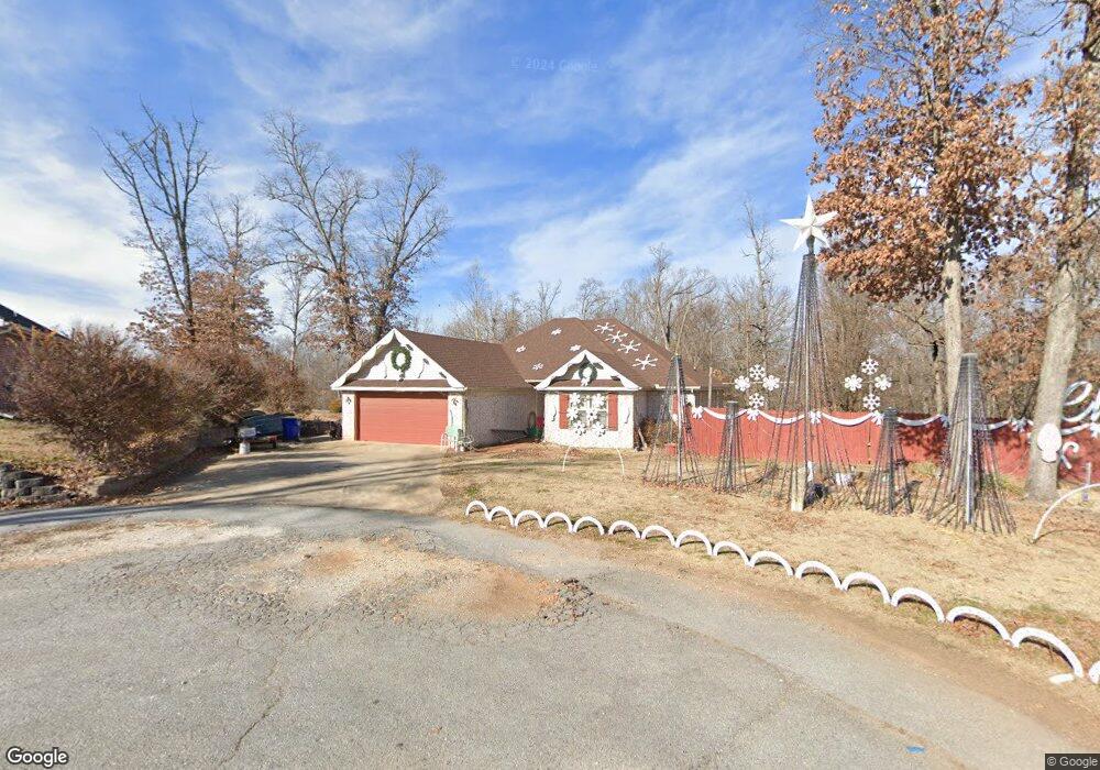
10537 Oak Tree Cir Rogers, AR 72756
Estimated Value: $335,324 - $349,000
3
Beds
2
Baths
1,650
Sq Ft
$207/Sq Ft
Est. Value
About This Home
This home is located at 10537 Oak Tree Cir, Rogers, AR 72756 and is currently estimated at $342,081, approximately $207 per square foot. 10537 Oak Tree Cir is a home located in Benton County with nearby schools including Northside Elementary School, Lingle Middle School, and Rogers Heritage High School.
Ownership History
Date
Name
Owned For
Owner Type
Purchase Details
Closed on
Aug 8, 2007
Sold by
M & R Builders Llc
Bought by
Dye Thomas R and Dye Sandra
Current Estimated Value
Home Financials for this Owner
Home Financials are based on the most recent Mortgage that was taken out on this home.
Original Mortgage
$28,600
Interest Rate
6.69%
Mortgage Type
Stand Alone Second
Purchase Details
Closed on
Oct 10, 2006
Sold by
Weston Hills Corp
Bought by
M & R Builders Llc
Home Financials for this Owner
Home Financials are based on the most recent Mortgage that was taken out on this home.
Original Mortgage
$108,000
Interest Rate
6.41%
Mortgage Type
Construction
Create a Home Valuation Report for This Property
The Home Valuation Report is an in-depth analysis detailing your home's value as well as a comparison with similar homes in the area
Purchase History
| Date | Buyer | Sale Price | Title Company |
|---|---|---|---|
| Dye Thomas R | $143,000 | Heritage Land Title Of Ar | |
| M & R Builders Llc | $20,000 | Heritage Land Title Of Ar |
Source: Public Records
Mortgage History
| Date | Status | Borrower | Loan Amount |
|---|---|---|---|
| Closed | Dye Thomas R | $28,600 | |
| Previous Owner | M & R Builders Llc | $108,000 |
Source: Public Records
Tax History
| Year | Tax Paid | Tax Assessment Tax Assessment Total Assessment is a certain percentage of the fair market value that is determined by local assessors to be the total taxable value of land and additions on the property. | Land | Improvement |
|---|---|---|---|---|
| 2025 | $1,977 | $64,216 | $4,000 | $60,216 |
| 2024 | $1,780 | $64,216 | $4,000 | $60,216 |
| 2023 | $1,695 | $43,400 | $1,200 | $42,200 |
| 2022 | $1,518 | $43,400 | $1,200 | $42,200 |
| 2021 | $1,434 | $43,400 | $1,200 | $42,200 |
| 2020 | $1,357 | $31,670 | $4,600 | $27,070 |
| 2019 | $1,294 | $31,670 | $4,600 | $27,070 |
| 2018 | $1,257 | $31,670 | $4,600 | $27,070 |
| 2017 | $1,041 | $31,670 | $4,600 | $27,070 |
| 2016 | $1,041 | $31,670 | $4,600 | $27,070 |
| 2015 | $1,161 | $24,140 | $4,400 | $19,740 |
| 2014 | $961 | $24,140 | $4,400 | $19,740 |
Source: Public Records
Map
Nearby Homes
- 13662 Cloverdale Rd
- 11010 Meadow Lark Rd
- 11010 Meadowlark Rd
- 13970 Cloverdale Rd
- 12030 Saddle Hill Ln
- 12010 Saddle Hill Ln
- 13000 Rooted
- 0 Windjammer Unit 22124193
- Lot 118 Windjammer
- 4006 NE Hudson Rd
- Lot 114 Sunset Bay
- Lot 110 Sunset Bay
- Lot 112 Sunset Bay
- Lot 116 Sunset Bay
- Lot 113 Sunset Bay
- Lot 129 Sunset Bay
- Lot 128 Sunset Bay
- Lot 136 Sunset Bay
- 10635 Prairie Creek Rd N
- 9570 Lakewoods Dr
- 10525 Oak Tree Cir
- 10548 Lyndon Place
- 10561 Lyndon Place
- 13576 Cloverdale Rd
- 13560 Cloverdale Rd
- 13534 Cloverdale Rd
- 10500 Kays Ln
- 13599 Cloverdale Rd
- 1620 London
- 13611 Cloverdale Rd
- 10525 Lyndon Place
- 10501 Lyndon Place
- 10513 Lyndon Place
- 10496 Kays Ln
- 13472 Kays Ln
- 10472 Kays Ln
- 10460 Kays Ln
- 13503 Walnut Valley Rd
- 13509 Cloverdale Rd
- 10436 Kays Ln
Your Personal Tour Guide
Ask me questions while you tour the home.