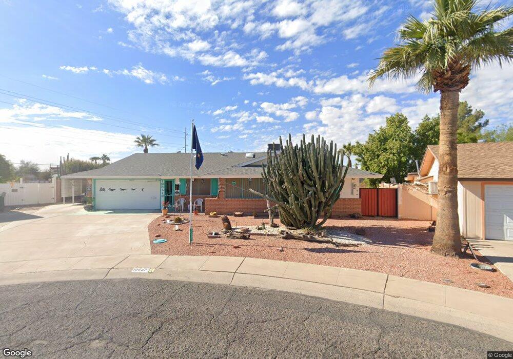
10537 W Caron Dr Sun City, AZ 85351
Estimated Value: $221,865 - $335,000
--
Bed
2
Baths
1,311
Sq Ft
$215/Sq Ft
Est. Value
About This Home
This home is located at 10537 W Caron Dr, Sun City, AZ 85351 and is currently estimated at $282,216, approximately $215 per square foot. 10537 W Caron Dr is a home located in Maricopa County with nearby schools including Ombudsman - Northwest Charter and Peoria Accelerated High School.
Ownership History
Date
Name
Owned For
Owner Type
Purchase Details
Closed on
Feb 28, 2012
Sold by
Inglis Richard A
Bought by
Inglis Richard A and The Richard A Inglis Trust
Current Estimated Value
Purchase Details
Closed on
Aug 16, 2007
Sold by
Inglis Richard A and Inglis Linda J
Bought by
Inglis Richard A
Home Financials for this Owner
Home Financials are based on the most recent Mortgage that was taken out on this home.
Original Mortgage
$315,000
Outstanding Balance
$185,156
Interest Rate
5.3%
Mortgage Type
Reverse Mortgage Home Equity Conversion Mortgage
Estimated Equity
$97,060
Purchase Details
Closed on
Jan 19, 1995
Sold by
First Interstate Bank Of Arizona
Bought by
Inglis Richard A and Inglis Linda J
Home Financials for this Owner
Home Financials are based on the most recent Mortgage that was taken out on this home.
Original Mortgage
$65,500
Interest Rate
9.27%
Mortgage Type
New Conventional
Create a Home Valuation Report for This Property
The Home Valuation Report is an in-depth analysis detailing your home's value as well as a comparison with similar homes in the area
Home Values in the Area
Average Home Value in this Area
Purchase History
| Date | Buyer | Sale Price | Title Company |
|---|---|---|---|
| Inglis Richard A | -- | None Available | |
| Inglis Richard A | -- | First American Title Ins Co | |
| Inglis Richard A | $85,500 | Security Title Agency |
Source: Public Records
Mortgage History
| Date | Status | Borrower | Loan Amount |
|---|---|---|---|
| Open | Inglis Richard A | $315,000 | |
| Closed | Inglis Richard A | $65,500 |
Source: Public Records
Tax History Compared to Growth
Tax History
| Year | Tax Paid | Tax Assessment Tax Assessment Total Assessment is a certain percentage of the fair market value that is determined by local assessors to be the total taxable value of land and additions on the property. | Land | Improvement |
|---|---|---|---|---|
| 2025 | $528 | $6,530 | -- | -- |
| 2024 | $524 | $6,530 | -- | -- |
| 2023 | $524 | $6,530 | $1,300 | $5,230 |
| 2022 | $518 | $6,530 | $1,300 | $5,230 |
| 2021 | $561 | $15,120 | $3,020 | $12,100 |
| 2020 | $574 | $13,180 | $2,630 | $10,550 |
| 2019 | $591 | $12,300 | $2,460 | $9,840 |
| 2018 | $598 | $6,530 | $1,300 | $5,230 |
| 2017 | $606 | $6,530 | $1,300 | $5,230 |
| 2016 | $594 | $6,530 | $1,300 | $5,230 |
| 2015 | $595 | $6,530 | $1,300 | $5,230 |
Source: Public Records
Map
Nearby Homes
- 10707 W Mission Ln
- 9202 N 107th Ave Unit 8
- 10726 W Kelso Dr Unit 172
- 10731 W Mission Ln Unit 200
- 8803 N 105th Dr
- 10726 W Denham Dr Unit 16
- 10732 W Denham Dr Unit 17
- 10326 W Caron Dr
- 10825 W Caron Dr
- 10512 W Ruth Ave
- 8800 N 107th Ave Unit 17
- 8800 N 107th Ave Unit 19
- 8800 N 107th Ave Unit 52
- 10603 W Ruth Ave
- 10816 W Venturi Dr
- 10221 W Puget Ave
- 9815 N 103rd Ave
- 10801 W Mountain View Rd
- 10201 W Caron Dr
- 10316 W Salem Dr Unit 6D
- 10533 W Caron Dr
- 10541 W Caron Dr
- 10605 W Caron Dr
- 10529 W Caron Dr
- 10527 W Caron Dr
- 10619 W Caron Dr
- 10548 W Caron Dr
- 10602 W Caron Dr
- 10542 W Caron Dr
- 10511 W Caron Dr
- 10534 W Caron Dr
- 10612 W Caron Dr
- 8932 N 105th Ln
- 10629 W Caron Dr
- 10528 W Caron Dr
- 10618 W Caron Dr
- 10524 W Caron Dr
- 8926 N 105th Ln Unit 60
- 8926 N 105th Ln
- 10624 W Caron Dr