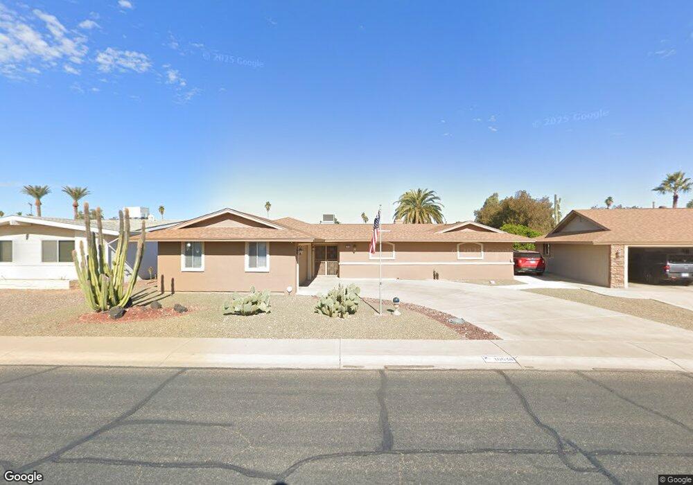
10538 W Kelso Dr Sun City, AZ 85351
Estimated Value: $314,955 - $352,000
--
Bed
3
Baths
1,841
Sq Ft
$179/Sq Ft
Est. Value
About This Home
This home is located at 10538 W Kelso Dr, Sun City, AZ 85351 and is currently estimated at $329,239, approximately $178 per square foot. 10538 W Kelso Dr is a home located in Maricopa County with nearby schools including Ombudsman - Northwest Charter and Peoria Accelerated High School.
Ownership History
Date
Name
Owned For
Owner Type
Purchase Details
Closed on
Dec 27, 2005
Sold by
Ashland William H and Ashland Lucille C
Bought by
Mamos James G and Mamos Karen
Current Estimated Value
Home Financials for this Owner
Home Financials are based on the most recent Mortgage that was taken out on this home.
Original Mortgage
$158,800
Outstanding Balance
$89,522
Interest Rate
6.32%
Mortgage Type
Credit Line Revolving
Estimated Equity
$239,717
Purchase Details
Closed on
Dec 27, 2000
Sold by
Huggins James and Clayton J Banta Trust
Bought by
Ashland William H and Ashland Lucille C
Home Financials for this Owner
Home Financials are based on the most recent Mortgage that was taken out on this home.
Original Mortgage
$50,000
Interest Rate
7.54%
Mortgage Type
New Conventional
Create a Home Valuation Report for This Property
The Home Valuation Report is an in-depth analysis detailing your home's value as well as a comparison with similar homes in the area
Home Values in the Area
Average Home Value in this Area
Purchase History
| Date | Buyer | Sale Price | Title Company |
|---|---|---|---|
| Mamos James G | $198,500 | First American Title Ins Co | |
| Ashland William H | $108,000 | Capital Title Agency |
Source: Public Records
Mortgage History
| Date | Status | Borrower | Loan Amount |
|---|---|---|---|
| Open | Mamos James G | $158,800 | |
| Previous Owner | Ashland William H | $50,000 |
Source: Public Records
Tax History Compared to Growth
Tax History
| Year | Tax Paid | Tax Assessment Tax Assessment Total Assessment is a certain percentage of the fair market value that is determined by local assessors to be the total taxable value of land and additions on the property. | Land | Improvement |
|---|---|---|---|---|
| 2025 | $1,340 | $15,102 | -- | -- |
| 2024 | $1,212 | $14,383 | -- | -- |
| 2023 | $1,212 | $24,900 | $4,980 | $19,920 |
| 2022 | $1,147 | $19,560 | $3,910 | $15,650 |
| 2021 | $1,172 | $18,400 | $3,680 | $14,720 |
| 2020 | $1,142 | $16,230 | $3,240 | $12,990 |
| 2019 | $1,121 | $15,280 | $3,050 | $12,230 |
| 2018 | $1,082 | $14,160 | $2,830 | $11,330 |
| 2017 | $1,047 | $12,830 | $2,560 | $10,270 |
| 2016 | $598 | $12,250 | $2,450 | $9,800 |
| 2015 | $933 | $11,020 | $2,200 | $8,820 |
Source: Public Records
Map
Nearby Homes
- 9202 N 107th Ave Unit 8
- 10707 W Mission Ln
- 10726 W Kelso Dr Unit 172
- 10731 W Mission Ln Unit 200
- 10726 W Denham Dr Unit 16
- 10732 W Denham Dr Unit 17
- 10326 W Caron Dr
- 8803 N 105th Dr
- 10825 W Caron Dr
- 10512 W Ruth Ave
- 10801 W Mountain View Rd
- 10816 W Venturi Dr
- 9815 N 103rd Ave
- 10316 W Salem Dr Unit 6D
- 9802 N 107th Ave
- 8800 N 107th Ave Unit 17
- 8800 N 107th Ave Unit 19
- 8800 N 107th Ave Unit 52
- 10603 W Ruth Ave
- 10788 W Cinnebar Ave
- 10544 W Kelso Dr
- 10532 W Kelso Dr
- 10547 W Mission Ln
- 10550 W Kelso Dr Unit 7
- 10526 W Kelso Dr
- 10535 W Mission Ln
- 10553 W Mission Ln
- 10531 W Kelso Dr
- 10521 W Mission Ln
- 10549 W Kelso Dr
- 10604 W Kelso Dr
- 10601 W Mission Ln
- 10520 W Kelso Dr
- 10523 W Kelso Dr
- 10517 W Mission Ln Unit 7
- 10603 W Kelso Dr
- 10546 W Mission Ln
- 10542 W Caron Dr
- 10540 W Mission Ln