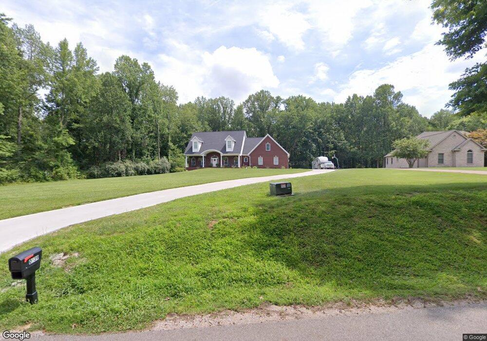
10539 Wolfinger Rd Mount Vernon, IN 47620
Estimated Value: $431,000 - $566,000
3
Beds
4
Baths
3,609
Sq Ft
$145/Sq Ft
Est. Value
About This Home
This home is located at 10539 Wolfinger Rd, Mount Vernon, IN 47620 and is currently estimated at $524,079, approximately $145 per square foot. 10539 Wolfinger Rd is a home with nearby schools including Mount Vernon Junior High School, Mount Vernon High School, and St. Philip School.
Ownership History
Date
Name
Owned For
Owner Type
Purchase Details
Closed on
May 20, 2016
Sold by
Pattie Mark L
Bought by
Sammet Michael L and Sammet Sara E
Current Estimated Value
Home Financials for this Owner
Home Financials are based on the most recent Mortgage that was taken out on this home.
Original Mortgage
$31,200
Outstanding Balance
$18,739
Interest Rate
3.58%
Mortgage Type
Future Advance Clause Open End Mortgage
Estimated Equity
$505,340
Create a Home Valuation Report for This Property
The Home Valuation Report is an in-depth analysis detailing your home's value as well as a comparison with similar homes in the area
Purchase History
| Date | Buyer | Sale Price | Title Company |
|---|---|---|---|
| Sammet Michael L | -- | None Available |
Source: Public Records
Mortgage History
| Date | Status | Borrower | Loan Amount |
|---|---|---|---|
| Open | Sammet Michael L | $31,200 |
Source: Public Records
Tax History
| Year | Tax Paid | Tax Assessment Tax Assessment Total Assessment is a certain percentage of the fair market value that is determined by local assessors to be the total taxable value of land and additions on the property. | Land | Improvement |
|---|---|---|---|---|
| 2025 | $4,076 | $474,700 | $54,600 | $420,100 |
| 2024 | $4,076 | $458,300 | $54,600 | $403,700 |
| 2023 | $3,904 | $412,400 | $50,500 | $361,900 |
| 2022 | $5,592 | $342,900 | $32,400 | $310,500 |
| 2021 | $4,172 | $247,300 | $32,400 | $214,900 |
| 2020 | $568 | $31,800 | $31,800 | $0 |
| 2019 | $541 | $30,700 | $30,700 | $0 |
| 2018 | $515 | $29,800 | $29,800 | $0 |
| 2017 | $486 | $29,700 | $29,700 | $0 |
| 2016 | $243 | $14,800 | $14,800 | $0 |
| 2014 | $215 | $14,800 | $14,800 | $0 |
| 2013 | $215 | $14,900 | $14,900 | $0 |
Source: Public Records
Map
Nearby Homes
- 5712 Hausman Rd
- 6900 W Franklin Rd
- 11000 Kramers Dr
- 11308 Kramers Dr
- 8870 Barter Rd
- 8837 Pleasant Ridge Dr
- 4715 Posey County Line Rd S
- 2810 Willow Creek Dr
- 2715 Hauschild Dr
- 2727 Willow Creek Dr
- 2646 Marycrest Dr
- 2704 Marycrest Dr
- 9051 Middle Mount Vernon Rd
- 10300 Weinzapfel Rd
- 9100 Marfield Ct
- 9001 Jillian Ct
- 9011 Jillian Ct
- 8225 Nation Rd
- 4800 Middle Mount Vernon Rd
- 6401 Middle Mount Vernon Rd
- 10511 Wolfinger Rd
- 10551 Wolfinger Rd
- 5900 Hausman Rd
- 10601 Wolfinger Rd
- 10425 Wolfinger Rd
- 10500 Wolfinger Rd Unit 7
- 10500 Wolfinger Rd
- 5820 Hausman Rd
- 6001 Saint Phillips Rd S
- 10540 Wolfinger Rd
- 5901 Hausman Rd
- 10701 Wolfinger Rd
- 10420 Wolfinger Rd
- 5825 Hausman Rd
- 10600 Wolfinger Rd
- 5810 Hausman Rd
- 5815 Hausman Rd
- 10410 Wolfinger Rd
- 10415 Wolfinger Rd
- 10423 Wolfinger Rd
Your Personal Tour Guide
Ask me questions while you tour the home.