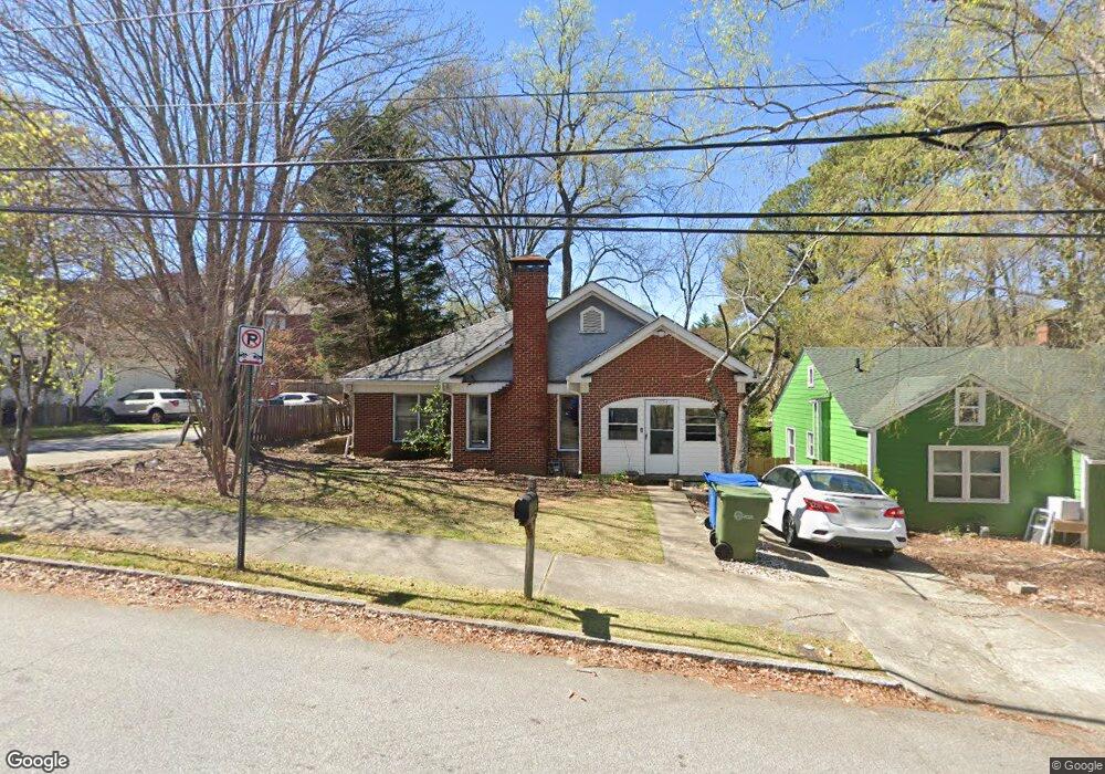
1054 Atlantic Dr NW Atlanta, GA 30318
Home Park NeighborhoodEstimated Value: $505,000 - $655,000
3
Beds
1
Bath
1,392
Sq Ft
$415/Sq Ft
Est. Value
About This Home
This home is located at 1054 Atlantic Dr NW, Atlanta, GA 30318 and is currently estimated at $577,233, approximately $414 per square foot. 1054 Atlantic Dr NW is a home located in Fulton County with nearby schools including Midtown High School, Centennial Academy, and Dar Un-Noor School.
Ownership History
Date
Name
Owned For
Owner Type
Purchase Details
Closed on
Oct 11, 2022
Sold by
Lai Cressida Pandy
Bought by
1054Adnw Llc
Current Estimated Value
Purchase Details
Closed on
Jun 13, 2014
Sold by
Cressida Lia And Home Park Inc
Bought by
Lai Cressida Pandy
Purchase Details
Closed on
May 28, 2008
Sold by
Hagan Linda J
Bought by
Lai Cressida
Home Financials for this Owner
Home Financials are based on the most recent Mortgage that was taken out on this home.
Original Mortgage
$251,500
Interest Rate
6.31%
Mortgage Type
New Conventional
Purchase Details
Closed on
Apr 30, 2008
Sold by
1054 Atlantic Drive La Trust
Bought by
Hagan Linda
Home Financials for this Owner
Home Financials are based on the most recent Mortgage that was taken out on this home.
Original Mortgage
$251,500
Interest Rate
6.31%
Mortgage Type
New Conventional
Purchase Details
Closed on
Apr 28, 2004
Sold by
Hagan Linda
Bought by
1054 Atlantic Drive Land Trust
Purchase Details
Closed on
Apr 7, 2004
Sold by
Hagan Linda J
Bought by
1054 Atlantic Drive Land Trust
Purchase Details
Closed on
Aug 6, 2003
Sold by
Freeport Titl/Guaranty Inc
Bought by
Tedeschi Linda J and Tedeschi Karen
Home Financials for this Owner
Home Financials are based on the most recent Mortgage that was taken out on this home.
Original Mortgage
$200,000
Interest Rate
5.42%
Mortgage Type
New Conventional
Purchase Details
Closed on
Aug 31, 2001
Sold by
Hagan Linda J
Bought by
Spotted Moose Land Trust
Purchase Details
Closed on
Feb 8, 2001
Sold by
Hagan Linda J
Bought by
Hagan Linda J
Home Financials for this Owner
Home Financials are based on the most recent Mortgage that was taken out on this home.
Original Mortgage
$225,000
Interest Rate
6.91%
Mortgage Type
New Conventional
Purchase Details
Closed on
Apr 28, 2000
Sold by
1054 Atlantic Drive Land Trust
Bought by
Hagan Linda
Home Financials for this Owner
Home Financials are based on the most recent Mortgage that was taken out on this home.
Original Mortgage
$202,000
Interest Rate
5.36%
Mortgage Type
New Conventional
Purchase Details
Closed on
Aug 10, 1995
Sold by
Carrier Lillie M
Bought by
Hagan Linda
Create a Home Valuation Report for This Property
The Home Valuation Report is an in-depth analysis detailing your home's value as well as a comparison with similar homes in the area
Home Values in the Area
Average Home Value in this Area
Purchase History
| Date | Buyer | Sale Price | Title Company |
|---|---|---|---|
| 1054Adnw Llc | -- | -- | |
| Lai Cressida Pandy | -- | -- | |
| Lai Cressida | $359,300 | -- | |
| Hagan Linda | -- | -- | |
| 1054 Atlantic Drive Land Trust | -- | -- | |
| 1054 Atlantic Drive Land Trust | -- | -- | |
| Tedeschi Linda J | -- | -- | |
| Spotted Moose Land Trust | -- | -- | |
| Hagan Linda J | -- | -- | |
| Hagan Linda | -- | -- | |
| Hagan Linda | $77,200 | -- |
Source: Public Records
Mortgage History
| Date | Status | Borrower | Loan Amount |
|---|---|---|---|
| Previous Owner | Lai Cressida | $251,500 | |
| Previous Owner | Tedeschi Linda J | $200,000 | |
| Previous Owner | Hagan Linda J | $225,000 | |
| Previous Owner | Hagan Linda | $202,000 |
Source: Public Records
Tax History Compared to Growth
Tax History
| Year | Tax Paid | Tax Assessment Tax Assessment Total Assessment is a certain percentage of the fair market value that is determined by local assessors to be the total taxable value of land and additions on the property. | Land | Improvement |
|---|---|---|---|---|
| 2025 | $6,975 | $236,080 | $81,720 | $154,360 |
| 2023 | $10,761 | $259,920 | $48,600 | $211,320 |
| 2022 | $10,519 | $259,920 | $48,600 | $211,320 |
| 2021 | $9,324 | $230,160 | $60,240 | $169,920 |
| 2020 | $8,536 | $208,360 | $65,720 | $142,640 |
| 2019 | $486 | $160,000 | $64,560 | $95,440 |
| 2018 | $8,875 | $214,360 | $25,000 | $189,360 |
| 2017 | $4,801 | $111,160 | $23,160 | $88,000 |
| 2016 | $4,813 | $111,160 | $23,160 | $88,000 |
| 2015 | $5,296 | $111,160 | $23,160 | $88,000 |
| 2014 | $3,129 | $111,160 | $23,160 | $88,000 |
Source: Public Records
Map
Nearby Homes
- 1031 State St NW Unit 106
- 1041 State St NW Unit 23
- 1008 State St NW
- 401 10th St NW Unit B104
- 401 10th St NW Unit B104
- 455 Lynch Ave NW
- 1186 Francis St NW
- 395 Laurent St NW Unit 4
- 1205 Holly St NW Unit A
- 1205 Holly St NW Unit B
- 385 15th St NW Unit 6
- 1072 Mcmillan St NW
- 384 16th St NW Unit 1
- 1231 Barnes St NW
- 383 16th St NW Unit 3
- 400 17th St NW Unit 1219
- 400 17th St NW Unit 2027
- 400 17th St NW Unit 2322
- 1058 Atlantic Dr NW
- 1042 Atlantic Dr NW
- 1064 Atlantic Dr NW
- 347 11th St NW
- 1038 Atlantic Dr NW
- 1074 Atlantic Dr NW
- 344 Hunerkopf St NW
- 1053 Atlantic Dr NW
- 1053 Atlantic Dr NW Unit A
- 1053 Atlantic Dr NW Unit B
- 1059 State St NW
- 1043 Atlantic Dr NW
- 1061 Atlantic Dr NW
- 1030 Atlantic Dr NW
- 1069 State St NW
- 1039 Atlantic Dr NW
- 1065 Atlantic Dr NW Unit A1
- 1065 Atlantic Dr NW Unit A
- 1065 Atlantic Dr NW Unit B
- 1065 Atlantic Dr NW