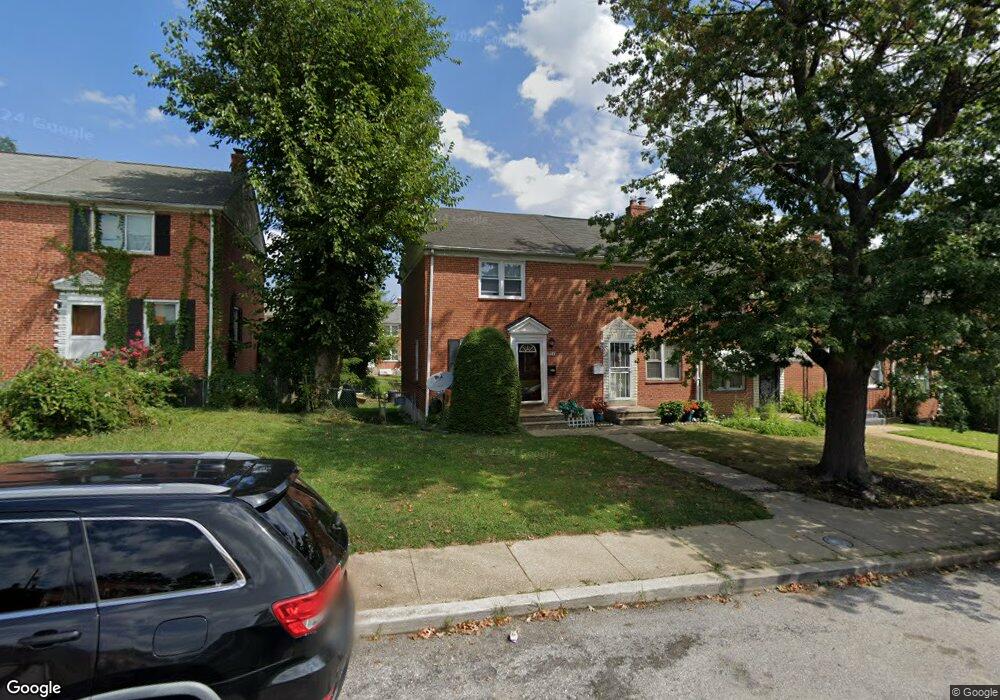
1054 Cameron Rd Baltimore, MD 21212
Cameron Village NeighborhoodEstimated Value: $138,625 - $139,000
Studio
2
Baths
832
Sq Ft
$167/Sq Ft
Est. Value
About This Home
This home is located at 1054 Cameron Rd, Baltimore, MD 21212 and is currently estimated at $138,813, approximately $166 per square foot. 1054 Cameron Rd is a home located in Baltimore City with nearby schools including Booker T. Washington Middle School, Reginald F. Lewis High School, and Paul Laurence Dunbar High School.
Ownership History
Date
Name
Owned For
Owner Type
Purchase Details
Closed on
Feb 3, 2000
Sold by
Allysons World Inc
Bought by
Bush Edward and Bush Rayna E
Current Estimated Value
Purchase Details
Closed on
Jun 16, 1999
Sold by
Addison Andre A
Bought by
Allysons World Inc
Purchase Details
Closed on
Feb 21, 1995
Sold by
Stollof Jack W
Bought by
Addison Andre A
Home Financials for this Owner
Home Financials are based on the most recent Mortgage that was taken out on this home.
Original Mortgage
$34,000
Interest Rate
9.19%
Create a Home Valuation Report for This Property
The Home Valuation Report is an in-depth analysis detailing your home's value as well as a comparison with similar homes in the area
Home Values in the Area
Average Home Value in this Area
Purchase History
| Date | Buyer | Sale Price | Title Company |
|---|---|---|---|
| Bush Edward | $59,000 | -- | |
| Allysons World Inc | $25,000 | -- | |
| Addison Andre A | $34,000 | -- |
Source: Public Records
Mortgage History
| Date | Status | Borrower | Loan Amount |
|---|---|---|---|
| Previous Owner | Addison Andre A | $34,000 |
Source: Public Records
Tax History
| Year | Tax Paid | Tax Assessment Tax Assessment Total Assessment is a certain percentage of the fair market value that is determined by local assessors to be the total taxable value of land and additions on the property. | Land | Improvement |
|---|---|---|---|---|
| 2025 | $1,945 | $100,867 | -- | -- |
| 2024 | $1,945 | $90,600 | $20,000 | $70,600 |
| 2023 | $2,085 | $88,367 | $0 | $0 |
| 2022 | $1,837 | $86,133 | $0 | $0 |
| 2021 | $1,980 | $83,900 | $20,000 | $63,900 |
| 2020 | $1,799 | $83,900 | $20,000 | $63,900 |
| 2019 | $1,790 | $83,900 | $20,000 | $63,900 |
| 2018 | $1,778 | $90,700 | $20,000 | $70,700 |
| 2017 | $1,723 | $84,900 | $0 | $0 |
| 2016 | $1,586 | $79,100 | $0 | $0 |
| 2015 | $1,586 | $73,300 | $0 | $0 |
| 2014 | $1,586 | $73,300 | $0 | $0 |
Source: Public Records
Map
Nearby Homes
- 1018 Cameron Rd
- 1014 Upnor Rd
- 1025 Witherspoon Rd
- 5516 Midwood Ave
- 5638 Midwood Ave
- 1200 Woodbourne Ave
- 1101 Woodbourne Ave
- 5320 The Alameda
- 5315 Midwood Ave
- 1027 Evesham Ave
- 830 Saint Dunstans Rd
- 916 E Belvedere Ave
- 1231 Sheridan Ave
- 5302 Saint Georges Ave
- 912 Evesham Ave
- 608 Harwood Ave
- 812 Mccabe Ave
- 608 Tunbridge Rd
- 5204 Ivanhoe Ave
- 5701 The Alameda
- 1056 Cameron Rd
- 1052 Cameron Rd
- 1058 Cameron Rd
- 1050 Cameron Rd
- 1060 Cameron Rd
- 1048 Cameron Rd
- 1062 Cameron Rd
- 1046 Cameron Rd
- 1064 Cameron Rd
- 1044 Cameron Rd
- 1066 Cameron Rd
- 1042 Cameron Rd
- 1041 Upnor Rd
- 1043 Upnor Rd
- 1039 Upnor Rd
- 1045 Upnor Rd
- 1040 Cameron Rd
- 1037 Upnor Rd
- 1047 Upnor Rd
- 1049 Upnor Rd
Your Personal Tour Guide
Ask me questions while you tour the home.