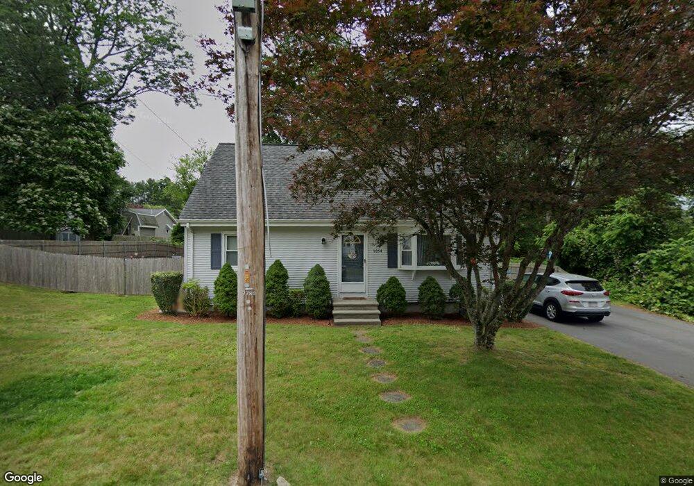
1054 Sassaquin Ave New Bedford, MA 02745
Estimated Value: $455,000 - $482,000
3
Beds
2
Baths
1,385
Sq Ft
$336/Sq Ft
Est. Value
About This Home
This home is located at 1054 Sassaquin Ave, New Bedford, MA 02745 and is currently estimated at $465,161, approximately $335 per square foot. 1054 Sassaquin Ave is a home located in Bristol County with nearby schools including Casimir Pulaski Elementary School, Normandin Middle School, and New Bedford High School.
Ownership History
Date
Name
Owned For
Owner Type
Purchase Details
Closed on
Nov 29, 2011
Sold by
Finn Brian and Finn Jennifer
Bought by
Manchester Carrie F
Current Estimated Value
Purchase Details
Closed on
Nov 1, 2002
Sold by
Eusebio Scott M and Eusebio Lisa V
Bought by
Finn Brian and Finn Jennifer
Purchase Details
Closed on
Dec 7, 1995
Sold by
Dandurand Michael D and Dandurand Helen M
Bought by
Eusebio Scott M and Eusebio Lisa V
Purchase Details
Closed on
May 1, 1990
Sold by
Lepage William J
Bought by
Dandurand Michael D
Create a Home Valuation Report for This Property
The Home Valuation Report is an in-depth analysis detailing your home's value as well as a comparison with similar homes in the area
Home Values in the Area
Average Home Value in this Area
Purchase History
| Date | Buyer | Sale Price | Title Company |
|---|---|---|---|
| Manchester Carrie F | $172,000 | -- | |
| Manchester Carrie F | $172,000 | -- | |
| Finn Brian | $200,000 | -- | |
| Finn Brian | $200,000 | -- | |
| Eusebio Scott M | $118,000 | -- | |
| Eusebio Scott M | $118,000 | -- | |
| Dandurand Michael D | $128,000 | -- |
Source: Public Records
Mortgage History
| Date | Status | Borrower | Loan Amount |
|---|---|---|---|
| Previous Owner | Dandurand Michael D | $273,950 | |
| Previous Owner | Dandurand Michael D | $257,600 |
Source: Public Records
Tax History Compared to Growth
Tax History
| Year | Tax Paid | Tax Assessment Tax Assessment Total Assessment is a certain percentage of the fair market value that is determined by local assessors to be the total taxable value of land and additions on the property. | Land | Improvement |
|---|---|---|---|---|
| 2025 | $4,478 | $395,900 | $138,600 | $257,300 |
| 2024 | $4,439 | $369,900 | $150,700 | $219,200 |
| 2023 | $4,589 | $321,100 | $121,200 | $199,900 |
| 2022 | $4,141 | $266,500 | $112,600 | $153,900 |
| 2021 | $4,063 | $260,600 | $112,600 | $148,000 |
| 2020 | $4,087 | $252,900 | $112,600 | $140,300 |
| 2019 | $3,963 | $240,600 | $108,300 | $132,300 |
| 2018 | $3,775 | $227,000 | $108,300 | $118,700 |
| 2017 | $3,570 | $213,900 | $106,100 | $107,800 |
| 2016 | $3,443 | $208,800 | $103,900 | $104,900 |
| 2015 | $3,144 | $199,900 | $99,600 | $100,300 |
| 2014 | $2,962 | $195,400 | $97,400 | $98,000 |
Source: Public Records
Map
Nearby Homes
- 1069 Cherokee St
- 16 Swallow St
- 13 Luscomb Ln
- 64 Blaze Rd
- 26 Blueberry Dr
- 34 Poplar Rd
- 210 Heritage Dr
- 1573 Braley Rd Unit 39
- 1063 Westgate St
- 1599 Braley Rd Unit 68
- 145 Heritage Dr
- 4597 Acushnet Ave
- SS Charbonneau Ln
- 2 Woodland Rd
- 62 Longview Rd
- 595 Quanapoag Rd
- 8 Holly Tree Ln
- 700 Pine Hill Dr
- 888 Hillcrest Rd
- 1269 Bartlett St
- 1048 Sassaquin Ave
- 1055 Cherokee St
- 1045 Cherokee St
- 1057 Sassaquin Ave
- 1042 Sassaquin Ave
- 1042 Sassaquin Ave Unit 2
- 1070 Sassaquin Ave
- 1047 Sassaquin Ave
- 1059 Cherokee St
- 1041 Sassaquin Ave
- 1069 Sassaquin Ave
- 1032 Sassaquin Ave
- 1025 Cherokee St
- 1078 Sassaquin Ave
- 1056 Cherokee St
- 1044 June St
- 1035 Sassaquin Ave
- 1079 Sassaquin Ave
- 1040 June St
- 1042 Cherokee St