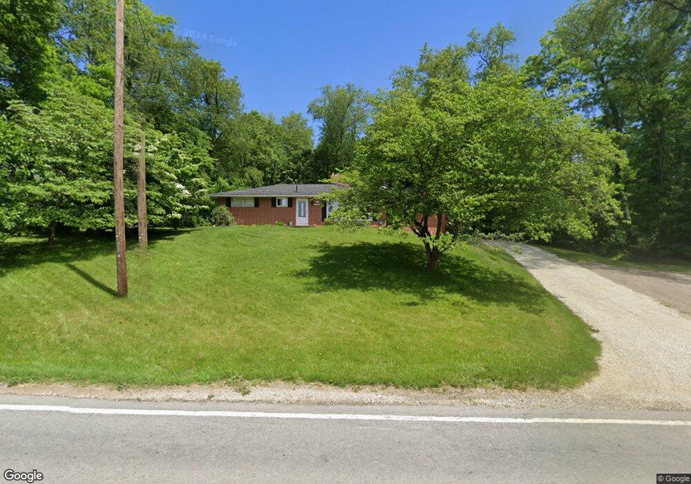
10545 Wooster St NW Massillon, OH 44647
Amherst Heights-Clearview NeighborhoodEstimated Value: $215,691 - $281,000
3
Beds
2
Baths
1,260
Sq Ft
$193/Sq Ft
Est. Value
About This Home
This home is located at 10545 Wooster St NW, Massillon, OH 44647 and is currently estimated at $243,673, approximately $193 per square foot. 10545 Wooster St NW is a home located in Stark County with nearby schools including Tuslaw Elementary School, Tuslaw Middle School, and Tuslaw High School.
Ownership History
Date
Name
Owned For
Owner Type
Purchase Details
Closed on
Nov 16, 2017
Sold by
Canfield Brent D and Canfield Shannon
Bought by
Rambo Jason and Rambo Terry
Current Estimated Value
Home Financials for this Owner
Home Financials are based on the most recent Mortgage that was taken out on this home.
Original Mortgage
$131,100
Outstanding Balance
$109,856
Interest Rate
3.85%
Mortgage Type
New Conventional
Estimated Equity
$133,817
Purchase Details
Closed on
Sep 27, 2017
Sold by
Manley Shelley
Bought by
Canfield Brent D
Home Financials for this Owner
Home Financials are based on the most recent Mortgage that was taken out on this home.
Original Mortgage
$131,100
Outstanding Balance
$109,856
Interest Rate
3.85%
Mortgage Type
New Conventional
Estimated Equity
$133,817
Create a Home Valuation Report for This Property
The Home Valuation Report is an in-depth analysis detailing your home's value as well as a comparison with similar homes in the area
Home Values in the Area
Average Home Value in this Area
Purchase History
| Date | Buyer | Sale Price | Title Company |
|---|---|---|---|
| Rambo Jason | $138,000 | Patriot Title Agency Inc | |
| Canfield Brent D | $50,000 | Patriot Title Agency Inc |
Source: Public Records
Mortgage History
| Date | Status | Borrower | Loan Amount |
|---|---|---|---|
| Open | Rambo Jason | $131,100 | |
| Closed | Canfield Brent D | $60,000 |
Source: Public Records
Tax History Compared to Growth
Tax History
| Year | Tax Paid | Tax Assessment Tax Assessment Total Assessment is a certain percentage of the fair market value that is determined by local assessors to be the total taxable value of land and additions on the property. | Land | Improvement |
|---|---|---|---|---|
| 2025 | -- | $65,530 | $27,620 | $37,910 |
| 2024 | -- | $65,530 | $27,620 | $37,910 |
| 2023 | $2,247 | $57,330 | $19,250 | $38,080 |
| 2022 | $2,245 | $57,330 | $19,250 | $38,080 |
| 2021 | $2,277 | $57,330 | $19,250 | $38,080 |
| 2020 | $1,984 | $47,010 | $15,790 | $31,220 |
| 2019 | $1,916 | $47,010 | $15,790 | $31,220 |
| 2018 | $1,886 | $47,010 | $15,790 | $31,220 |
| 2017 | $1,176 | $26,780 | $4,730 | $22,050 |
| 2016 | $1,147 | $25,830 | $3,780 | $22,050 |
| 2015 | $524 | $25,830 | $3,780 | $22,050 |
| 2014 | $743 | $24,960 | $3,640 | $21,320 |
| 2013 | $72 | $24,960 | $3,640 | $21,320 |
Source: Public Records
Map
Nearby Homes
- 10225 Wooster St NW
- 830 Standish Cir NW
- 860 17th St NW
- 852 15th St NW
- 485 Grosvenor Ave NW
- 2170 Carmont Ave NW
- 2855 Poplar St NW
- 429 18th St NW
- 948 Queen Anne Dr NW
- 313 23rd St NW
- 661 Cliff St NW
- 3069 Castle West Cir NW
- 1735 Woodruff Ave NW
- 309 15th St NW
- 1725 Auburn Ave NW
- 1301 Lincoln Way NW
- 3130 Lincoln Way W
- 104 16th St SW
- 1783 Heron Creek St NW
- 1835 Main Ave W
- 10543 Wooster St NW
- 10487 Wooster St NW
- 10471 Wooster St NW
- 10445 Wooster St NW
- 10621 Wooster St NW
- 10436 Wooster St NW
- 10405 Wooster St NW
- 10406 Wooster St NW
- 1663 Beaumont Ave NW
- 1683 Beaumont Ave NW
- 1728 Beaumont Ave NW
- 1695 Beaumont Ave NW
- 10691 Wooster St NW
- 1750 Beaumont Ave NW
- 1707 Beaumont Ave NW
- 1717 Beaumont Ave NW
- 1737 Beaumont Ave NW
- 10355 Wooster St NW
- 1792 Beaumont Ave NW
- 1580 Bison St NW