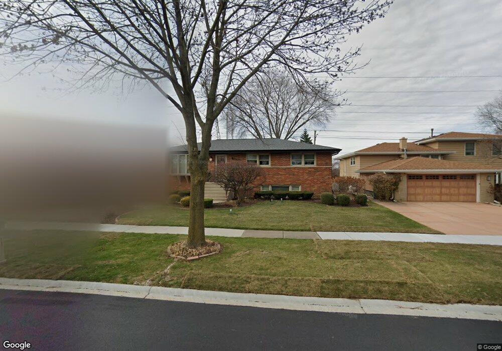
10548 S Michael Dr Palos Hills, IL 60465
Estimated Value: $331,000 - $385,000
3
Beds
2
Baths
1,342
Sq Ft
$270/Sq Ft
Est. Value
About This Home
This home is located at 10548 S Michael Dr, Palos Hills, IL 60465 and is currently estimated at $362,764, approximately $270 per square foot. 10548 S Michael Dr is a home located in Cook County with nearby schools including Sorrick Elementary School, Oak Ridge Elementary School, and H H Conrady Jr High School.
Ownership History
Date
Name
Owned For
Owner Type
Purchase Details
Closed on
Jun 1, 1999
Sold by
Pearson Dick A and Pearson Dorothy A
Bought by
Pearson Dick A and Pearson Dorothy A
Current Estimated Value
Create a Home Valuation Report for This Property
The Home Valuation Report is an in-depth analysis detailing your home's value as well as a comparison with similar homes in the area
Home Values in the Area
Average Home Value in this Area
Purchase History
| Date | Buyer | Sale Price | Title Company |
|---|---|---|---|
| Pearson Dick A | -- | -- |
Source: Public Records
Tax History Compared to Growth
Tax History
| Year | Tax Paid | Tax Assessment Tax Assessment Total Assessment is a certain percentage of the fair market value that is determined by local assessors to be the total taxable value of land and additions on the property. | Land | Improvement |
|---|---|---|---|---|
| 2024 | $3,264 | $29,000 | $6,598 | $22,402 |
| 2023 | $4,252 | $29,000 | $6,598 | $22,402 |
| 2022 | $4,252 | $21,961 | $5,747 | $16,214 |
| 2021 | $4,012 | $21,959 | $5,746 | $16,213 |
| 2020 | $3,659 | $21,959 | $5,746 | $16,213 |
| 2019 | $4,028 | $22,675 | $5,321 | $17,354 |
| 2018 | $3,884 | $22,675 | $5,321 | $17,354 |
| 2017 | $3,681 | $22,675 | $5,321 | $17,354 |
| 2016 | $4,938 | $19,512 | $4,682 | $14,830 |
| 2015 | $5,114 | $19,512 | $4,682 | $14,830 |
| 2014 | $4,936 | $19,512 | $4,682 | $14,830 |
| 2013 | $4,735 | $19,615 | $4,682 | $14,933 |
Source: Public Records
Map
Nearby Homes
- 10440 S 75th Ct
- 10409 Sheffield Dr Unit 13
- 10531 S Roberts Rd Unit 2D
- 10300 S Kathy Ct
- 10820 Kathleen Ct Unit D
- 7810 W 102nd St
- 10233 Concord Ln Unit C
- 10324 S 81st Ave
- 10225 Camden Ln Unit K
- 7357 W 109th St
- 10226 S 81st Ave
- 10926 Circle Ct
- 10927 Circle Dr
- 8057 Valley Dr
- 10125 S 81st Ct
- 10441 S 83rd Ave
- 11050 S Roberts Rd
- 7801 W 111th St
- 7420 W 111th St Unit 501
- 7434 W 111th St Unit 812
- 10554 S Michael Dr
- 10542 S Michael Dr
- 10536 S Michael Dr
- 10543 S Michael Dr
- 10606 S Michael Dr
- 10549 S Michael Dr
- 10530 S Michael Dr
- 10555 S Michael Dr
- 10537 S Michael Dr
- 10601 S Michael Dr
- 10612 S Michael Dr
- 10524 S Michael Dr
- 10607 S Michael Dr
- 10542 S Terry Dr
- 10618 S Michael Dr
- 10536 S Terry Dr
- 10548 S Terry Dr
- 10613 S Michael Dr
- 10518 S Michael Dr
- 10600 S Terry Dr