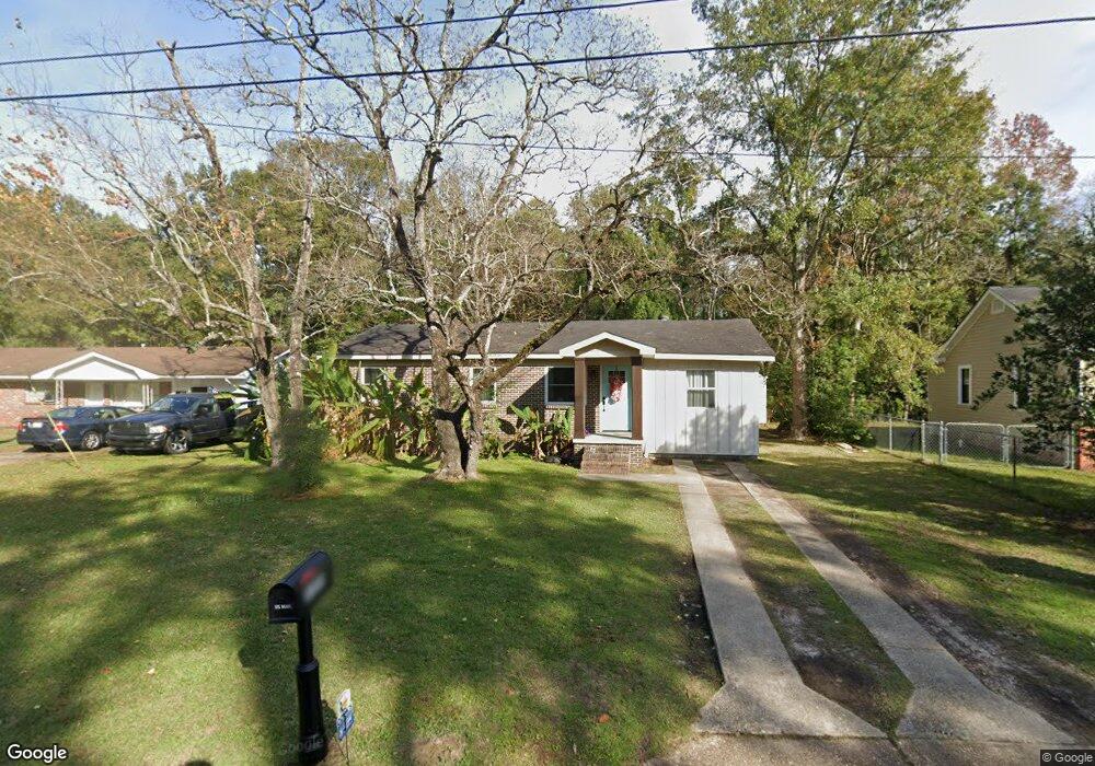
1055 Anderson Ct Mobile, AL 36606
Mertz NeighborhoodEstimated Value: $68,165 - $143,000
--
Bed
1
Bath
884
Sq Ft
$101/Sq Ft
Est. Value
About This Home
This home is located at 1055 Anderson Ct, Mobile, AL 36606 and is currently estimated at $89,541, approximately $101 per square foot. 1055 Anderson Ct is a home located in Mobile County with nearby schools including Maryvale Elementary School, Williamson High School, and Little Flower Catholic School.
Ownership History
Date
Name
Owned For
Owner Type
Purchase Details
Closed on
Apr 11, 2007
Sold by
Driftwood Llc
Bought by
Stovall Keri L and Stovall Keri
Current Estimated Value
Home Financials for this Owner
Home Financials are based on the most recent Mortgage that was taken out on this home.
Original Mortgage
$77,000
Outstanding Balance
$46,556
Interest Rate
6.15%
Mortgage Type
Unknown
Estimated Equity
$42,985
Purchase Details
Closed on
Jul 10, 2006
Sold by
Kopf Leon R and Kopf Janet B
Bought by
Driftwood Llc
Home Financials for this Owner
Home Financials are based on the most recent Mortgage that was taken out on this home.
Original Mortgage
$35,000
Interest Rate
6.6%
Mortgage Type
Balloon
Create a Home Valuation Report for This Property
The Home Valuation Report is an in-depth analysis detailing your home's value as well as a comparison with similar homes in the area
Home Values in the Area
Average Home Value in this Area
Purchase History
| Date | Buyer | Sale Price | Title Company |
|---|---|---|---|
| Stovall Keri L | $77,500 | Advanced Land & Title Inc | |
| Driftwood Llc | $31,000 | None Available |
Source: Public Records
Mortgage History
| Date | Status | Borrower | Loan Amount |
|---|---|---|---|
| Open | Stovall Keri L | $77,000 | |
| Previous Owner | Driftwood Llc | $35,000 |
Source: Public Records
Tax History Compared to Growth
Tax History
| Year | Tax Paid | Tax Assessment Tax Assessment Total Assessment is a certain percentage of the fair market value that is determined by local assessors to be the total taxable value of land and additions on the property. | Land | Improvement |
|---|---|---|---|---|
| 2024 | $266 | $4,770 | $1,100 | $3,670 |
| 2023 | $247 | $4,710 | $1,100 | $3,610 |
| 2022 | $577 | $4,540 | $1,100 | $3,440 |
| 2021 | $577 | $4,540 | $1,100 | $3,440 |
| 2020 | $577 | $4,540 | $1,100 | $3,440 |
| 2019 | $572 | $4,500 | $1,100 | $3,400 |
| 2018 | $626 | $9,860 | $0 | $0 |
| 2017 | $626 | $9,860 | $0 | $0 |
| 2016 | $635 | $10,000 | $0 | $0 |
| 2013 | -- | $8,920 | $0 | $0 |
Source: Public Records
Map
Nearby Homes
- 1161 Mcrae Ave
- 0 Pleasant Valley Rd Unit 7526387
- 903 Fairmont St
- 2520 Pleasant Valley Rd
- 762 Farnell Ln
- 805 Platt Ave
- 953 Kenny St
- 1833 Woodcock Place
- 1841 Woodcock Place
- 1837 Woodcock Place
- 1829 Woodcock Place
- 713 Mandrell St
- 3050 Kendale Dr
- 911 W Stuart Dr
- 2762 Marcelus Dr
- 3011 Westgate St
- 2755 Kreitner St
- 1016 Shady Brook Dr
- 3014 Farcott St
- 509 W Barksdale Dr
- 1053 Anderson Ct
- 1057 Anderson Ct
- 1050 Anderson Ct
- 1056 Anderson Ct
- 2716 S Thompson Dr
- 2718 S Thompson Dr
- 1060 Anderson Ct
- 2712 S Thompson Dr
- 2710 S Thompson Dr
- 2726 S Thompson Dr
- 2706 S Thompson Dr
- 2717 S Thompson Dr
- 2769 N Thompson Dr
- 2730 S Thompson Dr
- 1058 Mcrae Ave
- 1056 Mcrae Ave
- 1060 Mcrae Ave
- 2711 S Thompson Dr
- 2704 S Thompson Dr
- 2721 S Thompson Dr