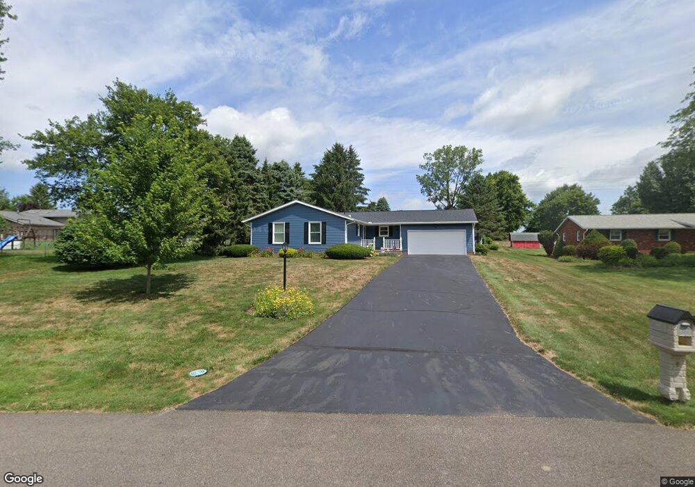
1055 Canyon St NW Uniontown, OH 44685
Estimated Value: $265,000 - $285,000
3
Beds
2
Baths
1,364
Sq Ft
$198/Sq Ft
Est. Value
About This Home
This home is located at 1055 Canyon St NW, Uniontown, OH 44685 and is currently estimated at $270,585, approximately $198 per square foot. 1055 Canyon St NW is a home located in Stark County with nearby schools including Lake Middle/High School and Lake Center Christian School.
Ownership History
Date
Name
Owned For
Owner Type
Purchase Details
Closed on
Apr 8, 1997
Sold by
Chan Paula J
Bought by
Chan John C
Current Estimated Value
Home Financials for this Owner
Home Financials are based on the most recent Mortgage that was taken out on this home.
Original Mortgage
$80,000
Outstanding Balance
$10,127
Interest Rate
7.65%
Mortgage Type
New Conventional
Estimated Equity
$260,458
Create a Home Valuation Report for This Property
The Home Valuation Report is an in-depth analysis detailing your home's value as well as a comparison with similar homes in the area
Home Values in the Area
Average Home Value in this Area
Purchase History
| Date | Buyer | Sale Price | Title Company |
|---|---|---|---|
| Chan John C | $27,500 | -- |
Source: Public Records
Mortgage History
| Date | Status | Borrower | Loan Amount |
|---|---|---|---|
| Open | Chan John C | $80,000 |
Source: Public Records
Tax History Compared to Growth
Tax History
| Year | Tax Paid | Tax Assessment Tax Assessment Total Assessment is a certain percentage of the fair market value that is determined by local assessors to be the total taxable value of land and additions on the property. | Land | Improvement |
|---|---|---|---|---|
| 2025 | -- | $78,890 | $23,100 | $55,790 |
| 2024 | -- | $78,890 | $23,100 | $55,790 |
| 2023 | $3,002 | $64,330 | $14,420 | $49,910 |
| 2022 | $1,506 | $64,330 | $14,420 | $49,910 |
| 2021 | $3,046 | $64,330 | $14,420 | $49,910 |
| 2020 | $2,913 | $55,170 | $12,430 | $42,740 |
| 2019 | $2,886 | $55,170 | $12,430 | $42,740 |
| 2018 | $2,887 | $55,170 | $12,430 | $42,740 |
| 2017 | $2,702 | $47,960 | $12,430 | $35,530 |
| 2016 | $2,707 | $47,960 | $12,430 | $35,530 |
| 2015 | $2,705 | $47,960 | $12,430 | $35,530 |
| 2014 | $331 | $43,020 | $11,170 | $31,850 |
| 2013 | $1,166 | $43,020 | $11,170 | $31,850 |
Source: Public Records
Map
Nearby Homes
- 1037 Canyon St NE
- 12055 King Church Ave NW
- 747 Grandview Cir
- 1771 Midway St NW
- 786 Fair Vista Cir SW
- 778 Fair Vista Cir SW
- 531 Gentlebrook Blvd SW
- 525 Gentlebrook Blvd SW
- 550 Woodlands Glen Ave
- 11121 Geib Ave NE
- 510 Meadow Cir SW Unit 11
- 12201 King Church Ave NW
- 2084 Hazel St NE
- 11900 Geib Ave NE
- 425 Tonawanda Trail SW
- Unit 9 Meadow Trail SW Unit 9
- 225 Seneca Trail SW
- 1180 Tessa Trail Unit 1180
- 1975 Eloise Cir NE
- 9790 Smithdale Ave NE
- 1037 Canyon St NW
- 1037 Canyon St NW
- 11112 Titus Ave NW
- 1081 Canyon St NW
- 1019 Canyon St NW
- 11130 Titus Ave NW
- 1067 Shelview Cir NW
- 11205 Market Ave NW
- 1080 Canyon St NW
- 1077 Shelview Cir NW
- 1068 Shelview Cir NW
- 11087 Market Ave NW
- 11105 Titus Ave NW
- 11140 Market Ave NE
- 11131 Titus Ave NW
- 11121 Titus Ave NW
- 11065 Market Ave NW
- 11192 Sarahann Ave NW
- 11225 Market Ave NW
- 11085 Titus Ave NW