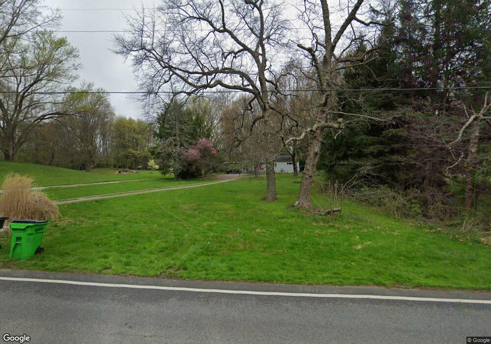
1055 E Howe Rd Tallmadge, OH 44278
Estimated Value: $184,000 - $234,000
3
Beds
1
Bath
960
Sq Ft
$206/Sq Ft
Est. Value
About This Home
This home is located at 1055 E Howe Rd, Tallmadge, OH 44278 and is currently estimated at $197,539, approximately $205 per square foot. 1055 E Howe Rd is a home located in Summit County with nearby schools including Tallmadge Middle School, Tallmadge High School, and Cornerstone Community School.
Ownership History
Date
Name
Owned For
Owner Type
Purchase Details
Closed on
Aug 22, 2024
Sold by
Drumm Donald H
Bought by
Drumm Kimberly L
Current Estimated Value
Home Financials for this Owner
Home Financials are based on the most recent Mortgage that was taken out on this home.
Original Mortgage
$112,558
Outstanding Balance
$111,289
Interest Rate
6.89%
Mortgage Type
New Conventional
Estimated Equity
$86,250
Purchase Details
Closed on
Sep 22, 2010
Sold by
Keller Drumm April R
Bought by
Drumm Donald H
Purchase Details
Closed on
Feb 16, 2001
Sold by
Pauline Drumm Donald H and Pauline G
Bought by
Drumm Donald H
Home Financials for this Owner
Home Financials are based on the most recent Mortgage that was taken out on this home.
Original Mortgage
$74,460
Interest Rate
7.1%
Mortgage Type
VA
Create a Home Valuation Report for This Property
The Home Valuation Report is an in-depth analysis detailing your home's value as well as a comparison with similar homes in the area
Home Values in the Area
Average Home Value in this Area
Purchase History
| Date | Buyer | Sale Price | Title Company |
|---|---|---|---|
| Drumm Kimberly L | $141,000 | None Listed On Document | |
| Drumm Donald H | -- | Attorney | |
| Drumm Donald H | $73,000 | Kent Title Agency Inc |
Source: Public Records
Mortgage History
| Date | Status | Borrower | Loan Amount |
|---|---|---|---|
| Open | Drumm Kimberly L | $112,558 | |
| Previous Owner | Drumm Donald H | $74,460 |
Source: Public Records
Tax History Compared to Growth
Tax History
| Year | Tax Paid | Tax Assessment Tax Assessment Total Assessment is a certain percentage of the fair market value that is determined by local assessors to be the total taxable value of land and additions on the property. | Land | Improvement |
|---|---|---|---|---|
| 2025 | $3,275 | $49,627 | $14,245 | $35,382 |
| 2024 | $3,275 | $49,627 | $14,245 | $35,382 |
| 2023 | $3,275 | $49,627 | $14,245 | $35,382 |
| 2022 | $3,149 | $38,175 | $10,959 | $27,216 |
| 2021 | $2,401 | $38,175 | $10,959 | $27,216 |
| 2020 | $3,117 | $38,180 | $10,960 | $27,220 |
| 2019 | $3,332 | $38,060 | $10,970 | $27,090 |
| 2018 | $2,341 | $38,060 | $10,970 | $27,090 |
| 2017 | $2,077 | $38,060 | $10,970 | $27,090 |
| 2016 | $2,236 | $33,370 | $9,980 | $23,390 |
| 2015 | $2,077 | $33,370 | $9,980 | $23,390 |
| 2014 | $2,064 | $33,370 | $9,980 | $23,390 |
| 2013 | $1,980 | $32,560 | $9,980 | $22,580 |
Source: Public Records
Map
Nearby Homes
- 779 Atwood Dr
- 0 Northeast Ave Unit 5114314
- 313 Whittlesey Dr
- 43 Picadilly Ct
- 59 Tudor Ln
- 43 Benjamin Way
- 999 Howard Dr
- 943 Howard Dr
- 617 Northeast Ave
- 557 Wring Dr
- 4196 Lancaster Ln
- Aspire Plan at Tallmadge Reserve
- Fairview Plan at Tallmadge Reserve
- Crisfield Plan at Tallmadge Reserve
- Mitchell Plan at Tallmadge Reserve
- Passport Plan at Tallmadge Reserve
- Hampton Plan at Tallmadge Reserve
- Oakdale Plan at Tallmadge Reserve
- 1168 East Ave
- 0 East Ave
- 1063 E Howe Rd
- 1045 E Howe Rd
- 1033 E Howe Rd
- 1015 E Howe Rd
- 932 E Howe Rd
- 1062 Hillcrest Dr
- 641 Atwood Dr
- 1007 E Howe Rd
- 1042 Hillcrest Dr
- 1030 Hillcrest Dr
- 667 Atwood Dr
- 1072 Hillcrest Dr
- 1018 Hillcrest Dr
- 679 Atwood Dr
- 689 Atwood Dr
- 640 Atwood Dr
- 704 Locust Dr
- 977 E Howe Rd
- 662 Atwood Dr
- 1051 Hillcrest Dr
