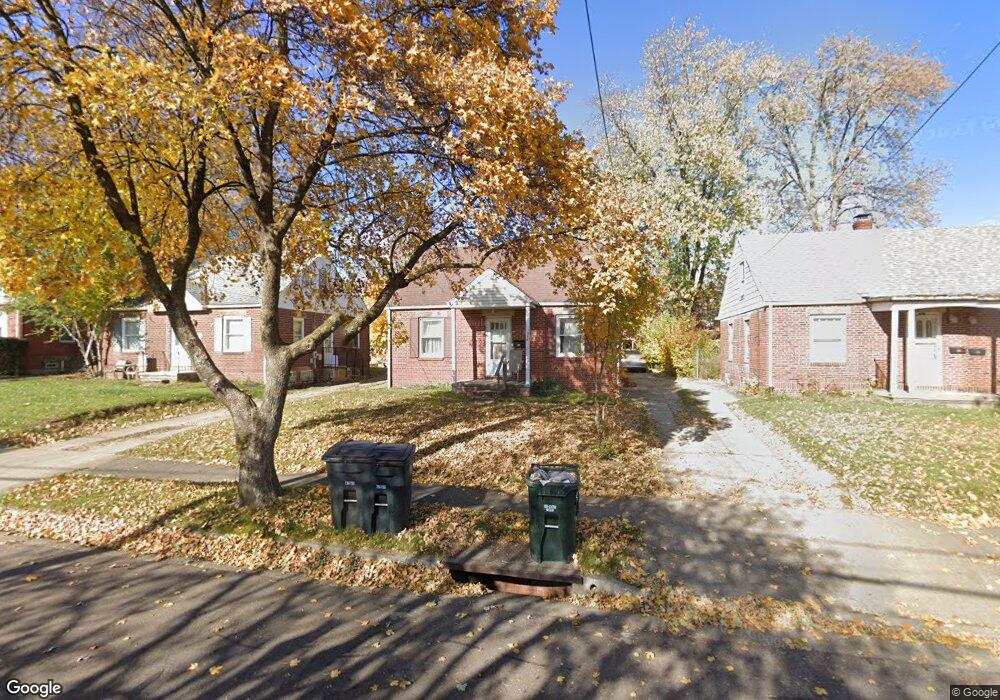
1055 Lindsay Ave Akron, OH 44306
East Akron NeighborhoodEstimated Value: $74,651 - $94,000
3
Beds
1
Bath
1,015
Sq Ft
$82/Sq Ft
Est. Value
About This Home
This home is located at 1055 Lindsay Ave, Akron, OH 44306 and is currently estimated at $83,413, approximately $82 per square foot. 1055 Lindsay Ave is a home located in Summit County with nearby schools including Eagle Elementary, Main Preparatory Academy, and Case Preparatory Academy.
Ownership History
Date
Name
Owned For
Owner Type
Purchase Details
Closed on
Aug 16, 2024
Sold by
Kelly Karen H
Bought by
Cama Sdira Llc and Blackstone William M
Current Estimated Value
Purchase Details
Closed on
Jun 1, 2011
Sold by
Kelly Karen H
Bought by
Sdira Cama and William M Blackstone Ira
Home Financials for this Owner
Home Financials are based on the most recent Mortgage that was taken out on this home.
Original Mortgage
$30,000
Interest Rate
7%
Mortgage Type
Seller Take Back
Create a Home Valuation Report for This Property
The Home Valuation Report is an in-depth analysis detailing your home's value as well as a comparison with similar homes in the area
Home Values in the Area
Average Home Value in this Area
Purchase History
| Date | Buyer | Sale Price | Title Company |
|---|---|---|---|
| Cama Sdira Llc | $35,000 | None Listed On Document | |
| Sdira Cama | $35,000 | Attorney |
Source: Public Records
Mortgage History
| Date | Status | Borrower | Loan Amount |
|---|---|---|---|
| Previous Owner | Sdira Cama | $30,000 |
Source: Public Records
Tax History Compared to Growth
Tax History
| Year | Tax Paid | Tax Assessment Tax Assessment Total Assessment is a certain percentage of the fair market value that is determined by local assessors to be the total taxable value of land and additions on the property. | Land | Improvement |
|---|---|---|---|---|
| 2025 | $1,126 | $18,648 | $4,424 | $14,224 |
| 2024 | $1,126 | $18,648 | $4,424 | $14,224 |
| 2023 | $1,126 | $18,648 | $4,424 | $14,224 |
| 2022 | $1,070 | $13,811 | $3,276 | $10,535 |
| 2021 | $1,071 | $13,811 | $3,276 | $10,535 |
| 2020 | $1,033 | $13,820 | $3,280 | $10,540 |
| 2019 | $1,293 | $16,250 | $4,070 | $12,180 |
| 2018 | $1,214 | $16,250 | $4,070 | $12,180 |
| 2017 | $1,257 | $16,250 | $4,070 | $12,180 |
| 2016 | $1,258 | $16,590 | $4,070 | $12,520 |
| 2015 | $1,257 | $16,590 | $4,070 | $12,520 |
| 2014 | $1,247 | $16,590 | $4,070 | $12,520 |
| 2013 | $1,226 | $16,650 | $4,070 | $12,580 |
Source: Public Records
Map
Nearby Homes
- 1042 Lindsay Ave
- 1060 Georgia Ave
- 1071 Georgia Ave
- 1137 S Arlington St
- 1170 Reed Ave
- 955 N Firestone Blvd
- 1102 Palmetto Ave
- 912 Lindsay Ave
- 1140 Palmetto Ave
- 787 Ravenswood St
- 1224 Lindsay Ave
- 782 Ardella Ave
- 960 Donald Ave
- 1095 E Archwood Ave
- 944 Donald Ave
- 839 Minota Ave
- 912 E Archwood Ave
- 868 Davies Ave
- 864 Davies Ave
- 805 Georgia Ave Unit 807
- 1059 Lindsay Ave
- 1049 Lindsay Ave
- 1045 Lindsay Ave
- 1063 Lindsay Ave
- 1052 Reed Ave
- 1060 Reed Ave
- 1067 Lindsay Ave
- 1048 Reed Ave
- 1070 Reed Ave
- 1042 Reed Ave
- 1042 V/L Reed Ave
- 1073 Lindsay Ave
- 1046 Lindsay Ave
- 1064 Lindsay Ave
- 1074 Reed Ave
- 1037 Lindsay Ave
- 1068 Lindsay Ave
- 1077 Lindsay Ave
- 1038 Lindsay Ave
- 1072 Lindsay Ave