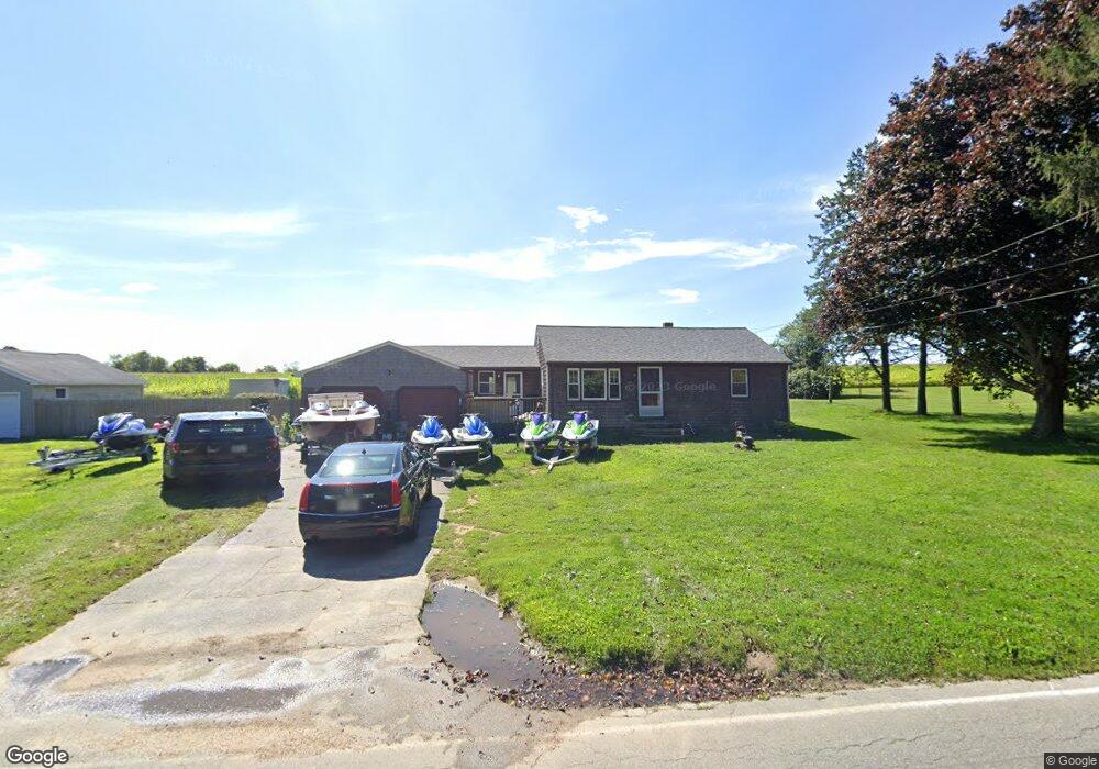
1055 Sodom Rd Westport, MA 02790
Adamsville NeighborhoodEstimated Value: $385,000 - $473,840
2
Beds
2
Baths
982
Sq Ft
$440/Sq Ft
Est. Value
About This Home
This home is located at 1055 Sodom Rd, Westport, MA 02790 and is currently estimated at $432,210, approximately $440 per square foot. 1055 Sodom Rd is a home located in Bristol County with nearby schools including Alice A. Macomber Primary School, Westport Elementary School, and Westport Middle-High School.
Ownership History
Date
Name
Owned For
Owner Type
Purchase Details
Closed on
Aug 10, 2005
Sold by
T Manuel
Bought by
Priest Thomas J
Current Estimated Value
Home Financials for this Owner
Home Financials are based on the most recent Mortgage that was taken out on this home.
Original Mortgage
$189,000
Outstanding Balance
$98,517
Interest Rate
5.54%
Mortgage Type
Purchase Money Mortgage
Estimated Equity
$333,693
Purchase Details
Closed on
Jul 6, 2005
Sold by
Mary Manuel and Mary Lewis T
Bought by
Priest Thomas J
Home Financials for this Owner
Home Financials are based on the most recent Mortgage that was taken out on this home.
Original Mortgage
$189,000
Outstanding Balance
$98,517
Interest Rate
5.54%
Mortgage Type
Purchase Money Mortgage
Estimated Equity
$333,693
Create a Home Valuation Report for This Property
The Home Valuation Report is an in-depth analysis detailing your home's value as well as a comparison with similar homes in the area
Home Values in the Area
Average Home Value in this Area
Purchase History
| Date | Buyer | Sale Price | Title Company |
|---|---|---|---|
| Priest Thomas J | $198,000 | -- | |
| Priest Thomas J | $2,000 | -- |
Source: Public Records
Mortgage History
| Date | Status | Borrower | Loan Amount |
|---|---|---|---|
| Open | Priest Thomas J | $189,000 |
Source: Public Records
Tax History Compared to Growth
Tax History
| Year | Tax Paid | Tax Assessment Tax Assessment Total Assessment is a certain percentage of the fair market value that is determined by local assessors to be the total taxable value of land and additions on the property. | Land | Improvement |
|---|---|---|---|---|
| 2025 | $2,486 | $333,700 | $161,900 | $171,800 |
| 2024 | $2,470 | $319,500 | $150,000 | $169,500 |
| 2023 | $2,347 | $287,600 | $136,600 | $151,000 |
| 2022 | $2,246 | $264,900 | $136,600 | $128,300 |
| 2021 | $2,177 | $252,500 | $124,200 | $128,300 |
| 2020 | $2,041 | $242,100 | $113,800 | $128,300 |
| 2019 | $2,000 | $241,800 | $113,800 | $128,000 |
| 2018 | $4,349 | $227,100 | $116,600 | $110,500 |
| 2017 | $1,792 | $224,900 | $116,600 | $108,300 |
| 2016 | $1,699 | $214,800 | $116,600 | $98,200 |
| 2015 | $1,618 | $204,000 | $116,600 | $87,400 |
Source: Public Records
Map
Nearby Homes
- 101 Adamsville Rd
- 837 Main Road & Lot 2
- 837 Main Rd
- 8 Village Way
- 15 Village Way
- 7 Village Way
- 17 Quail Trail
- 920 Drift Rd
- 225 Hixbridge Rd
- 1346 Main Rd Unit B
- 978 Sodom Rd
- 8 Strawberry Ln
- 184 Field Stone Ln
- 118 Charlotte White Rd
- 118 Charlotte White Rd Extension
- 0 Hidden Glen Ln
- 116 Amy Hart Path
- 1580 Main Rd
- 0 S Lake Rd Unit 73361665
- 0 S Lake Rd Unit 1382842