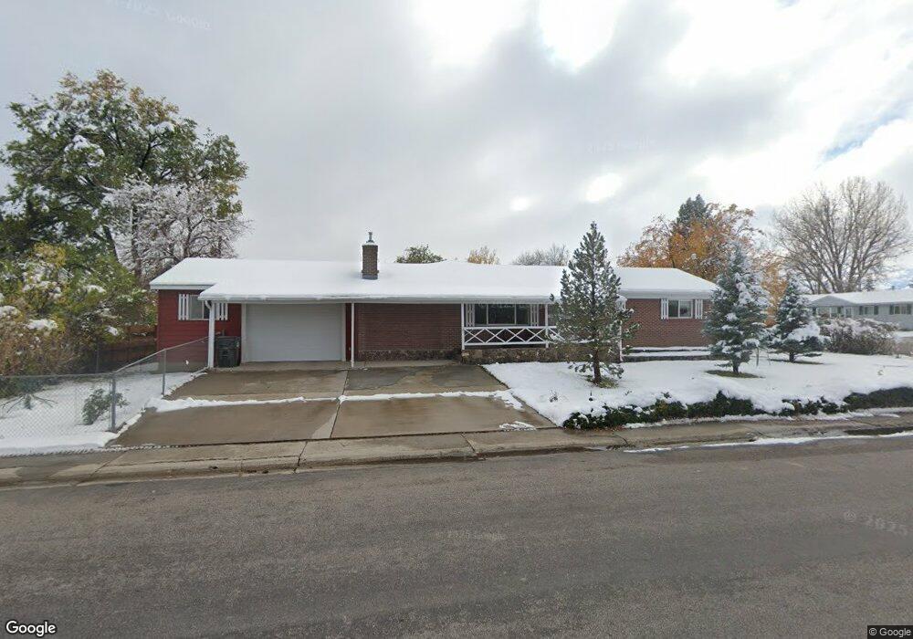
1055 Spriggs Dr Lander, WY 82520
Estimated Value: $385,000 - $460,000
4
Beds
3
Baths
1,720
Sq Ft
$239/Sq Ft
Est. Value
About This Home
This home is located at 1055 Spriggs Dr, Lander, WY 82520 and is currently estimated at $411,564, approximately $239 per square foot. 1055 Spriggs Dr is a home located in Fremont County with nearby schools including Lander Valley High School and Lander Christian Academy.
Ownership History
Date
Name
Owned For
Owner Type
Purchase Details
Closed on
Sep 26, 2025
Sold by
Moxley Ann Koch
Bought by
Sala Michael William and Summers Kimberly Ann
Current Estimated Value
Home Financials for this Owner
Home Financials are based on the most recent Mortgage that was taken out on this home.
Original Mortgage
$380,972
Outstanding Balance
$380,972
Interest Rate
6.58%
Mortgage Type
FHA
Estimated Equity
$30,592
Create a Home Valuation Report for This Property
The Home Valuation Report is an in-depth analysis detailing your home's value as well as a comparison with similar homes in the area
Home Values in the Area
Average Home Value in this Area
Purchase History
| Date | Buyer | Sale Price | Title Company |
|---|---|---|---|
| Sala Michael William | -- | None Listed On Document |
Source: Public Records
Mortgage History
| Date | Status | Borrower | Loan Amount |
|---|---|---|---|
| Open | Sala Michael William | $380,972 |
Source: Public Records
Tax History
| Year | Tax Paid | Tax Assessment Tax Assessment Total Assessment is a certain percentage of the fair market value that is determined by local assessors to be the total taxable value of land and additions on the property. | Land | Improvement |
|---|---|---|---|---|
| 2025 | $3,216 | $32,187 | $3,788 | $28,399 |
| 2024 | $3,216 | $41,661 | $5,051 | $36,610 |
| 2023 | $3,070 | $40,095 | $4,893 | $35,202 |
| 2022 | $2,524 | $33,693 | $4,893 | $28,800 |
| 2021 | $2,236 | $28,887 | $4,773 | $24,114 |
| 2020 | $2,066 | $26,741 | $4,773 | $21,968 |
| 2019 | $2,041 | $25,992 | $4,729 | $21,263 |
| 2018 | $2,026 | $25,528 | $4,729 | $20,799 |
| 2017 | $1,924 | $24,176 | $4,729 | $19,447 |
| 2016 | $1,926 | $24,240 | $4,729 | $19,511 |
| 2015 | $1,868 | $23,775 | $4,729 | $19,046 |
| 2014 | $2,055 | $26,206 | $4,729 | $21,477 |
Source: Public Records
Map
Nearby Homes
- 1035 Spriggs Dr
- 1060 Spriggs Dr
- 560 Smith St
- 1050 Spriggs Dr
- 1025 Spriggs Dr
- 1030 Mcdougall Dr
- 515 Smith St
- 460 Smith St
- 535 Smith St
- 580 Smith St
- 1020 Mcdougall Dr
- 1080 Spriggs Dr
- 1080 Spriggs Dr Unit Smith St.
- 555 Smith St
- 1030 Spriggs Dr
- 1030 Spriggs Dr Unit S. 9th St.
- 1030 Spriggs Dr Unit S 9th Street
- 1015 Spriggs Dr
- 475 Smith St
- 440 Smith St
Your Personal Tour Guide
Ask me questions while you tour the home.