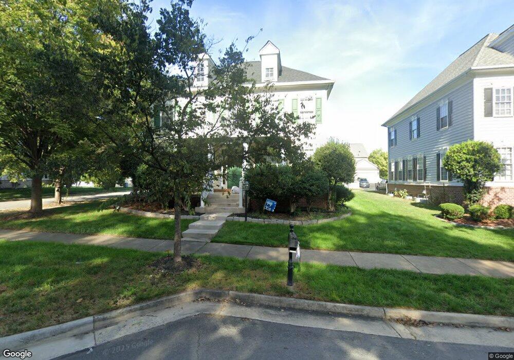
10550 Bristow Station Dr Bristow, VA 20136
Estimated Value: $813,000 - $855,000
4
Beds
4
Baths
4,616
Sq Ft
$182/Sq Ft
Est. Value
About This Home
This home is located at 10550 Bristow Station Dr, Bristow, VA 20136 and is currently estimated at $840,333, approximately $182 per square foot. 10550 Bristow Station Dr is a home located in Prince William County with nearby schools including T. Clay Wood Elementary School, E.H. Marsteller Middle School, and Brentsville District High School.
Ownership History
Date
Name
Owned For
Owner Type
Purchase Details
Closed on
Dec 19, 2019
Sold by
Lawal Mouri Jay Egblorgbe and Kpogo Diana Etornam
Bought by
Lawal Mouri Jay Egblorgbe and Kpogo Diana Etornam
Current Estimated Value
Home Financials for this Owner
Home Financials are based on the most recent Mortgage that was taken out on this home.
Original Mortgage
$135,000
Outstanding Balance
$119,022
Interest Rate
3.6%
Mortgage Type
Credit Line Revolving
Estimated Equity
$721,311
Purchase Details
Closed on
Oct 25, 2005
Sold by
Centex Homes
Bought by
Aboagye Frank and Aboagye Acquah,Joana
Home Financials for this Owner
Home Financials are based on the most recent Mortgage that was taken out on this home.
Original Mortgage
$487,800
Outstanding Balance
$263,176
Interest Rate
5.79%
Mortgage Type
New Conventional
Estimated Equity
$577,157
Create a Home Valuation Report for This Property
The Home Valuation Report is an in-depth analysis detailing your home's value as well as a comparison with similar homes in the area
Home Values in the Area
Average Home Value in this Area
Purchase History
| Date | Buyer | Sale Price | Title Company |
|---|---|---|---|
| Lawal Mouri Jay Egblorgbe | -- | None Available | |
| Aboagye Frank | $609,785 | -- |
Source: Public Records
Mortgage History
| Date | Status | Borrower | Loan Amount |
|---|---|---|---|
| Open | Lawal Mouri Jay Egblorgbe | $135,000 | |
| Open | Aboagye Frank | $487,800 |
Source: Public Records
Tax History Compared to Growth
Tax History
| Year | Tax Paid | Tax Assessment Tax Assessment Total Assessment is a certain percentage of the fair market value that is determined by local assessors to be the total taxable value of land and additions on the property. | Land | Improvement |
|---|---|---|---|---|
| 2025 | $7,141 | $781,700 | $208,500 | $573,200 |
| 2024 | $7,141 | $718,000 | $198,600 | $519,400 |
| 2023 | $7,050 | $677,600 | $164,300 | $513,300 |
| 2022 | $7,116 | $632,200 | $164,300 | $467,900 |
| 2021 | $6,769 | $556,100 | $142,300 | $413,800 |
| 2020 | $8,071 | $520,700 | $142,300 | $378,400 |
| 2019 | $7,659 | $494,100 | $142,300 | $351,800 |
| 2018 | $6,071 | $502,800 | $142,300 | $360,500 |
| 2017 | $6,171 | $502,300 | $142,300 | $360,000 |
| 2016 | $5,997 | $492,700 | $135,800 | $356,900 |
| 2015 | $5,617 | $484,600 | $128,500 | $356,100 |
| 2014 | $5,617 | $451,100 | $118,900 | $332,200 |
Source: Public Records
Map
Nearby Homes
- 10554 Andrew Humphreys Ct
- 11650 Iron Brigade Unit Ave
- 11823 Whitworth Cannon Ln
- 11688 Camp Jones Ct
- 10505 Blazing Star Loop
- 12021 Spring Beauty Rd
- 12002 Fitzgerald Way
- 12054 Nokesville Rd
- 12203 Aster Rd
- 12171 Open Meadow Ln
- The Sienna Plan at Woodlawn Estates
- The Jocelyn Plan at Woodlawn Estates
- The Lawrence Plan at Woodlawn Estates
- The Emma Plan at Woodlawn Estates
- 9923 Bagpipe Ct
- 12360 Corncrib Ct
- 11862 Arcari Dr
- 14058 Hawkeye Run Ct
- 10024 Darnaway Ct
- 12410 Iona Sound Dr
- 10546 Bristow Station Dr
- 10560 Bristow Station Dr
- 10515 Poagues Battery Dr
- 11701 Town Green Rd
- 10564 Bristow Station Dr
- 10501 Poagues Battery Dr
- 11705 Town Green Rd
- 10525 Poagues Battery Dr
- 10568 Bristow Station Dr
- 10529 Poagues Battery Dr
- 11709 Town Green Rd
- 11800 Robert Allen Ln
- 10549 Bristow Station Dr
- 10533 Poagues Battery Dr
- 11801 Robert Allen Ln
- 10572 Bristow Station Dr
- 10520 Poagues Battery Dr
- 10537 Poagues Battery Dr
- 10576 Bristow Station Dr
- 11860 Frank Haskell Ct