
10550 Johnstown Rd New Albany, OH 43054
Estimated payment $41,284/month
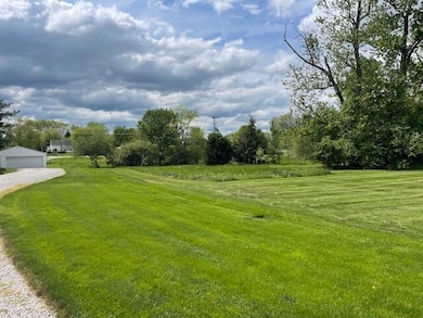
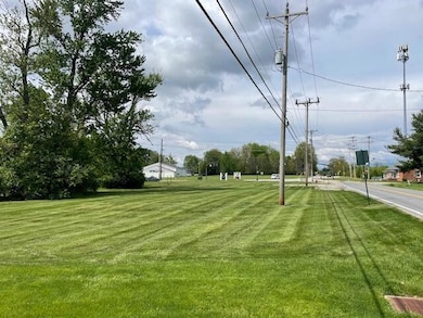
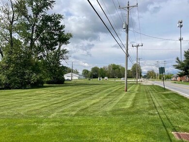
About This Lot
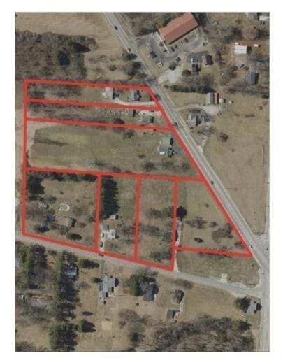
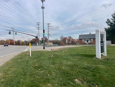
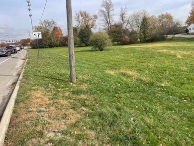
There are 11.9 acres included in this 7-parcel assemblage, 6 of which have single-family homes currently occupied. Constraints surrounding the five-points intersection calls for the city to work proactively with ODOT to acquire sufficient right-of-way to ensure that improvements remain consistent with the character of New Albany and the surrounding unincorporated areas within Plain Township. While the city owns two parcels near the intersection, only one has immediate frontage along US-62. The other surrounding parcels are privately owned. Properties are currently zoned residential. The city has delineated this area as the 'Five Points Gateway' (see page 120 of the city's Focus Area Plan dated September 2025). Website detailed in Agent to Agent comments.
The intersection is a major traffic node with safety and congestion challenges. Improvements require additional right‑of‑way (ROW) to accommodate roadway changes, pedestrian infrastructure, and streetscape enhancements. Without ROW acquisition, upgrades could be limited or inconsistent with New Albany's design standards. The city underscores how infrastructure planning, land ownership, and intergovernmental coordination intersect. It's not just about traffic—it's about shaping the identity and livability of New Albany's growth corridor.
Property Details
Property Type
- Land
Est. Annual Taxes
- $3,057
Lot Details
- 11.9 Acre Lot
- Additional Parcels
Additional Features
- Outbuilding
- Gas Available
Listing and Financial Details
- Assessor Parcel Number 222-000400
Map
Home Values in the Area
Average Home Value in this Area
Tax History
| Year | Tax Paid | Tax Assessment Tax Assessment Total Assessment is a certain percentage of the fair market value that is determined by local assessors to be the total taxable value of land and additions on the property. | Land | Improvement |
|---|---|---|---|---|
| 2024 | $4,475 | $48,060 | $48,060 | -- |
| 2023 | $2,826 | $48,055 | $48,055 | $0 |
| 2022 | $2,878 | $37,700 | $37,700 | $0 |
| 2021 | $2,769 | $37,700 | $37,700 | $0 |
| 2020 | $2,753 | $37,700 | $37,700 | $0 |
| 2019 | $2,621 | $32,760 | $32,760 | $0 |
| 2018 | $2,897 | $32,760 | $32,760 | $0 |
| 2017 | $3,680 | $51,870 | $32,760 | $19,110 |
| 2016 | $3,206 | $36,930 | $31,150 | $5,780 |
| 2015 | $3,204 | $36,930 | $31,150 | $5,780 |
| 2014 | $3,073 | $36,930 | $31,150 | $5,780 |
| 2013 | $1,502 | $35,175 | $29,680 | $5,495 |
Property History
| Date | Event | Price | List to Sale | Price per Sq Ft |
|---|---|---|---|---|
| 12/12/2025 12/12/25 | For Sale | $7,800,000 | -- | -- |
Purchase History
| Date | Type | Sale Price | Title Company |
|---|---|---|---|
| Quit Claim Deed | -- | Holz Law Firm | |
| Quit Claim Deed | -- | Holz Law Firm | |
| Interfamily Deed Transfer | -- | None Available |
Source: Columbus and Central Ohio Regional MLS
MLS Number: 225045415
APN: 222-000400
Disclaimer: Certain information contained herein is derived from information provided by parties other than Homes.com. All information provided is deemed reliable, but is not guaranteed to be accurate and should be independently verified.
![]() IDX information is provided exclusively for personal, non-commercial use, and may not be used for any purpose other than to identify prospective properties consumers may be interested in purchasing.
IDX information is provided exclusively for personal, non-commercial use, and may not be used for any purpose other than to identify prospective properties consumers may be interested in purchasing.
Information is deemed reliable but not guaranteed.
- 6550 Kitzmiller Rd
- 0 Johnstown Rd
- 8961 Grate Park Square
- 10656 Johnstown Rd
- 10087 Johnstown Rd
- 6935 Kindler Dr
- 7989 Clouse Rd
- Haven Plan at The Courtyards at Haines Creek
- Portico Plan at The Courtyards at Haines Creek
- Clay Plan at The Courtyards at Haines Creek
- Bedford Plan at The Courtyards at Haines Creek
- Palazzo Plan at The Courtyards at Haines Creek
- Promenade Plan at The Courtyards at Haines Creek
- Provenance Plan at The Courtyards at Haines Creek
- 7061 Maynard Place
- 10937 Johnstown Rd
- 6919 Joysmith Cir
- 10981 Johnstown Rd
- 5685 Jersey Dr
- 11048 Johnstown Rd
- 7090 Dean Farm Rd
- 5920 Triplett Square
- 5692 Sugarwood Dr
- 5733 Traditions Dr
- 5501 New Albany Rd E
- 200 W Main St
- 15 Keswick Commons Unit 15
- 6071 Phar Lap Dr
- 7187 Normanton Dr
- 6171 Womersley Dr
- 5185 Sulgrave Dr
- 6002 Andrew John Dr
- 5704 New Albany Rd W
- 6140 Ashtead Dr
- 5935 Central College Rd
- 6213 Home Park Dr
- 6770 Printers Blvd
- 6735 Brookline Gardens Rd
- 6710 Bethany Dr
- 5621 Warner Park Dr
