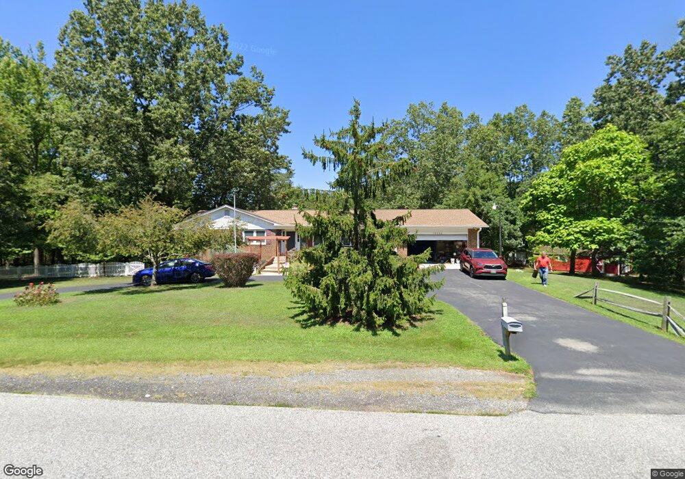
10550 Prince Charles Dr La Plata, MD 20646
Estimated Value: $556,282 - $678,000
Studio
4
Baths
1,817
Sq Ft
$337/Sq Ft
Est. Value
About This Home
This home is located at 10550 Prince Charles Dr, La Plata, MD 20646 and is currently estimated at $611,571, approximately $336 per square foot. 10550 Prince Charles Dr is a home located in Charles County with nearby schools including Walter J. Mitchell Elementary School, Milton M. Somers Middle School, and La Plata High School.
Ownership History
Date
Name
Owned For
Owner Type
Purchase Details
Closed on
Feb 11, 2026
Sold by
Kummerer Anthony Francis and Kummerer Patricia Ann
Bought by
Joint Revocable Trust and Kummerer
Current Estimated Value
Purchase Details
Closed on
May 8, 2002
Sold by
Lewin John M and Lewin Carol L
Bought by
Kummerer Anthony F and Kummerer Patricia A
Purchase Details
Closed on
Nov 1, 1989
Sold by
Hollifield Francis M and Hollifield Josephine
Bought by
Lewin John M and Carol Chambers
Home Financials for this Owner
Home Financials are based on the most recent Mortgage that was taken out on this home.
Original Mortgage
$176,000
Interest Rate
9.82%
Create a Home Valuation Report for This Property
The Home Valuation Report is an in-depth analysis detailing your home's value as well as a comparison with similar homes in the area
Home Values in the Area
Average Home Value in this Area
Purchase History
| Date | Buyer | Sale Price | Title Company |
|---|---|---|---|
| Joint Revocable Trust | -- | None Listed On Document | |
| Kummerer Anthony F | $282,500 | -- | |
| Lewin John M | $220,000 | -- |
Source: Public Records
Mortgage History
| Date | Status | Borrower | Loan Amount |
|---|---|---|---|
| Previous Owner | Lewin John M | $176,000 | |
| Closed | Kummerer Anthony F | -- |
Source: Public Records
Tax History
| Year | Tax Paid | Tax Assessment Tax Assessment Total Assessment is a certain percentage of the fair market value that is determined by local assessors to be the total taxable value of land and additions on the property. | Land | Improvement |
|---|---|---|---|---|
| 2025 | $14,570 | $499,233 | -- | -- |
| 2024 | $6,558 | $473,467 | $0 | $0 |
| 2023 | $6,398 | $447,700 | $155,200 | $292,500 |
| 2022 | $5,911 | $428,467 | $0 | $0 |
| 2021 | $5,364 | $409,233 | $0 | $0 |
| 2020 | $5,364 | $390,000 | $151,500 | $238,500 |
| 2019 | $5,231 | $380,967 | $0 | $0 |
| 2018 | $5,068 | $371,933 | $0 | $0 |
| 2017 | $4,941 | $362,900 | $0 | $0 |
| 2016 | -- | $351,867 | $0 | $0 |
| 2015 | $4,665 | $340,833 | $0 | $0 |
| 2014 | $4,665 | $329,800 | $0 | $0 |
Source: Public Records
Map
Nearby Homes
- 9900 Charles St
- 10710 Prince Charles Dr
- 615 Clarks Run Rd
- 10322 Charles St
- 528 Clarks Run Rd
- 6879 S Zelkova Ct
- 1209 Cornwall Dr
- 513 Clarks Run Rd
- 6912 S Zelkova Ct
- 1020 Suffolk Dr
- 7351 Spring Hill Ct
- 1013 Suffolk Dr
- 10226 Springhill Newtown Rd
- 3002 Wildflower Dr
- 1020 Chaff Way
- 1007 Norfolk Dr
- 112 Huckleberry Dr
- 915 Hickory Cir
- 3023 Wildflower Dr
- 12 Willow Woods Dr
- 9974 Charles St
- 10555 Prince Charles Dr
- 6985 Ellenwood Ct
- 10561 Prince Charles Dr
- 6975 Ellenwood Ct
- 9966 Charles St
- 10575 Prince Charles Dr
- 713 Prince Charles Dr
- 6955 Ellenwood Ct
- 10569 Prince Charles Dr
- 6990 Ellenwood Ct
- 6970 Ellenwood Ct
- 6950 Ellenwood Ct
- 9958 Charles St
- 710 Silver Linden Dr
- 10082 Charles St
- 6815 Semmes Ct
- 6805 Semmes Ct
- 711 Silver Linden Dr
- 706 Silver Linden Dr
Your Personal Tour Guide
Ask me questions while you tour the home.