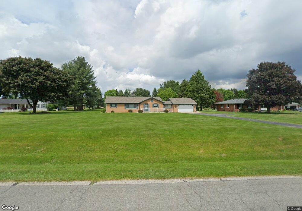
10551 Homestead Ln Plymouth, MI 48170
Estimated Value: $463,000 - $507,000
4
Beds
2
Baths
1,716
Sq Ft
$284/Sq Ft
Est. Value
About This Home
This home is located at 10551 Homestead Ln, Plymouth, MI 48170 and is currently estimated at $486,717, approximately $283 per square foot. 10551 Homestead Ln is a home located in Washtenaw County with nearby schools including Canton High School, Bird Elementary School, and West Middle School.
Ownership History
Date
Name
Owned For
Owner Type
Purchase Details
Closed on
Feb 18, 2021
Sold by
Hall Linda M
Bought by
Hall Linda M and Hall Aaron Michael
Current Estimated Value
Home Financials for this Owner
Home Financials are based on the most recent Mortgage that was taken out on this home.
Original Mortgage
$123,500
Outstanding Balance
$90,911
Interest Rate
2.7%
Mortgage Type
New Conventional
Estimated Equity
$395,806
Purchase Details
Closed on
Apr 18, 2007
Sold by
Hall Tony R
Bought by
Hall Linda M
Home Financials for this Owner
Home Financials are based on the most recent Mortgage that was taken out on this home.
Original Mortgage
$139,786
Interest Rate
6.21%
Mortgage Type
Unknown
Purchase Details
Closed on
Apr 5, 2007
Sold by
Hall Tony R
Bought by
Hall Linda M
Home Financials for this Owner
Home Financials are based on the most recent Mortgage that was taken out on this home.
Original Mortgage
$139,786
Interest Rate
6.21%
Mortgage Type
Unknown
Create a Home Valuation Report for This Property
The Home Valuation Report is an in-depth analysis detailing your home's value as well as a comparison with similar homes in the area
Home Values in the Area
Average Home Value in this Area
Purchase History
| Date | Buyer | Sale Price | Title Company |
|---|---|---|---|
| Hall Linda M | -- | Title One | |
| Hall Linda M | -- | Fidelity National Title | |
| Hall Linda M | -- | Fidelity National Title |
Source: Public Records
Mortgage History
| Date | Status | Borrower | Loan Amount |
|---|---|---|---|
| Open | Hall Linda M | $123,500 | |
| Closed | Hall Linda M | $139,786 |
Source: Public Records
Tax History Compared to Growth
Tax History
| Year | Tax Paid | Tax Assessment Tax Assessment Total Assessment is a certain percentage of the fair market value that is determined by local assessors to be the total taxable value of land and additions on the property. | Land | Improvement |
|---|---|---|---|---|
| 2025 | $2,869 | $181,750 | $0 | $0 |
| 2024 | $2,869 | $168,700 | $0 | $0 |
| 2023 | $2,735 | $116,800 | $0 | $0 |
| 2022 | $297 | $111,850 | $0 | $0 |
| 2021 | $2,819 | $117,000 | $0 | $0 |
| 2020 | $2,788 | $107,150 | $0 | $0 |
| 2019 | $2,736 | $106,000 | $106,000 | $0 |
| 2018 | $2,628 | $103,600 | $0 | $0 |
| 2017 | $2,489 | $105,400 | $0 | $0 |
| 2016 | $2,108 | $98,200 | $0 | $0 |
| 2015 | -- | $105,266 | $0 | $0 |
| 2014 | -- | $101,978 | $0 | $0 |
| 2013 | -- | $101,978 | $0 | $0 |
Source: Public Records
Map
Nearby Homes
- 10631 Homestead Ln
- 00 N Territorial Rd
- 0000 N Territorial Rd
- 6411 Lapham Ct
- 6908 Abi Ln
- 50536 Cottonwood Ct
- 50499 Cottonwood Ct Unit 26
- 50511 Beechwood Ct Unit 1112
- 50492 Beechwood Ct
- 50520 Elmwood Ct
- 50501 Elmwood Ct Unit 11
- 6755 Brook Trout Ct
- 11641 Chandler Dr
- 9343 5 Mile Rd
- 9109 N Territorial Rd
- 0 E Ann Arbor Trail Unit 20251048195
- 14180 F Dr
- 49582 Main Dr
- 46755 Five Mile Rd
- 9875 Ann Arbor Trail
- 10571 Homestead Ln
- 10533 Homestead Ln
- 10509 Homestead Ln
- 10589 Homestead Ln
- 10611 Homestead Ln
- 10534 Homestead Ln
- 10495 Homestead Ln
- 10572 Homestead Ln
- 6465 Napier Rd
- 10483 Homestead Ln
- 10590 Homestead Ln
- 10478 Homestead Ln
- 10614 Homestead Ln
- 10552 Homestead Ln
- 10510 Homestead Ln
- 10634 Homestead Ln
- 10651 Homestead Ln
- 6515 Napier Rd
- 10343 Dobbin Ln
- 10435 N Territorial Rd