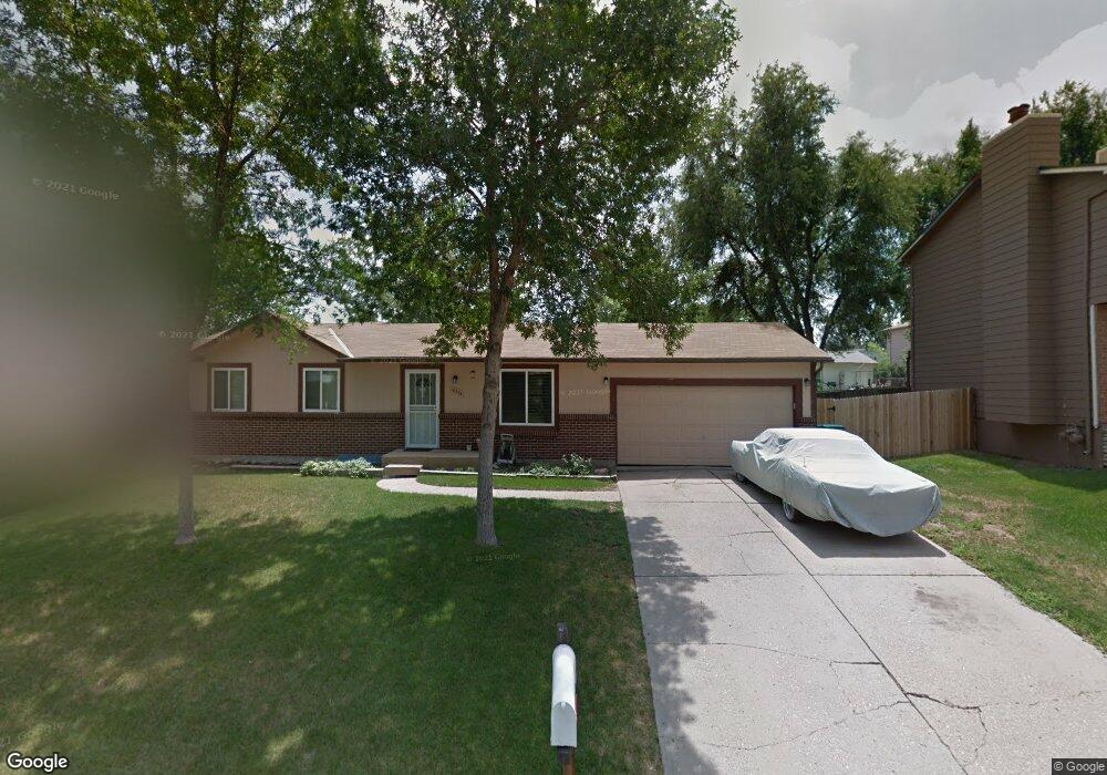
10554 Quail Ct Westminster, CO 80021
Walnut Grove NeighborhoodEstimated Value: $508,000 - $547,000
4
Beds
3
Baths
1,027
Sq Ft
$506/Sq Ft
Est. Value
About This Home
This home is located at 10554 Quail Ct, Westminster, CO 80021 and is currently estimated at $519,824, approximately $506 per square foot. 10554 Quail Ct is a home located in Jefferson County with nearby schools including Lukas Elementary School, Wayne Carle Middle School, and Standley Lake High School.
Ownership History
Date
Name
Owned For
Owner Type
Purchase Details
Closed on
Oct 18, 2006
Sold by
Hud
Bought by
Rahming George A and Mason Crystal A
Current Estimated Value
Purchase Details
Closed on
Jun 13, 2006
Sold by
Arellano Daniel
Bought by
Hud
Purchase Details
Closed on
Jun 20, 2003
Sold by
Osborne Douglas R and Osborne Constance M
Bought by
Arellano Daniel
Home Financials for this Owner
Home Financials are based on the most recent Mortgage that was taken out on this home.
Original Mortgage
$204,294
Interest Rate
5.56%
Mortgage Type
FHA
Purchase Details
Closed on
Jun 29, 1998
Sold by
Heltemes Mathias J and Heltemes Luann K
Bought by
Osborne Douglas R and Osborne Constance M
Home Financials for this Owner
Home Financials are based on the most recent Mortgage that was taken out on this home.
Original Mortgage
$136,990
Interest Rate
7.08%
Mortgage Type
VA
Create a Home Valuation Report for This Property
The Home Valuation Report is an in-depth analysis detailing your home's value as well as a comparison with similar homes in the area
Home Values in the Area
Average Home Value in this Area
Purchase History
| Date | Buyer | Sale Price | Title Company |
|---|---|---|---|
| Rahming George A | $178,000 | None Available | |
| Hud | $212,439 | None Available | |
| Arellano Daniel | $207,500 | Empire Title & Escrow | |
| Osborne Douglas R | $133,000 | -- |
Source: Public Records
Mortgage History
| Date | Status | Borrower | Loan Amount |
|---|---|---|---|
| Previous Owner | Arellano Daniel | $204,294 | |
| Previous Owner | Osborne Douglas R | $136,990 |
Source: Public Records
Tax History Compared to Growth
Tax History
| Year | Tax Paid | Tax Assessment Tax Assessment Total Assessment is a certain percentage of the fair market value that is determined by local assessors to be the total taxable value of land and additions on the property. | Land | Improvement |
|---|---|---|---|---|
| 2024 | $2,344 | $30,785 | $11,519 | $19,266 |
| 2023 | $2,344 | $30,785 | $11,519 | $19,266 |
| 2022 | $1,891 | $24,317 | $6,481 | $17,836 |
| 2021 | $1,919 | $25,016 | $6,667 | $18,349 |
| 2020 | $1,765 | $23,145 | $6,366 | $16,779 |
| 2019 | $1,737 | $23,145 | $6,366 | $16,779 |
| 2018 | $1,595 | $20,549 | $4,934 | $15,615 |
| 2017 | $1,428 | $20,549 | $4,934 | $15,615 |
| 2016 | $1,368 | $18,261 | $5,422 | $12,839 |
| 2015 | $1,140 | $18,261 | $5,422 | $12,839 |
| 2014 | $1,140 | $14,192 | $4,680 | $9,512 |
Source: Public Records
Map
Nearby Homes
- 11321 W 107th Ave
- 11496 W 106th Way
- 11221 W 107th Ave
- 10541 Routt St
- 10571 Parfet Ct
- 11461 W 107th Place
- 11476 W 105th Dr
- 10741 Owens St
- 10665 Newcombe St
- 10411 Routt Ln
- 10687 W 107th Ave
- 10307 Owens St
- 14269 Currant St
- 14265 Currant St
- 14261 Currant St
- 14241 Currant St
- 14245 Currant St
- 11437 W 103rd Ave
- 10610 Moore Ct
- 10632 Van Gordon Way Unit 1