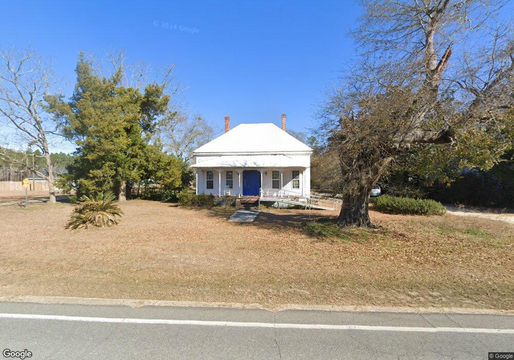
10555 Ga Highway 292 Collins, GA 30421
Estimated Value: $102,140 - $191,000
--
Bed
2
Baths
2,041
Sq Ft
$76/Sq Ft
Est. Value
About This Home
This home is located at 10555 Ga Highway 292, Collins, GA 30421 and is currently estimated at $155,785, approximately $76 per square foot. 10555 Ga Highway 292 is a home located in Tattnall County with nearby schools including Tattnall County High School and Pinewood Christian Academy.
Ownership History
Date
Name
Owned For
Owner Type
Purchase Details
Closed on
Aug 1, 2022
Sold by
Carnes Brittany
Bought by
Cavanaugh Thomas P and Cavanaugh Phillip J
Current Estimated Value
Purchase Details
Closed on
Jun 23, 2022
Sold by
Carnes Richard A
Bought by
Carnes Brittany
Purchase Details
Closed on
May 20, 2005
Sold by
Carnes Richard A
Bought by
Carnes Richard A and Carnes Donna H
Home Financials for this Owner
Home Financials are based on the most recent Mortgage that was taken out on this home.
Original Mortgage
$44,090
Interest Rate
5.74%
Mortgage Type
New Conventional
Purchase Details
Closed on
Jul 31, 1998
Sold by
Hardin Mildred B
Bought by
Godwin Leonard D and Godwin M
Purchase Details
Closed on
Nov 5, 1992
Bought by
Donohue John A
Purchase Details
Closed on
Feb 6, 1992
Bought by
Hardin Mildred B
Create a Home Valuation Report for This Property
The Home Valuation Report is an in-depth analysis detailing your home's value as well as a comparison with similar homes in the area
Home Values in the Area
Average Home Value in this Area
Purchase History
| Date | Buyer | Sale Price | Title Company |
|---|---|---|---|
| Cavanaugh Thomas P | $135,000 | -- | |
| Carnes Brittany | -- | -- | |
| Carnes Richard A | -- | -- | |
| Carnes Richard A | $44,099 | -- | |
| Godwin Leonard D | $35,000 | -- | |
| Donohue John A | -- | -- | |
| Hardin Mildred B | $25,000 | -- |
Source: Public Records
Mortgage History
| Date | Status | Borrower | Loan Amount |
|---|---|---|---|
| Previous Owner | Carnes Richard A | $44,090 |
Source: Public Records
Tax History Compared to Growth
Tax History
| Year | Tax Paid | Tax Assessment Tax Assessment Total Assessment is a certain percentage of the fair market value that is determined by local assessors to be the total taxable value of land and additions on the property. | Land | Improvement |
|---|---|---|---|---|
| 2025 | $895 | $43,840 | $1,480 | $42,360 |
| 2024 | $898 | $31,240 | $1,480 | $29,760 |
| 2023 | $315 | $31,240 | $1,480 | $29,760 |
| 2022 | $724 | $25,880 | $1,480 | $24,400 |
| 2021 | $682 | $25,120 | $1,480 | $23,640 |
| 2020 | $683 | $25,120 | $1,480 | $23,640 |
| 2019 | $683 | $24,640 | $1,480 | $23,160 |
| 2018 | $695 | $24,640 | $1,480 | $23,160 |
| 2017 | $683 | $24,640 | $1,480 | $23,160 |
| 2016 | $691 | $24,360 | $1,480 | $22,880 |
| 2015 | -- | $24,560 | $1,480 | $23,080 |
| 2014 | -- | $24,560 | $1,480 | $23,080 |
| 2013 | -- | $24,560 | $1,480 | $23,080 |
Source: Public Records
Map
Nearby Homes
- 92 Graham Ln
- 47 Manassas Station Rd
- 62 Manassas Station Rd
- 319 A Rupert Wood Ln
- 179 Creek Ridge Rd
- 147 Creek Ridge Rd
- 1302 Jim Sapp Rd
- LOT 7 Tupelo Dr
- 15683 Ga Highway 129 N
- 611 NE Pearl St
- 352 Riverside Dr
- 1200 Riverside Dr
- 628 Riverside Dr
- 19 Collins St
- 101 Ridge Dr
- 29 Grove Ln
- 4909 Perry Rd
- 0 Turnpike Rd Unit SA339603
- 27746 Ga Highway 23
- 6893 Hilton Hall Rd
- 10555 Georgia 292
- LOT 6 Church & W Main St
- 10575 Ga Highway 292
- 89 Gov Seay Rd
- 74 Church St
- 163 Railroad St
- 85 Church St
- 83 Gov Seay Rd
- 69 Gov Seay Rd
- 89 Gov Seay Rd
- 106 Church St
- 10663 Ga Highway 292
- 136 Rogers Ln
- 10683 Ga Highway 292
- 57 SE Railroad St
- 35 Railroad St
- 17 SE Railroad St
- 51 Queen St
- 12469 Henry St
- 10757 Ga Highway 292