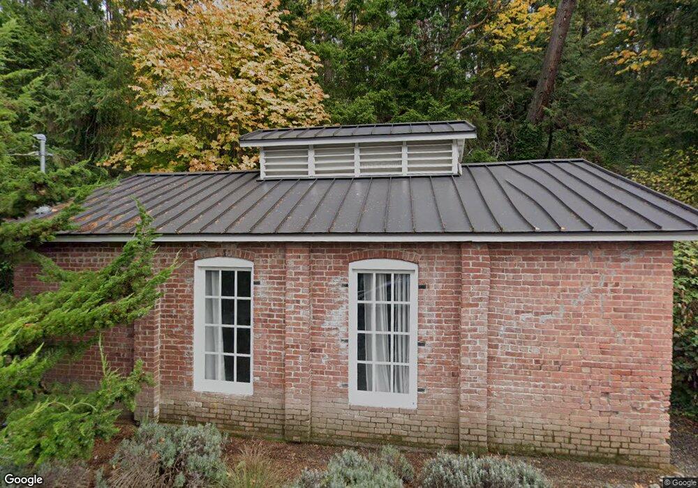
10555 NE Seaborn Rd Bainbridge Island, WA 98110
Estimated Value: $3,620,000 - $4,280,482
--
Bed
2
Baths
3,545
Sq Ft
$1,097/Sq Ft
Est. Value
About This Home
This home is located at 10555 NE Seaborn Rd, Bainbridge Island, WA 98110 and is currently estimated at $3,889,494, approximately $1,097 per square foot. 10555 NE Seaborn Rd is a home with nearby schools including Bainbridge High School, Montessori Country School, and Madrona School.
Ownership History
Date
Name
Owned For
Owner Type
Purchase Details
Closed on
Jul 17, 2014
Sold by
Blakely Harbor Properties Llc
Bought by
Decker Shauna
Current Estimated Value
Purchase Details
Closed on
Dec 18, 2007
Sold by
Samson Kelly and Samson Sally A
Bought by
Blakely Harbor Properties Llc
Create a Home Valuation Report for This Property
The Home Valuation Report is an in-depth analysis detailing your home's value as well as a comparison with similar homes in the area
Home Values in the Area
Average Home Value in this Area
Purchase History
| Date | Buyer | Sale Price | Title Company |
|---|---|---|---|
| Decker Shauna | $990,280 | Land Title Company | |
| Blakely Harbor Properties Llc | $600,280 | Pacific Nw Title |
Source: Public Records
Tax History Compared to Growth
Tax History
| Year | Tax Paid | Tax Assessment Tax Assessment Total Assessment is a certain percentage of the fair market value that is determined by local assessors to be the total taxable value of land and additions on the property. | Land | Improvement |
|---|---|---|---|---|
| 2026 | $24,916 | $3,132,070 | $1,472,740 | $1,659,330 |
| 2025 | $24,916 | $3,132,070 | $1,472,740 | $1,659,330 |
| 2024 | $23,806 | $3,132,070 | $1,472,740 | $1,659,330 |
| 2023 | $22,473 | $2,826,370 | $1,326,800 | $1,499,570 |
| 2022 | $22,057 | $2,362,930 | $1,131,660 | $1,231,270 |
| 2021 | $21,459 | $2,191,330 | $1,050,830 | $1,140,500 |
| 2020 | $21,563 | $2,191,330 | $1,050,830 | $1,140,500 |
| 2019 | $11,653 | $1,208,360 | $934,030 | $274,330 |
| 2018 | $7,441 | $655,710 | $652,570 | $3,140 |
| 2017 | $6,667 | $655,710 | $652,570 | $3,140 |
| 2016 | $6,272 | $584,360 | $582,360 | $2,000 |
| 2015 | $6,142 | $584,360 | $582,360 | $2,000 |
| 2014 | -- | $517,300 | $515,300 | $2,000 |
| 2013 | -- | $517,300 | $515,300 | $2,000 |
Source: Public Records
Map
Nearby Homes
- 10403 NE Seaborn Rd
- 9721 NE Charisma Cir
- 4740 NE Rose Ave NE
- 0 NE Old Creosote Hill Rd
- 2372 Douglas Dr NE
- 10761 Bill Point Crest NE
- 0 Lot 9 Park View Dr NE
- 11121 NE Brownell Ln
- 0 Devenny Ave NE Unit NWM2324546
- 1574 Park View Dr NE Unit 1
- 0 Mardell (Lot 11) Ct Unit NWM1856637
- 0 Mardell (Lot 12) Ct Unit NWM1856638
- 0 Mardell (Lot 6) Ct Unit NWM1768026
- 0 Mardell (Lot 7) Ct Unit 1759157
- 4420 Bluff Ln NE
- 4205 Pleasant Beach Dr NE
- 4869 Rosalind Rd NE
- 141 Parfitt Way SW Unit M-10
- 465 Winslow Way E Unit 108
- 4566 Flying Goat Ave NE Unit C220
- 10601 NE Seaborn Rd
- 0 LOT K NE Seaborn Rd
- 0 LOT I NE Seaborn Rd
- 3921 Southern Cross Rd NE
- 0 Bristle Ridge Unit 822219
- 0 Bristle Ridge Unit 758106
- 0 Bristle Ridge Unit 755980
- 3933 Southern Cross Rd NE
- 10653 NE Seaborn Rd
- 10705 NE Halls Hill Rd
- 3945 Southern Cross Rd NE
- 10705 NE Halls Hill Rd
- 10669 NE Seaborn Rd
- 10397 NE Seaborn Rd
- 3957 Southern Cross Rd NE
- 10671 NE Seaborn Rd
- 10359 NE Seaborn Rd
- 3952 Southern Cross Rd NE
- 10683 NE Seaborn Rd
- 3920 Southern Cross Rd NE