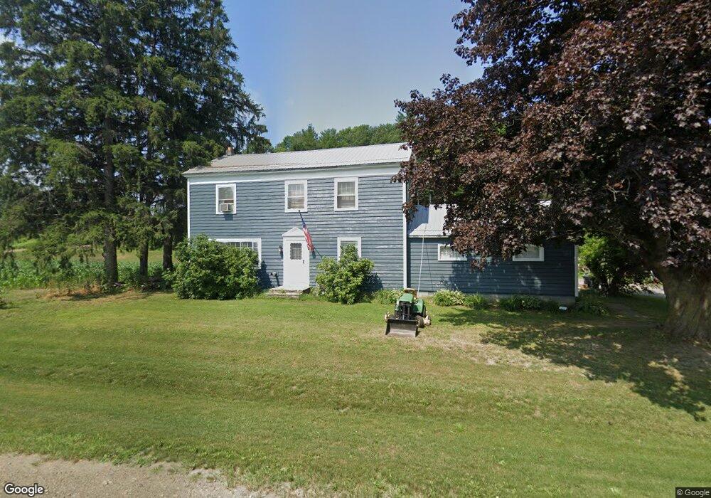
10555 Route 19 Fillmore, NY 14735
Estimated Value: $90,000 - $102,000
5
Beds
2
Baths
2,256
Sq Ft
$43/Sq Ft
Est. Value
About This Home
This home is located at 10555 Route 19, Fillmore, NY 14735 and is currently estimated at $98,044, approximately $43 per square foot. 10555 Route 19 is a home located in Allegany County with nearby schools including Fillmore Central School and Houghton Academy.
Ownership History
Date
Name
Owned For
Owner Type
Purchase Details
Closed on
May 15, 2002
Sold by
Beardsley Thomas
Bought by
Beardsley Thomas
Current Estimated Value
Purchase Details
Closed on
Apr 23, 2002
Sold by
State Of Ny Mortgage Agency
Bought by
Beardsley Thomas
Purchase Details
Closed on
Aug 23, 2001
Purchase Details
Closed on
Aug 4, 1995
Sold by
Noether James L and Noether Rhonda E
Bought by
Clawson Arlene M
Create a Home Valuation Report for This Property
The Home Valuation Report is an in-depth analysis detailing your home's value as well as a comparison with similar homes in the area
Home Values in the Area
Average Home Value in this Area
Purchase History
| Date | Buyer | Sale Price | Title Company |
|---|---|---|---|
| Beardsley Thomas | -- | Marc I. Woltag | |
| Beardsley Thomas | $35,001 | Marc Woltag | |
| -- | $49,664 | -- | |
| Clawson Arlene M | $55,000 | -- |
Source: Public Records
Tax History Compared to Growth
Tax History
| Year | Tax Paid | Tax Assessment Tax Assessment Total Assessment is a certain percentage of the fair market value that is determined by local assessors to be the total taxable value of land and additions on the property. | Land | Improvement |
|---|---|---|---|---|
| 2024 | $2,219 | $68,700 | $2,500 | $66,200 |
| 2023 | $2,251 | $68,700 | $2,500 | $66,200 |
| 2022 | $2,270 | $59,400 | $2,500 | $56,900 |
| 2021 | $2,264 | $59,400 | $2,500 | $56,900 |
| 2020 | $2,714 | $59,400 | $2,500 | $56,900 |
| 2019 | $3,607 | $59,400 | $2,500 | $56,900 |
| 2018 | $3,607 | $59,400 | $2,500 | $56,900 |
| 2017 | $1,928 | $59,400 | $2,500 | $56,900 |
| 2016 | $2,340 | $59,400 | $2,500 | $56,900 |
| 2015 | -- | $56,400 | $2,500 | $53,900 |
| 2014 | -- | $56,400 | $2,500 | $53,900 |
Source: Public Records
Map
Nearby Homes
- 122 W Main St
- 10372 Riverlawn Rd
- 6341 County Road 4
- 10734 Claybed Rd
- 10752 Claybed Rd
- 11056 Dugway Rd
- 9840 Cronk Hill Rd
- 0 County Road 27b
- WP Lot 01 County Route 27b
- Wp Unit 1 County Route 27B
- 0 Dutch Hill Rd Unit R1633477
- VL Lot 02 County Route 27b
- Vl Unit 2 County Route 27B
- WP Lot 3 County Route 27b
- 11257 Route 19
- 10477 County Road 23
- WP Lot 4 County Route 27b
- VL Rd
- 7399 Centerville Rd
- 11577 Armison Rd
- 10565 Route 19
- 10571 Route 19
- 10550 Route 19
- 10536 Route 19
- 10508 Bernard St
- 10498 Bernard St
- 70 S Genesee St
- 10489 Bernard St
- 10484 Bernard St
- 68 S Genesee St
- 10485 Bernard St
- 69 S Genesee St
- 64 S Genesee St
- 10495 Route 19
- 65 S Genesee St
- 62 S Genesee St
- 63 S Genesee St
- 58 S Genesee St
- 61 S Genesee St
- 59 Genesee St