Estimated Value: $133,771 - $230,000
Studio
1
Bath
780
Sq Ft
$250/Sq Ft
Est. Value
About This Home
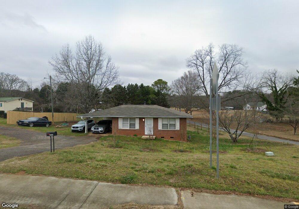
This home is located at 10558 Highway 72 W, Hull, GA 30646 and is currently estimated at $194,693, approximately $249 per square foot. 10558 Highway 72 W is a home located in Madison County with nearby schools including Madison County High School.
Ownership History
Date
Name
Owned For
Owner Type
Purchase Details
Closed on
Jun 16, 2021
Sold by
Tribble Elaine
Bought by
Tribble Elaine and Hodges Jesse Langford
Current Estimated Value
Purchase Details
Closed on
Jul 6, 2017
Sold by
Hodges William L
Bought by
Hodges Elaine
Purchase Details
Closed on
Oct 24, 2003
Sold by
Merck James A
Bought by
Hodges William L and Hodges Elaine F
Purchase Details
Closed on
Feb 18, 1997
Bought by
Merck James A
Purchase Details
Closed on
Jan 1, 1995
Bought by
Merck James A
Create a Home Valuation Report for This Property
The Home Valuation Report is an in-depth analysis detailing your home's value as well as a comparison with similar homes in the area
Purchase History
| Date | Buyer | Sale Price | Title Company |
|---|---|---|---|
| Tribble Elaine | -- | -- | |
| Hodges Elaine | $65,832 | -- | |
| Hodges William L | $120,000 | -- | |
| Merck James A | -- | -- | |
| Merck James A | $45,000 | -- |
Source: Public Records
Tax History
| Year | Tax Paid | Tax Assessment Tax Assessment Total Assessment is a certain percentage of the fair market value that is determined by local assessors to be the total taxable value of land and additions on the property. | Land | Improvement |
|---|---|---|---|---|
| 2025 | $1,149 | $43,252 | $8,988 | $34,264 |
| 2024 | $1,144 | $42,106 | $8,988 | $33,118 |
| 2023 | $1,041 | $38,316 | $7,490 | $30,826 |
| 2022 | $904 | $32,296 | $5,152 | $27,144 |
| 2021 | $766 | $23,866 | $5,152 | $18,714 |
| 2020 | $746 | $23,117 | $4,403 | $18,714 |
| 2019 | $741 | $22,707 | $4,403 | $18,304 |
| 2018 | $712 | $21,734 | $4,028 | $17,706 |
| 2017 | $616 | $20,567 | $3,745 | $16,822 |
| 2016 | $521 | $17,289 | $3,405 | $13,884 |
| 2015 | $519 | $17,289 | $3,405 | $13,884 |
| 2014 | $510 | $16,974 | $3,064 | $13,910 |
| 2013 | -- | $16,974 | $3,064 | $13,910 |
Source: Public Records
Map
Nearby Homes
- 19 Glenn Carrie Rd
- 232 Glenn Carrie Rd Unit 1
- 240 Glenn Carrie Rd Unit 2
- 1361 Hull Rd
- 1309 Hull Rd
- 789 Glenn Carrie Rd
- 3013 Lawton Ln
- 105 Hidden Lake Ct
- 741 Harve Mathis Rd
- 540 & 542 Harve Mathis Rd
- 73 Woodale St
- 151 Rolling Woods Ln
- 31 Rolling Woods Ln
- 0 Spratlin Mill Dr Unit LOT 14-C
- 0 Reese Ln Unit 7703910
- 0 Reese Ln Unit CL346847
- 1080 Spratlin Mill Dr
- 200 Lem Edwards Rd
- 8986 Highway 29 S
- 3080 Danielsville Rd
- 10512 Highway 72 W
- 10512 Georgia 72
- 10600 Highway 72 W
- 67 Yarborough Ridgeway Rd
- 67 Yarbrough Rd
- 21 Chandler Ray Rd
- 10531 Hwy 72w
- 10531 Highway 72 W
- 30 Cornelia Dr
- 37 Chandler Ray Rd
- 85 Yarbrough Rd
- 10482 Highway 72 W
- 10535 Highway 72 W
- 10535 Hwy 72w
- 10533 Highway 72 W
- 107 Yarbrough Rd
- 70 Cornelia Dr
- 10446 Georgia 72
- 10446 Highway 72 W
- 112 Cornelia Dr
Your Personal Tour Guide
Ask me questions while you tour the home.