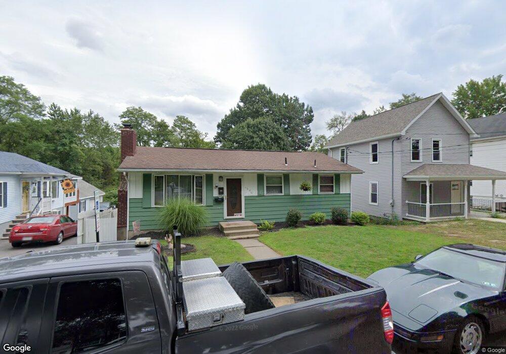
1056 Mohawk St Scranton, PA 18508
Providence NeighborhoodEstimated Value: $136,000 - $231,000
3
Beds
2
Baths
1,612
Sq Ft
$109/Sq Ft
Est. Value
About This Home
This home is located at 1056 Mohawk St, Scranton, PA 18508 and is currently estimated at $175,845, approximately $109 per square foot. 1056 Mohawk St is a home located in Lackawanna County with nearby schools including Neil Armstrong Elementary School, Northeast Scranton Intermediate School, and Scranton High School.
Ownership History
Date
Name
Owned For
Owner Type
Purchase Details
Closed on
Mar 11, 2020
Sold by
Lynott Brian P and Lynott Janet
Bought by
Lynott Brian P
Current Estimated Value
Purchase Details
Closed on
Dec 31, 2004
Bought by
Lynott Brian P and Lynott Janet
Create a Home Valuation Report for This Property
The Home Valuation Report is an in-depth analysis detailing your home's value as well as a comparison with similar homes in the area
Home Values in the Area
Average Home Value in this Area
Purchase History
| Date | Buyer | Sale Price | Title Company |
|---|---|---|---|
| Lynott Brian P | -- | None Available | |
| Lynott Brian P | -- | -- | |
| Lynott Brian P | -- | None Available |
Source: Public Records
Tax History
| Year | Tax Paid | Tax Assessment Tax Assessment Total Assessment is a certain percentage of the fair market value that is determined by local assessors to be the total taxable value of land and additions on the property. | Land | Improvement |
|---|---|---|---|---|
| 2025 | $3,829 | $12,000 | $1,750 | $10,250 |
| 2024 | $3,497 | $12,000 | $1,750 | $10,250 |
| 2023 | $3,497 | $12,000 | $1,750 | $10,250 |
| 2022 | $3,420 | $12,000 | $1,750 | $10,250 |
| 2021 | $3,420 | $12,000 | $1,750 | $10,250 |
| 2020 | $3,356 | $12,000 | $1,750 | $10,250 |
| 2019 | $3,156 | $12,000 | $1,750 | $10,250 |
| 2018 | $3,156 | $12,000 | $1,750 | $10,250 |
| 2017 | $3,099 | $12,000 | $1,750 | $10,250 |
| 2016 | $925 | $12,000 | $1,750 | $10,250 |
| 2015 | $1,992 | $12,000 | $1,750 | $10,250 |
| 2014 | -- | $12,000 | $1,750 | $10,250 |
Source: Public Records
Map
Nearby Homes
- 1020 W Market St
- 1011 W Market St
- 1210 Summit Pointe
- 1309 Summit Pointe
- 1603 Summit Pointe
- 510 Oak St
- 1704 Summit Pointe
- 463 Oak St
- 418 Leggett St
- 1720 Mcdonough Ave
- 805 Ferdinand St
- 214 William St
- 320 Greenbush St
- 2009-2011 Margaret Ave
- 194 Charles St
- Lot 10 Margery Ln
- 227 Reese St
- 1 Rachel Rd
- 6 Rachel Rd
- 2105 Belmont Terrace
- 1082 Mohawk St
- 1045 Mohawk St
- 1060 Mohawk St
- 1043 Mohawk St
- 1090 Mohawk St
- 1047 Mohawk St
- 1078 W Market St
- 1076 W Market St
- 1080 W Market St
- 1082 W Market St
- 1072 W Market St
- 1084 W Market St
- 1064 W Market St Unit 66
- 1086 W Market St
- 1058 Mohawk St
- 1108 W Market St
- 1094 W Market St
- 1060 1062 W Market St
- 1079 W Market St
- 1052 Mohawk St
Your Personal Tour Guide
Ask me questions while you tour the home.