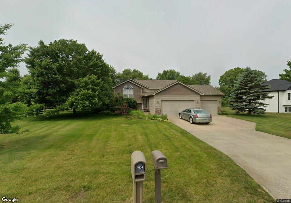
1056 S Stoneridge Dr Unit 70 Plainwell, MI 49080
Estimated Value: $383,000 - $417,000
4
Beds
2
Baths
2,300
Sq Ft
$175/Sq Ft
Est. Value
About This Home
This home is located at 1056 S Stoneridge Dr Unit 70, Plainwell, MI 49080 and is currently estimated at $401,845, approximately $174 per square foot. 1056 S Stoneridge Dr Unit 70 is a home located in Allegan County with nearby schools including Plainwell High School and Otsego Christian Academy.
Ownership History
Date
Name
Owned For
Owner Type
Purchase Details
Closed on
May 20, 2019
Sold by
Pinneo David A and Pinneo Donna Marie
Bought by
Pinneo David A and Pinneo Donna Marie
Current Estimated Value
Purchase Details
Closed on
Apr 19, 2007
Sold by
Mauchmar Jeffrey S and Mauchmar Karen
Bought by
Pinneo David A and Pinneo Donna M
Purchase Details
Closed on
Oct 10, 2006
Sold by
Pine Meadows Development Llc
Bought by
Mauchmar Jeffrey S
Create a Home Valuation Report for This Property
The Home Valuation Report is an in-depth analysis detailing your home's value as well as a comparison with similar homes in the area
Home Values in the Area
Average Home Value in this Area
Purchase History
| Date | Buyer | Sale Price | Title Company |
|---|---|---|---|
| Pinneo David A | -- | None Available | |
| Pinneo David A | $181,000 | Devon Title Agency | |
| Mauchmar Jeffrey S | $26,500 | Devon Title Agency |
Source: Public Records
Tax History Compared to Growth
Tax History
| Year | Tax Paid | Tax Assessment Tax Assessment Total Assessment is a certain percentage of the fair market value that is determined by local assessors to be the total taxable value of land and additions on the property. | Land | Improvement |
|---|---|---|---|---|
| 2025 | $3,121 | $165,600 | $10,200 | $155,400 |
| 2024 | $2,844 | $163,400 | $10,700 | $152,700 |
| 2023 | $2,890 | $156,000 | $11,000 | $145,000 |
| 2022 | $2,844 | $146,500 | $9,000 | $137,500 |
| 2021 | $2,659 | $167,300 | $12,000 | $155,300 |
| 2020 | $2,659 | $101,500 | $14,000 | $87,500 |
| 2019 | $0 | $95,600 | $13,300 | $82,300 |
| 2018 | $0 | $91,100 | $13,300 | $77,800 |
| 2017 | $0 | $90,900 | $13,300 | $77,600 |
| 2016 | $0 | $80,400 | $13,300 | $67,100 |
| 2015 | -- | $80,400 | $13,300 | $67,100 |
| 2014 | -- | $80,400 | $13,300 | $67,100 |
| 2013 | -- | $75,700 | $13,300 | $62,400 |
Source: Public Records
Map
Nearby Homes
- 518 Foxmoor Dr Unit 39
- 455 N 10th St
- 1036 Sir Knight Rd
- 1081 Sir Knight Rd
- 771 N Main St
- 140 W 1st Ave
- 965 Miller Rd
- 623 Glenview Cir
- 1183 Miller Rd
- 390 12th St
- 426 W Bridge St
- 1177 106th Ave
- 355 12th St
- 551 W Bridge St
- 204 N Sherwood Ave
- 317 E Chart St
- 950 Lafayette St
- 1025 Allen Ct
- 721 E Bridge St
- 830 Miller Rd Unit 9.86 Acres
- 1052 S Stoneridge Dr Unit 69
- 1051 S Stoneridge Dr Unit 67
- 1057 S Stoneridge Dr
- 1048 S Stoneridge Dr Unit 68
- 1069 S Stoneridge Dr
- 1047 S Stoneridge Dr
- 1061 S Stoneridge Dr
- 1044 S Stoneridge Dr Unit 56
- 1065 S Stoneridge Dr
- 1072 S Stoneridge Dr
- 480 Bridgeview Dr
- 1064 Wedgewood Dr
- 483 Bridgeview Dr Unit 51
- 1058 N Stoneridge Dr
- 1062 Wedgewood Dr
- 1062 Wedgewood Dr Unit 40
- 1040 S Stoneridge Dr Unit 57
- 1060 Wedgewood Dr Unit 41
- 1058 Wedgewood Dr
- 1056 Wedgewood Dr Unit 43