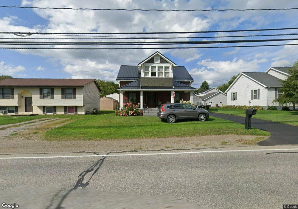
10560 Route 6n Albion, PA 16401
Estimated Value: $153,000 - $174,000
3
Beds
1
Bath
1,721
Sq Ft
$94/Sq Ft
Est. Value
About This Home
This home is located at 10560 Route 6n, Albion, PA 16401 and is currently estimated at $162,508, approximately $94 per square foot. 10560 Route 6n is a home located in Erie County with nearby schools including Northwestern Senior High School and Cranesville Christian Academy.
Ownership History
Date
Name
Owned For
Owner Type
Purchase Details
Closed on
Sep 11, 2004
Sold by
Hall Shane M and Hall Julianne M
Bought by
Juhasz Holly
Current Estimated Value
Home Financials for this Owner
Home Financials are based on the most recent Mortgage that was taken out on this home.
Original Mortgage
$63,923
Outstanding Balance
$31,521
Interest Rate
5.81%
Mortgage Type
Purchase Money Mortgage
Estimated Equity
$130,987
Purchase Details
Closed on
Apr 23, 1997
Sold by
Mccommons Herbert F
Bought by
Hall Shane M
Create a Home Valuation Report for This Property
The Home Valuation Report is an in-depth analysis detailing your home's value as well as a comparison with similar homes in the area
Home Values in the Area
Average Home Value in this Area
Purchase History
| Date | Buyer | Sale Price | Title Company |
|---|---|---|---|
| Juhasz Holly | $65,900 | -- | |
| Hall Shane M | $69,000 | -- |
Source: Public Records
Mortgage History
| Date | Status | Borrower | Loan Amount |
|---|---|---|---|
| Open | Juhasz Holly | $63,923 |
Source: Public Records
Tax History Compared to Growth
Tax History
| Year | Tax Paid | Tax Assessment Tax Assessment Total Assessment is a certain percentage of the fair market value that is determined by local assessors to be the total taxable value of land and additions on the property. | Land | Improvement |
|---|---|---|---|---|
| 2025 | $1,997 | $96,710 | $16,900 | $79,810 |
| 2024 | $1,954 | $96,710 | $16,900 | $79,810 |
| 2023 | $1,756 | $96,710 | $16,900 | $79,810 |
| 2022 | $1,730 | $96,710 | $16,900 | $79,810 |
| 2021 | $1,707 | $96,710 | $16,900 | $79,810 |
| 2020 | $1,683 | $96,710 | $16,900 | $79,810 |
| 2019 | $1,649 | $96,710 | $16,900 | $79,810 |
| 2018 | $1,586 | $96,710 | $16,900 | $79,810 |
| 2017 | $1,586 | $96,710 | $16,900 | $79,810 |
| 2016 | $1,956 | $96,710 | $16,900 | $79,810 |
| 2015 | $1,932 | $96,710 | $16,900 | $79,810 |
| 2014 | $1,002 | $96,710 | $16,900 | $79,810 |
Source: Public Records
Map
Nearby Homes
- 15 Thornton Ave
- 95 3rd Ave
- 16 Highland Ave
- 60 Park Ave
- 86 S Main St
- 0 Route 6n
- 22 Cherry St
- 9958 Bateman Ave
- 9840 Bateman Ave
- 9834 Bateman Ave
- 10023 Reservoir Rd
- 0 Winchester Dr Unit 178085
- 0 Winchester Dr Unit 178083
- 11120 West Rd
- Lot3 West Rd
- Lot1 West Rd
- 9749 9801 Moses Rd
- 10650 Bowmantown Rd
- 10210 Knapp Rd
- 8574 Kinsey Rd
- 10334 John Williams Ave
- 10573 Route 6n
- 10590 Route 6n
- 10600 Route 6n
- 10593 Route 6n
- 10313 John Williams Ave
- 316 E State St
- 310 E State St
- 10297 John Williams Ave
- 311 E State St
- 296 E State St
- 10280 John Williams Ave
- 292 E State St
- 10561 E Washington St
- 272 E Pearl St
- 10500 Route 6n
- 10420 Grandview Ave
- 249 E Pearl St
- 10330 Grandview Ave