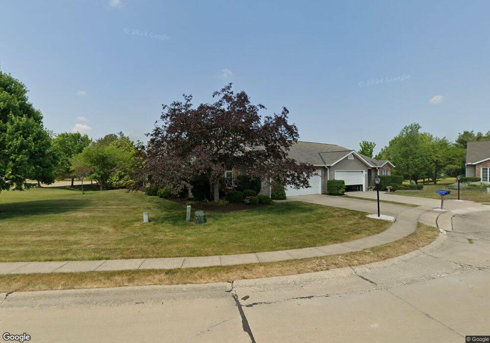
10562 Royal Oak Dr Strongsville, OH 44136
Estimated Value: $247,421 - $277,000
2
Beds
2
Baths
1,343
Sq Ft
$196/Sq Ft
Est. Value
About This Home
This home is located at 10562 Royal Oak Dr, Strongsville, OH 44136 and is currently estimated at $263,355, approximately $196 per square foot. 10562 Royal Oak Dr is a home located in Cuyahoga County with nearby schools including Strongsville High School, Sts Joseph & John Interparochial School, and Royal Redeemer Lutheran School.
Ownership History
Date
Name
Owned For
Owner Type
Purchase Details
Closed on
Jul 20, 2017
Sold by
Haborak Annette K
Bought by
Vogel Barbara J and Haborak Scott A
Current Estimated Value
Purchase Details
Closed on
Mar 12, 2015
Sold by
Mickas Rita A
Bought by
Haborak Annette K
Home Financials for this Owner
Home Financials are based on the most recent Mortgage that was taken out on this home.
Original Mortgage
$114,000
Outstanding Balance
$87,183
Interest Rate
3.64%
Mortgage Type
New Conventional
Estimated Equity
$176,172
Purchase Details
Closed on
Sep 22, 1992
Sold by
Rohacs Michael R
Bought by
Mickas Edward P
Purchase Details
Closed on
Jan 1, 1991
Bought by
Rohacs Michael R
Create a Home Valuation Report for This Property
The Home Valuation Report is an in-depth analysis detailing your home's value as well as a comparison with similar homes in the area
Home Values in the Area
Average Home Value in this Area
Purchase History
| Date | Buyer | Sale Price | Title Company |
|---|---|---|---|
| Vogel Barbara J | -- | None Available | |
| Haborak Annette K | $12,000 | Attorney | |
| Mickas Edward P | $103,000 | -- | |
| Rohacs Michael R | -- | -- |
Source: Public Records
Mortgage History
| Date | Status | Borrower | Loan Amount |
|---|---|---|---|
| Open | Haborak Annette K | $114,000 |
Source: Public Records
Tax History Compared to Growth
Tax History
| Year | Tax Paid | Tax Assessment Tax Assessment Total Assessment is a certain percentage of the fair market value that is determined by local assessors to be the total taxable value of land and additions on the property. | Land | Improvement |
|---|---|---|---|---|
| 2024 | $3,121 | $76,265 | $11,935 | $64,330 |
| 2023 | $3,121 | $59,020 | $11,030 | $47,990 |
| 2022 | $3,125 | $59,010 | $11,030 | $47,990 |
| 2021 | $3,100 | $59,010 | $11,030 | $47,990 |
| 2020 | $2,848 | $49,600 | $9,280 | $40,320 |
| 2019 | $2,764 | $141,700 | $26,500 | $115,200 |
| 2018 | $2,509 | $49,600 | $9,280 | $40,320 |
| 2017 | $2,185 | $41,690 | $7,040 | $34,650 |
| 2016 | $2,167 | $41,690 | $7,040 | $34,650 |
| 2015 | $2,254 | $41,690 | $7,040 | $34,650 |
| 2014 | $2,254 | $42,530 | $7,180 | $35,350 |
Source: Public Records
Map
Nearby Homes
- 10369 Council Bluff
- 9945 Twelve Oaks Cir
- 16519 Albion Rd
- 15485 Albion Rd
- 9890 Webster Rd
- 10010 Chevy Chase
- 0 Webster Rd
- 9129 Tahoe Cir
- 12101 The Bluffs
- 11650 River Moss Rd
- 14069 Basswood Cir
- 9531 Nicole Cir
- 14298 Calderdale Ln
- 14584 Baywood Ln
- 14557 Baywood Ln
- 14644 Baywood Ln
- 14236 Calderdale Ln
- 17945 Cliffside Dr
- 18433 Whitney Rd
- 18203 Broxton Dr
- 10534 Royal Oak Dr
- 10534 Royal Oak Dr Unit 41-A
- 10563 Decatur Dr
- 10541 Decatur Dr
- 10519 Decatur Dr
- 10519 Decatur Dr Unit 45-A
- 10478 Royal Oak Dr
- 10611 Royal Oak Dr
- 10611 Royal Oak Dr Unit 34a
- 10497 Decatur Dr
- 10583 Royal Oak Dr
- 10583 Royal Oak Dr Unit 35-A
- 10639 Royal Oak Dr
- 10450 Royal Oak Dr
- 10555 Royal Oak Dr
- 10555 Royal Oak Dr Unit 36-A
- 10629 Carmel Oval
- 10471 Royal Oak Dr
- 10499 Royal Oak Dr
- 10499 Royal Oak Dr Unit 37-A